


Torrential rain, thunder, lightning and hail will give way to a two-week blast of glorious summer sunshine.
Britons are about to bake in a barbecue fortnight as a warmth sweeps in from the tropical Azores.
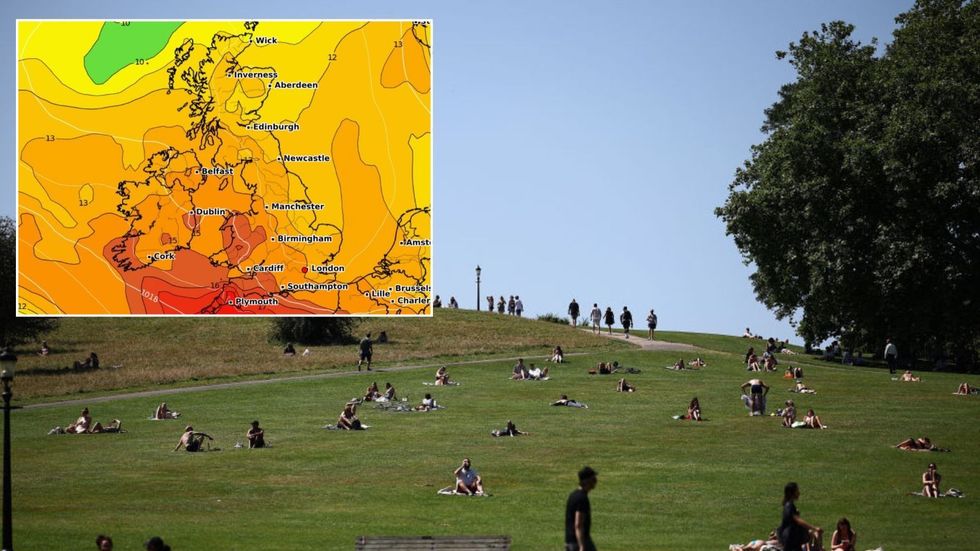
A high-pressure heat dome will settle over the UK next week and is likely to stay wedged in place until the summer solstice.
Met Office meteorologist Aidan McGivern said: “For the next two weeks, the favoured scenario is higher pressure towards the UK.
Torrential rain, thunder, lightning and hail will give way to a two-week blast of glorious summer sunshine
|Getty/ WXCHARTS
“If we go to Thursday, the high pressure to the south is likely to occasionally cover much of the UK.
“The most likely pattern is high pressure ridging across the south, keeping weather systems to the north, but mostly these are weak systems.
“We are expecting the high pressure to ebb and flow across the UK throughout next week.”
Glorious weather will follow an explosive weekend as a barrage of thunderstorms ploughs in from France.
After what is expected to nudge the hottest day of the year so far today, rising humidity will ignite a powder keg.
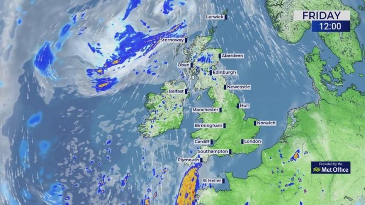
Met Office warnings are in force tonight and through tomorrow for powerful storms loaded with inches of rain.
Fireworks will kick off later this afternoon, McGivern warned, with the southeast in the firing line for the worst of the weather.
He said: “It is late afternoon that we start to see the first signs of these imported thunderstorms coming up through the channel.
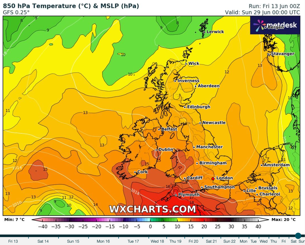
A high-pressure heat dome will settle over the UK next week and is likely to stay wedged in place until the summer solstice
|WXCHARTS
“It looks most likely that the southeastern quarter of the UK where we will see the biggest impact of these thunderstorms.
“We are talking torrential rainfall, hail, gusty winds and frequent lightning.”
But rain-weary Britons will have just another 24 hours of hell to endure before summer finally arrives in style.
He added: “High pressure builds to the south of the UK and shifts the jet stream further north, and that sets the scene for next week.
“High pressure near the Azores extends its influence towards the UK, shifting weather systems further north, this is the most likely weather pattern.
“For much of the UK, it is drier, and it is more settled.”
Britain’s weather over the past few days has been shaken by an explosive mix of heat, humidity and low pressure.
Steered in by an unusually southerly jet stream, Atlantic lows have fuelled torrential downpours.
The jet will move northwards through the weekend, allowing high pressure to build from the tropical Azores Islands.
It was a so-called ‘Azores High’ that drove Britain’s hottest ever temperature of 40.3C in July 2022.
While temperatures over the next fortnight are expected to come nowhere near, fine, settled summer weather is on the cards.
Jim Dale, meteorologist for British Weather Services and social commentator, said: “From the weekend we should see more settled weather, with temperatures possibly in the high 20Cs or even Sunday as high pressure becomes dominant.”
Jason Nicholls, lead international forecaster for AccuWeather, added: “While we can’t rule out isolated showers in parts of the country, this weekend is looking drier and brighter.”