


Summer’s arrival will fall foul of the stormy Atlantic as the ‘Mediterranean spring’ ends in gales and downpours.
June will kick off with bouts of heavy rain, thunder and strong winds as low-pressure, the enemy of the sun, takes aim.
Western regions will suffer the first dousing towards mid-week before much of the country falls into the firing line.
A stubborn cyclonic low-pressure cell spinning close to Norway will put summer on hold for another week.
Jim Dale, meteorologist for British Weather Services, said: “This low ends up spinning to the north of the UK and that is going to hang around bringing more in the way of unsettled weather through the middle of the week and the start of June.
“What it does is return us to a typical British summer, with the warm, dry sunny weather on the way out and the rain on the way in.
“Through the week, we are looking at a picture of cool, wet and at times windy weather.”
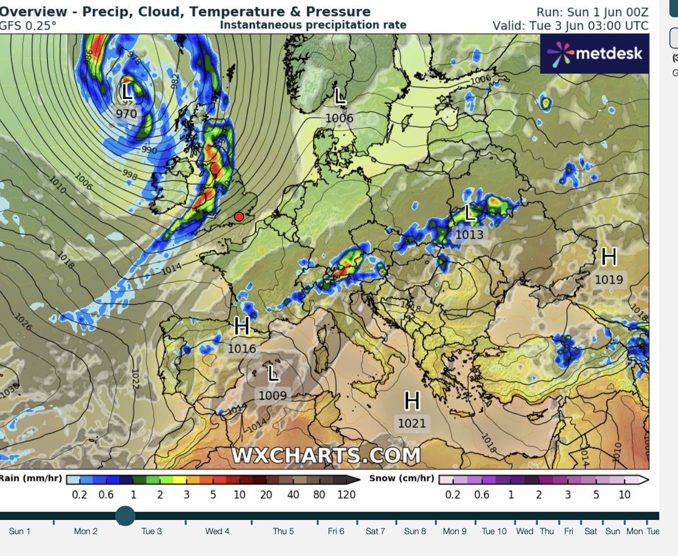
Summer starts with low pressure, wind and rain
|WX Charts
High pressure dominating the weather for the past three months has led to the sunniest spring on record.
The UK has seen 630 hours of sunshine, beating the 2020 record by four hours, according to the Met Office.
However, sunshine and clear skies are about to give way to gloom as synoptic pressure flips from high to low.
Dale said: “We have just gone through a Mediterranean spring with high pressure in situ, possibly longer than we have seen before at this time of year.
“It has been in the right position, bringing air in from the right direction, but this week we will see a change.”
LATEST DEVELOPMENTS: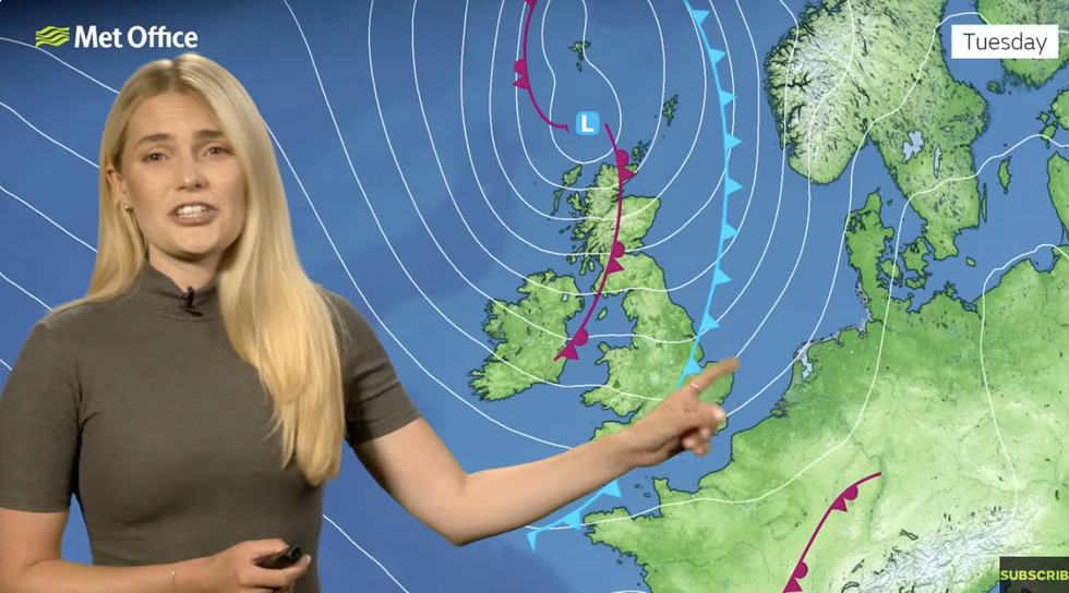
Met Office’s Kathryn Chalk warns low pressure is on the way in
|Met Office
After a dry start to the week, wind and rain will pick up from tomorrow, according to the Met Office.
Temperatures at the start of the week could hit the high teens widely, with 20C or 22C possible in the south and southeast.
Met Office meteorologist Kathryn Chalk said: “For most of us, it turns drier by Monday morning with clear spells and lighter winds.
“It is turning chilly across northern areas, and through Monday, there is plenty of sunshine and dry for most of us.
“Then the sunshine turns hazy across Northern Ireland and Scotland with the breeze picking up in association with an area of low pressure out to the north and the west.
“Another area of low pressure moves in later and affects many places on Monday night and into Tuesday, bringing heavy spells of rain … and some strong and gusty winds.”
Jason Nicholls, lead international forecaster for AccuWeather, said: “There will be a risk of rain and thunder into Tuesday and further, lingering showers through the middle of the week.
“Later in the week, there is going to be a risk of further rain before a chance things will turn drier for the weekend.”