


An unusual weather pattern sandwiching Britain between four pressure systems will drive a week of rain and rising temperatures.
Western regions are in the firing line for a relentless succession of stormy Atlantic weather fronts.
Southeastern counties, however, will enjoy a balmy run into mid-month, with sunshine and temperatures nudging 20C.
The nationwide splice is due in part to a ‘col’ – an unusual formation of high pressure and low pressure in the North Atlantic.
Met Office meteorologist Alex Daeakin said: “We’re between weather systems with high pressure down to the southwest and up to the northeast, and low pressure down to the southeast and up to the northeast, and we are in what’s called a ‘col’.
“As the jet stream weakens, a low-pressure system drifts to the north and throws us plenty of weather fronts and showers, and then another on follows behind.
“Winds are mostly coming in from the west and the southwest, and that means that western areas that see the wettest weather as those weather fronts come in.”
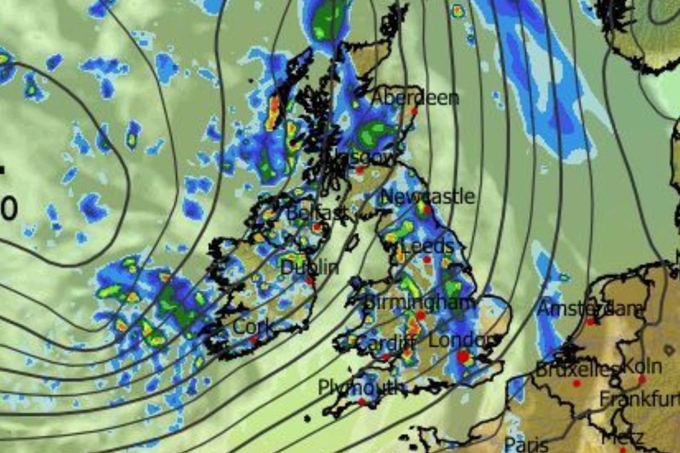
WXCharts is warning of downpours across the UK
|WXCHARTS
Stormy systems rattling in from the west on the jet stream will bring the risk of strong winds to western coasts.
Powerful gusts will steer bands of heavy rain into western Britain, with stormy lows forecast through the week.
Mr Deakin said: “ By the time we get to the end of the week, western areas will see the heaviest of the rain.
LATEST DEVELOPMENTS
“Wind is likely to strengthen further as we go into Wednesday, with a driving low out to the west throwing weather fronts.
Bands of rain then edge in as that cold front moves in, and Wales and Southwest England will still be blustery.
“It will get warmer over the next few days, but with rising temperature we will see a fair few showers.”
Southeastern regions will escape all but the odd shower with a starkly different outlook into the weekend.
Temperatures in London could nudge 20C by the weekend, as warm winds sweep up from the south.
Jim Dale, meteorologist for British Weather Services and co-author of ‘Surviving Extreme Weather’, said: “Through the next couple of days, it will be the west and the northwest that will see the most rainfall.
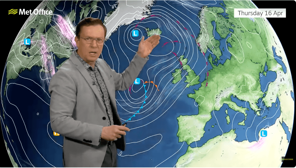
Temperatures in London could nudge 20C by the weekend, as warm winds sweep up from the south
|MET OFFICE
“But to the southeast, it will be pleasant with slightly above average temperatures.
“For the most part, it will be a proper spell of good spring weather, with bits and pieces of rain around.”
Mr Deakin added: “The winds are still coming in from the south and the southwest drawing in milder air, and still drawing up some milder air, so on Friday we could get up to 20C in the London area.”