


After a dour few months, it's looking like the UK is finally heading for a warm spell, according to meteorologists, with drizzle clearing and temperatures soaring to the high teens across the country.
Britons will still need to brace for some chilly climes through this weekend; while the vast majority of the UK won't see temperatures rise past 12C until Tuesday evening, people in Manchester and the North-West will be able to enjoy the relative warmth of 15C by Sunday.
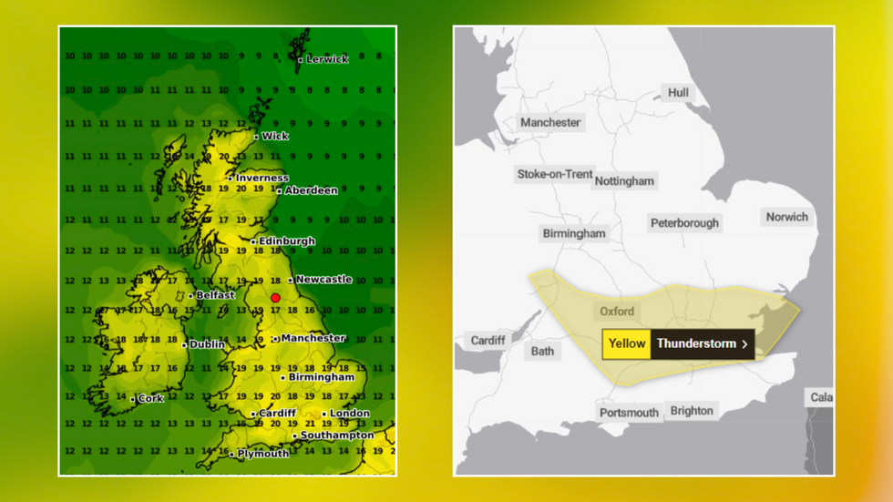
Thermometers are set to stay in the mid-teens for the next two weekends, but by midday on Monday, May 13, areas of southern England and northern Scotland will, at last, break the 20C barrier.
In the south of England, maps are set to turn yellow as air temperatures cross 21C in Surrey and Hampshire, while parts of Somerset and Wiltshire reach 20C.
Parts of Gloucestershire and East Wales, as well as areas of Scotland around Inverness, are also heading for a balmy few days, as the UK finally starts showing signs of summer.
The warm predictions for the weeks ahead came as London and the south grappled with a series of thunderstorms
|WXCharts/Met Office
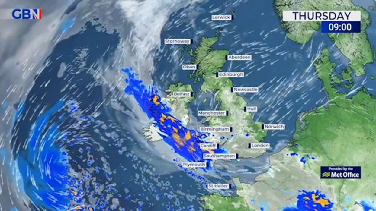
But while much of the country has some pleasant weather to look forward to, people in the south of England were woken in the early hours of this morning by a series of thunderstorms.
The Met Office had issued an urgent weather warning, with motorists warned of difficult driving conditions throughout the area.
The forecaster had issued a yellow warning for thunderstorms covering London, parts of the south, and even parts of Wales, until 10am today.
At around 5am, downpours and rolling thunder finally struck, with thousands of lightning flashes reported across the affected regions.
Some minor flooding and travel disruption is expected throughout this morning - but it's unclear just how widespread the issues may be.
MORE WEATHER NEWS:
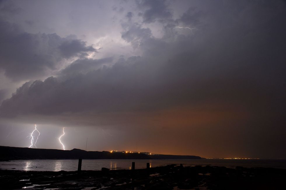 Lightning strikes over England | PA
The Met Office had warned that Britons could expect "spray and sudden flooding" which "could lead to difficult driving conditions and some road closures".
It also flagged the likelihood of disruption to public transport services and even power cuts in areas of flooding and lightning strikes - which eventually hit the morning rush hour, prompting delays stretching from London to Exeter.
It also pointed to the "small chance" of damage to homes and businesses thanks to flood water, lightning strikes, hail or strong winds.
While the warning had been in place until 8am, the Met Office decided to push it back by two hours as thunderstorms rolled on through the morning before gradually clearing westwards.
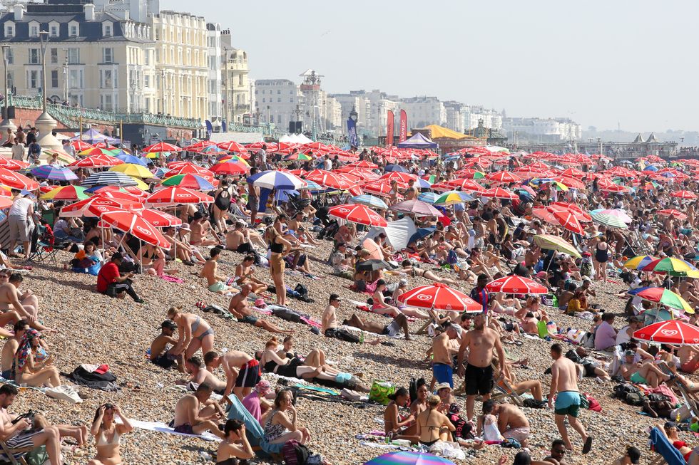
Temperatures in the twenties could see Britons heading to beachside tourist hotspots
|Getty
But the stormy weather is set to subside, with all Met Office warnings coming to an end today - and none in place over the days to come.
The Met Office's long-range weather forecast for May 6 through to May 15 says it "should be fairly warm with scattered showers".
The forecast says an area of high pressure "will bring dry and fine weather for most areas, although there is still a possibility of rain or showers in the west".
It continues: "Into the following week, high pressure is likely to remain dominant. Sunnier conditions are expected across the south, while it may be cloudier in the north and east. Temperatures are expected to be slightly above normal for early May."