


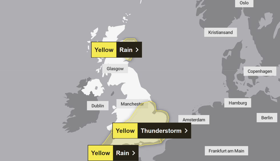
The Met Office has issued three yellow weather warnings as rain batters Britain just days after the warmest summer on record came to a close.
Britons living in much of Southern England, South Wales and North East Scotland have been warned about torrential downpours, with six flood alerts also in place.
Meanwhile, the Northern Lights were visible across parts of the UK and Ireland overnight on Monday and Tuesday.
The alert is in place from 11am to 8pm today, Wednesday and between 2am and 5pm on Thursday.
In its weather warning, the Met Office said "heavy rain may cause travel disruption and flooding in places".
It added that "some interruption to power supplies and other services is possible" and bus and train services will probably be affected, with "journey times taking longer".
Chief meteorologist at the Met Office, Rebekah Hicks, said: "We’re expecting a band of heavy rain and strong winds to move north-east through the first part of Wednesday, followed by heavy showers and the risk of thunderstorms.
"Some of these could bring hail and gusty winds, particularly in southern areas. Of course, the warning coincides with the first school run after the summer holidays for some, meaning a wet and potentially disruptive start to the day for many."
Heavy rain is expected to batter the UK this weekend
|MET OFFICE
Heavy rain and strong winds will move north-east from early on Wednesday, followed by heavy showers and some thunderstorms.
Conditions will gradually improve from the South West through Wednesday afternoon as showers become more isolated.
Rainfall totals will be 20-30mm across much of the area covered by the weather warning on Wednesday, but some places could see 40-60mm within a period of six to nine hours.
Coastal gales are also likely for a time, especially along English Channel coasts, the Met Office added.
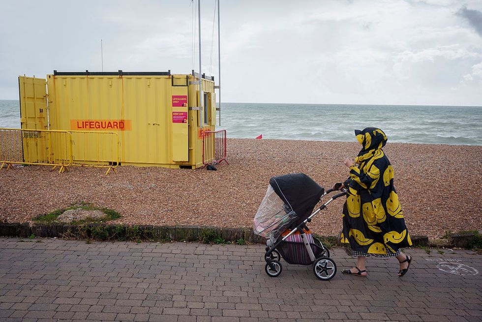
A woman and a child walk along the seafront, passing a lifeguard hut on the shingle beach at Hove
|GETTY
The weather service said conditions on Thursday would be "unsettled", with widespread showers and occasional thunderstorms.
Some sunny spells are expected, but rain may become more persistent in parts of western Scotland.
By Friday, southern areas will begin to see more settled conditions, with increasing sunshine and fewer showers. However, the North West will remain wet and windy, with a small chance of coastal gales, the Met Office said.
A forecaster from Met4Cast said there is "an enhanced tornado risk exists across London, North Kent and across much of Essex, Suffolk & Norfolk today."

The Northern Lights were visible through clouds over Saltburn-by-the-Sea in North Yorkshire
|PA
The weather service confirmed on Monday that this year’s summer was the UK’s warmest on record.
The mean average temperature across June, July and August was a provisional 16.10C, beating the previous seasonal high of 15.76C set in 2018.
It comes just months after the UK experienced the warmest and sunniest spring since data began.
The back-to-back record-breaking seasons have brought long spells of dry and hot weather for many across the country.
However, the heat over the summer may have taken its toll on the environment and agriculture, leading to hosepipe bans, drought orders, poor harvests and low water levels in reservoirs.
A Met Office spokesman said: "Consider if your location is at risk of flash flooding. If so, consider preparing a flood plan and an emergency flood kit.
"Give yourself the best chance of avoiding delays by checking road conditions if driving, or bus and train timetables, amending your travel plans if necessary.
"People cope better with power cuts when they have prepared for them in advance. It’s easy to do; consider gathering torches and batteries, a mobile phone power pack and other essential items. "