


High-octane jet-stream winds surging into Britain from storm-stricken America will drive what is feared will be an imminent nationwide snow deluge.
Britain is facing a ‘serious and significant’ snow dump prompting government officials to warn of widespread disruption from this weekend.
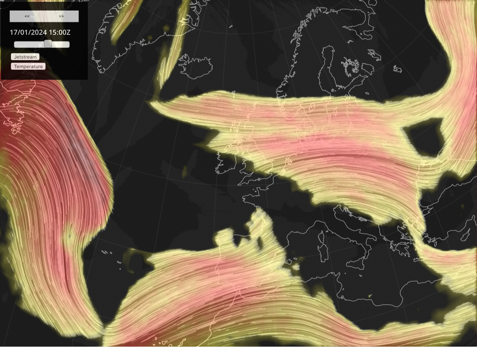
It will be steered by a furious jet stream crossing the Atlantic in two branches, powered by a massive winter storm mauling the United States.
UK weather: Jet Stream to bring ‘serious and significant’ nationwide snow dump
|Jet Stream map
The Met Office has warned northerly winds will smother Britain this weekend and through the start of next week as an “interesting” and “juicy” bout of winter weather gears up to strike.
Met Office meteorologist Alex Deakin said: “It could be a juicy one, especially if you are interested in snow.
“In North America quite a wide and well-defined jet stream is splitting, or bifurcating.
“One arm of it extends to the north and another dips to the south, and that interacts with an area of low pressure and that potentially brings us some pretty interesting weather as we go into next week.
LATEST DEVELOPMENTS: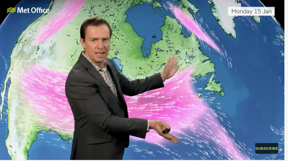
Met Office meteorologist Alex Deakin warns the jet stream will influence the snow
|Met Office
“We are going to see strong winds coming down from the north, and they are going to generate snow showers, and these could be fairly significant, particularly when attached to those strong and gusty winds.”
Snow will set in widely this weekend with the first flurries due on Saturday night, turning heavier into Sunday.
Exacta Weather forecaster James Madden said: “From Sunday, there will be an increasing risk of snow showers to turn more widespread.
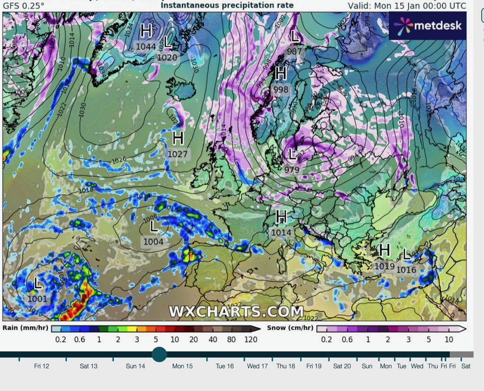
Jet stream pulls in bitter northerly winds
|WX charts
“London and the southeast will be at risk of some potentially heavy snow through the latter part of the weekend, and this could come as a surprise to those in the region.
The jet stream is firing across the Atlantic from the United States which is currently battling the third winter storm in as many days.
Storm Gerri threatens heavy snow across midwestern and northeastern America this week, threatening freezing temperatures and huge snowstorms.
The jet stream, which is strengthened by differences in temperatures high in the atmosphere, will then cross the Atlantic and make a beeline for the UK.
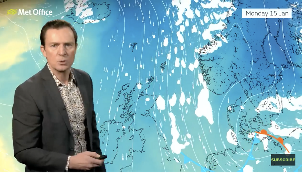
Cold air will flood in from the Arctic
|Met Office
Heavy snow widely across Britain is all but inevitable next week, although it is the interaction between the jet, low pressure and cold air that will determine where it falls and how heavy it is.
Mr Deakin said: “The snow showers could result in some serious dumps in some places.
“An area of low pressure in the Atlantic, is going to be influenced by what is going on with the jet stream
“The southern-most arm will eventually interact with this low and push it towards the UK, but it is quite a complex situation exactly when and where it drifts up towards the UK as we go into next week.
“From mid-week onwards, it is eyes down to the southwest and just how this area of low pressure approaches the UK.”