


A brief warm blast driven by a ‘wiggly’ jet stream will rocket temperatures before northerly winds and snow bring a ‘real feel of winter’.
Thermometers will rocket to an unseasonable 15C in parts over the next couple of days as warm air sweeps in from the south.
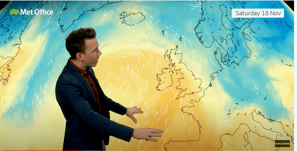
Mild air comes in from the south this weekend
|Met Office
However, an abrupt change in wind direction after the weekend will open the gates to a bitter -7C blast from the north.
Parts of the country are on alert for dense fog, frost and even a flurry of snow over the hills and mountains.
Jim Dale, social commentator and senior meteorologist for British Weather Services, said: “With the wind chill and airflow straight from the Arctic next week, there is a real feel of winter coming.
“The weekend is looking milder with a continuation of the rain, particularly across the south and the west.
“But this will be followed by a shar change in the weather to bring a brief but much colder snap with flurries of snow over high ground of Scotland.
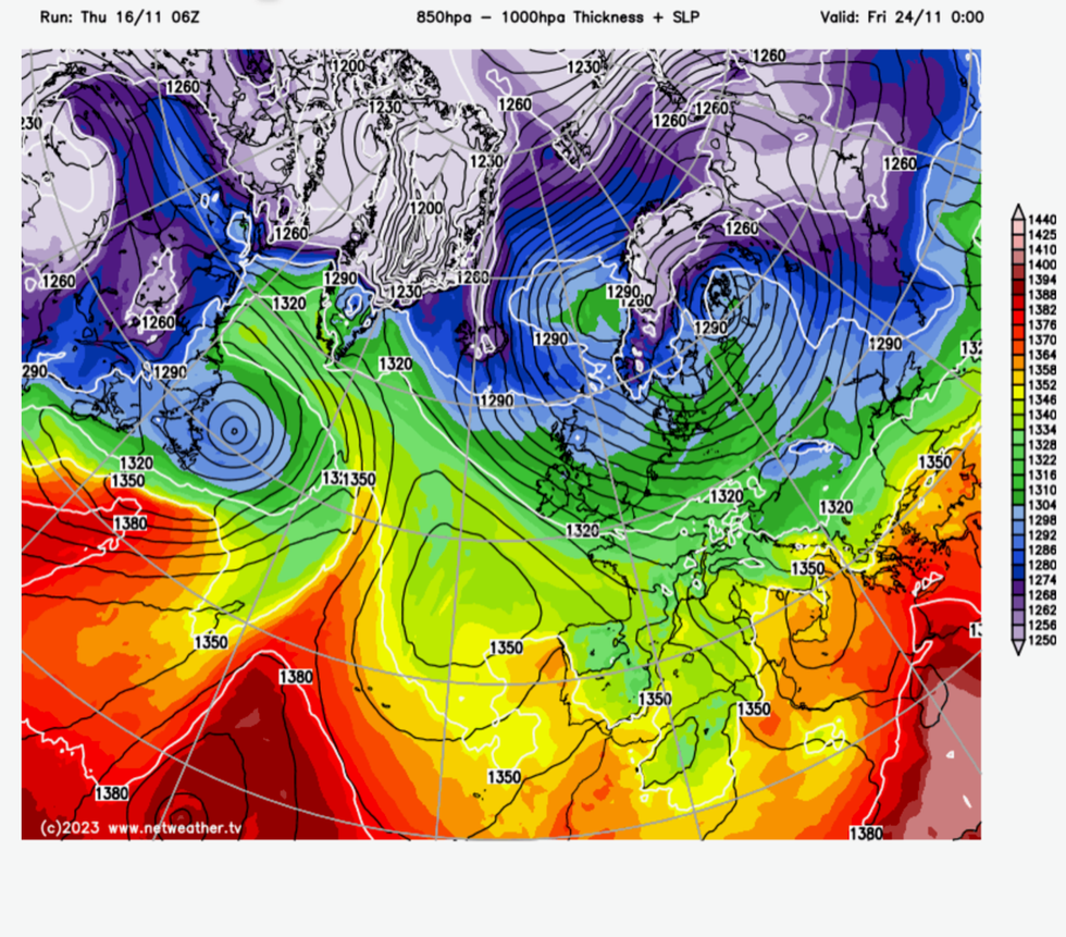
UK weather: Before the cold arrives
|Netweather
“Windchill could make it feel like -7C in exposed regions.”
It will follow a bout of wind and rain which this week saw Storm Debi leave swathes of the country flooded and waterlogged.
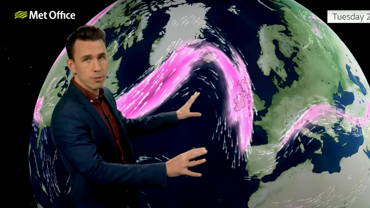
The jet stream, which has ploughed in from the west dragging in storms, will turn from straight to bendy, driving the change.
Low pressure from the west will move northwards pulling in winds from the north, according to the Met Office.
Met Office meteorologist Aidan McGivern said: “Autumn so far has been mild, especially in the south, and in some places, very, very wet.
“But there are signs that both those factors will change a little during next week.
“Next week the jet stream will be coming in from the northwest.
“It’s a bit more of a wriggly jet stream with low pressure to the east and higher pressure building to the west, and that is really the theme through next week.”
Gusts of 50mph will drive further downpours across southern Britain through the weekend as temperatures drop over Scotland.
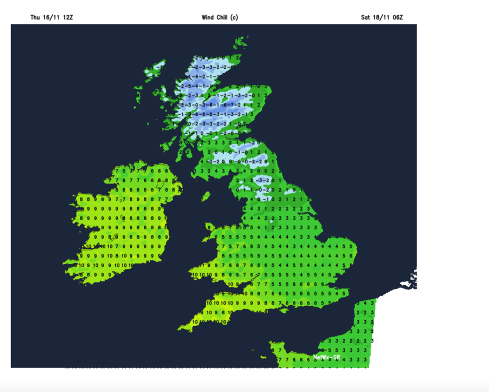
Windchill of -7C in parts
|Netweather
A ‘plume’ of mild air will push temperatures to 15C in southern Britain on Saturday morning, Mr McGivern said.
But the jet stream will ‘change shape’ on Monday, with low pressure over Scandinavia feeding a chilly flow into Britain, he added.
He said: “We are going to see a plume of milder air come up from the southwest for the start of Saturday.
“But we keep the colder conditions at first over parts of central and eastern Scotland, with a touch of frost over the northeast of Scotland and some snowflakes over the hills and mountains as the rain bumps into that colder air.
“With the winds coming from the north and the northwest it will turn colder with the return of frost and fog patches by night, and also some of those showers will turn to snow over those northern hills and mountains.”
James Madden, forecaster for Exacta Weather, added: “The first major wintry and snowy blast of the season is now starting to build in and be reflected upon from other third-party forecasts during the final third of November.”