


Britain’s fireblast summer will get a boost from a freak "marine heatwave" sending coastal temperatures to simmer point.
Unusually warm sea waters will fuel a near-35C weekend fire blast amid warnings Britain is about to roast in a record summer.
Temperatures will rocket through the rest of the week, peaking on Sunday as boiling hot air plumes in from the Continent.
Parts of the country, particularly the south and the south east, face above-average temperatures through the coming weeks.
Jim Dale, meteorologist for British Weather Services, said: “When it comes to summer as a whole, there is now a greater risk that we will see continued hot weather through July with the risk of summer temperature records being broken.
“While this is consistent with a pattern of climate change, other factors are also coming into play.
“These are the warm spring we have had which has already left the ground warm, and the unusually high ocean temperatures around the UK, which can all play into continued hot weather during the summer months.”
Feeding into the heat will be an "extreme marine heatwave" gripping waters of the Atlantic.
LATEST DEVELOPMENTS:
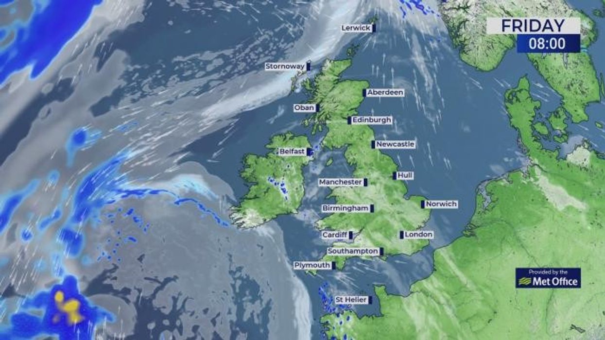
Temperatures will peak on Saturday
|MET OFFICE
Temperatures around the Ireland coast are up around 4C compared to average with UK waters at around 2.5C warmer than normal.
Rising ocean temperatures have been fuelled by unusually warm weather during spring and a milder end to winter.
The alarm has been raised in a report from the UK Met Office which warns the ‘marine heatwave’ is ‘significant due to its intensity and persistence’.
Report author and scientific manager Segolene Berthou said: “The heatwave is the result of several overlapping factors.
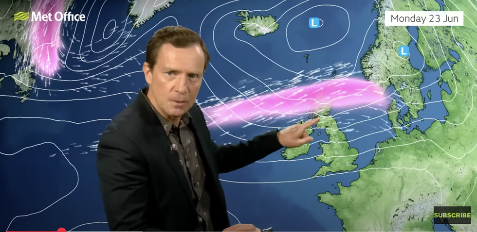
Alex Deakin describes fresher winds coming through on Monday
|MET OFFICE
“Prolonged high-pressure systems brought a dry, sunny spring and weak winds and waves, creating ideal conditions for warming.
“Marine heatwaves in UK waters usually last around two to four weeks, but his year’s event began early March and has continued into May, making it one of the longest on record for this time of year.”
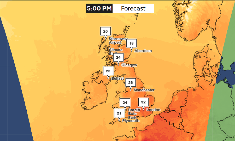
Meanwhile, Britain is slapping on the suncream for temperatures in parts to hit 33C this weekend.
The summer solstice on Saturday may peak with a tropical night, with temperatures hovering around 20C through the hours of darkness.
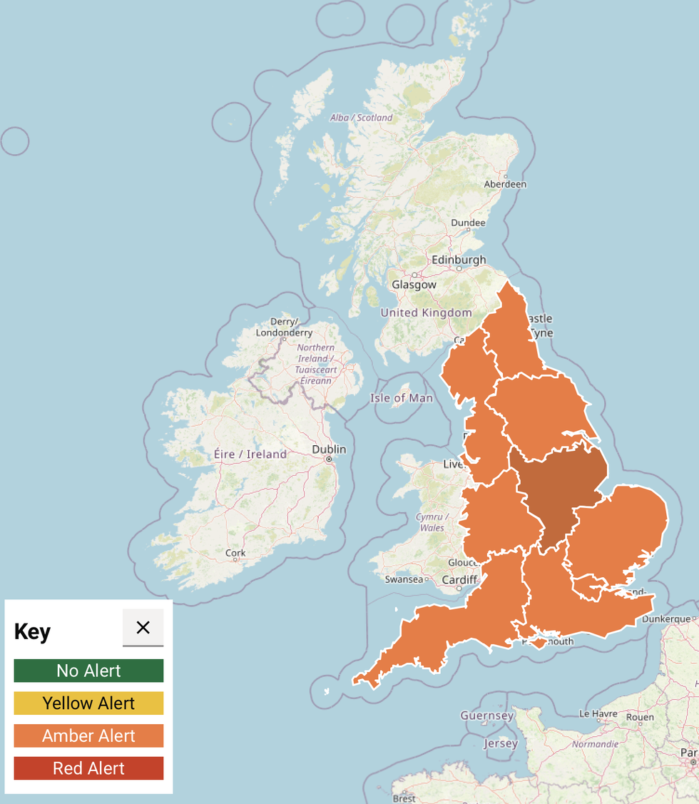
Amber health alerts are in place throughout England
|MET OFFICE
While southeastern Britain may cling on to the heat through the start of next week, a fresher blast awaits the west.
Met Office meteorologist Alex Deakin said: “The shortest night of the year may well be the warmest night of the year, and the biggest question mark is how long this hot spell is going to last.
“In the next four or five days, we are going to see some significant changes and we need to look at what the jet stream is doing in the Atlantic.
“We are going to see some hot conditions last for the next few days, but the time we get to Monday, the winds at the surface will be coming in from the west and trying to bring in cooler air from the Atlantic.”
A UK Health Security Agency Heat Health Alert across Britain has in the past 24 hours been upgraded from yellow to amber – ‘enhanced’.
A spokesperson said: “Significant impacts are likely across health and social care services due to the high temperatures.”