


A once-in-a-half-century meteorological event will drive chilling Arctic winds across Britain beyond New Year.
A major U-turn from the wet, windy and mild run-up to the festive season will nosedive temperatures over Christmas.
A giant anticyclonic ‘block’ sliding in from Scandinavia to pull in easterly winds will wedge over northern Britain.
Once in place, it will lock down, forcing the mercury below freezing through the next week and into January.
TRENDING
Stories
Videos
Your Say
Met Office meteorologist Annie Shuttleworth said: “This is a very strong block, so we think it will last at least through the Christmas period and into the new year.
“It looks like one of the strongest blocks of this type in this area for this time of year that has developed over the past 45 years, and it does look like it will last into the new year.”
Blocking patterns in winter are notorious for triggering cold weather under clear skies and depending on their position, dragging in easterlies.
Low pressure behind the unusually wet run into mid-winter will retreat to the south, held at bay by the blocking high.
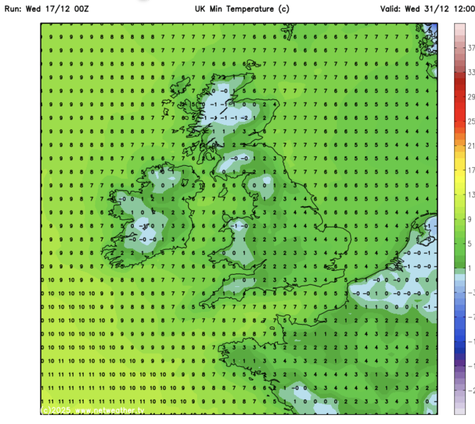
Temperatures will plummet at the end of the year
|NETWEATHER
Parts of the country are in the firing line for further showers through the next 48 hours, with rain and sleet more likely than snow, Ms Shuttleworth explained.
She said: “We will see some wetter weather in the lead up to Christmas as well as some wetter weather.
“We will have low pressure to the south of the UK where it will sit for much of Christmas week, but to the north and the northeast, we have high pressure, and this will bring drier and more settled weather, but there is a risk of showers.
“On Christmas Eve, we have low pressure to the south of the UK and high pressure to the north, and we are expecting this blocked pattern to remain for much of the Christmas week and into the new year.”
LATEST DEVELOPMENTS:
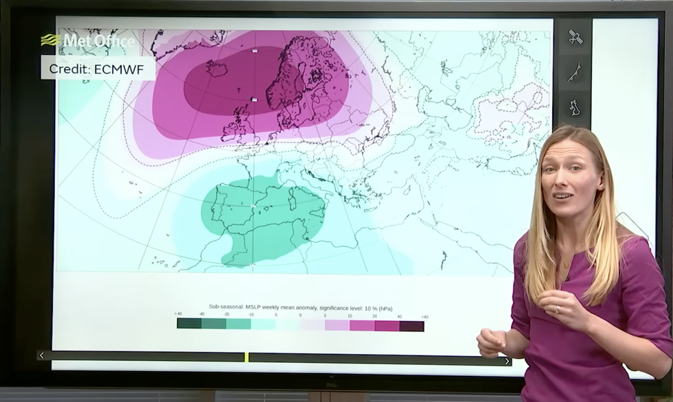
Met Office’s Annie Shuttleworth describes block moving over north UK
|MET OFFICE
Thermometers will tumble as hopes of a White Christmas continue to hang in the balance.
While Thursday is expected to be colder compared to the past few years, festive snow is not guaranteed.
Jim Dale, meteorologist for British Weather Services and co-author of ‘Surviving Extreme Weather’, said: “It is very unlikely that we are going to see a widespread White Christmas this year, with the greatest chance of snow across the southern and southeastern counties.
“For the majority, it is going to be a dry, cold day, although with the chance of frosts in the morning.”
Cold weather will hang on through the end of the week and into the start of next year, he warned.
He said: “The cold is going to bed in through the period and into New Year, with things starting to turn colder from Christmas and thereafter.
“We have a blocking high which means that everything trying to come in from the Atlantic will get held off, allowing colder winds to come in from the north and the east.”
New Year revellers will be wrapping up this year, he said, in temperatures widely at freezing or below.
He added: “As we go into the start of 2026, there will be a growing risk of harsh frosts, ice and cold.”
Our Standards: The GB News Editorial Charter