


A heavy snow blast is set to sweep across Britain within days as temperatures plummet and conditions remain "unsettled", according to the latest weather charts.
Weather experts have warned Britons to prepare for more prolonged spells of rain, which could be heavy at times, across many parts of the UK.
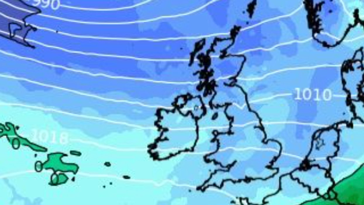
A polar blast is expected to sweep in from the Atlantic on Wednesday.
There is heavy snow over ocean at present and it could bring the first real snow of the year to the Scottish Highlands.
A polar blast is expected to sweep in from the Atlantic on Wednesday, bringing snow to the Scottish Highlands
|WXCHARTS
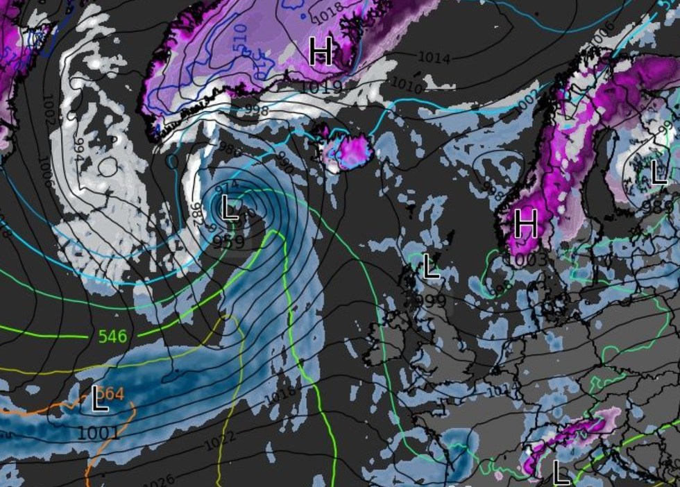
Weather patterns building over Greenland and the Arctic circle suggest winter could deliver its first blow during November with snow possible until the end of the year.
A strengthening Polar Vortex showing signs of possible collapse similar to the 2018 Beast from the East could drive months of snowfall.
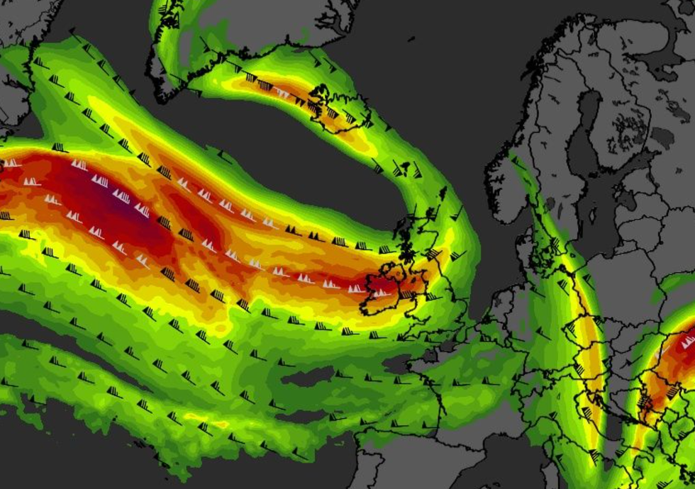
Freezing temperatures are set to hit Britain this weekend after a huge low-pressure system crashed into a "blocking" high-pressure system over Norway and Sweden earlier this week.
According to the Met Office temperatures could drop to 3C in some parts of the country this week.
A Met Office spokesperson said: "Remaining unsettled with showers and occasional more prolonged spells of rain, heavy at times, across many parts of the UK.
WATCH NOW: GB News weather forecast
"The wettest conditions are most likely to be across southern and western parts, with northern and eastern areas perhaps having some drier spells of weather.
"Often windy, with a risk of gales, mostly in coastal regions, but perhaps inland at times too.
"From mid-month, the most unsettled conditions are likely to transfer further north, with areas further south perhaps having some drier spells of weather at times. Within these drier spells, some overnight frost and fog is possible."
Met Office forecasters say the chance of a cold snap between now and January is "higher than for equivalent periods in many recent years".
Weather patterns building over Greenland and the Arctic circle suggest winter could deliver its first blow during November with snow possible until the end of the year
|WXCHARTS
Ahead of the chilly conditions, weather warnings for rain remain in place until Sunday as Storm Ciarán continues to rage on.
Experts have warned that the storm will not be a one-off.
"Our climate projections are showing that we are going to get higher wind speeds associated with storms (and) more rainfall in shorter periods," Dr Melissa Lazenby from the University of Sussex told Forbes.
"I don't think the UK is at the point where it's ready for all the extreme events we're already seeing, whether it be heat waves or, winter storms.
"We need to put in a lot more flood defences. I don't think I can emphasise how quickly (these changes) need to happen."