


Britain will face downpours and cool temperatures for the rest of the month after getting stuck in a "very loopy jet stream".
According to the Met Office, the UK will experience unsettled weather conditions until the start of August.
But it says "summer is not over", with hope conditions will improve in the coming weeks.
Explaining why Britain is seeing such poor sumer weather compared to last year, Meteorologist Aidan McGivern said: "The main similarity between this time last year and the current setup is basically a very loopy jet stream - at the moment there are between five and seven of these ridges and between five and seven corresponding dips in the jet stream.
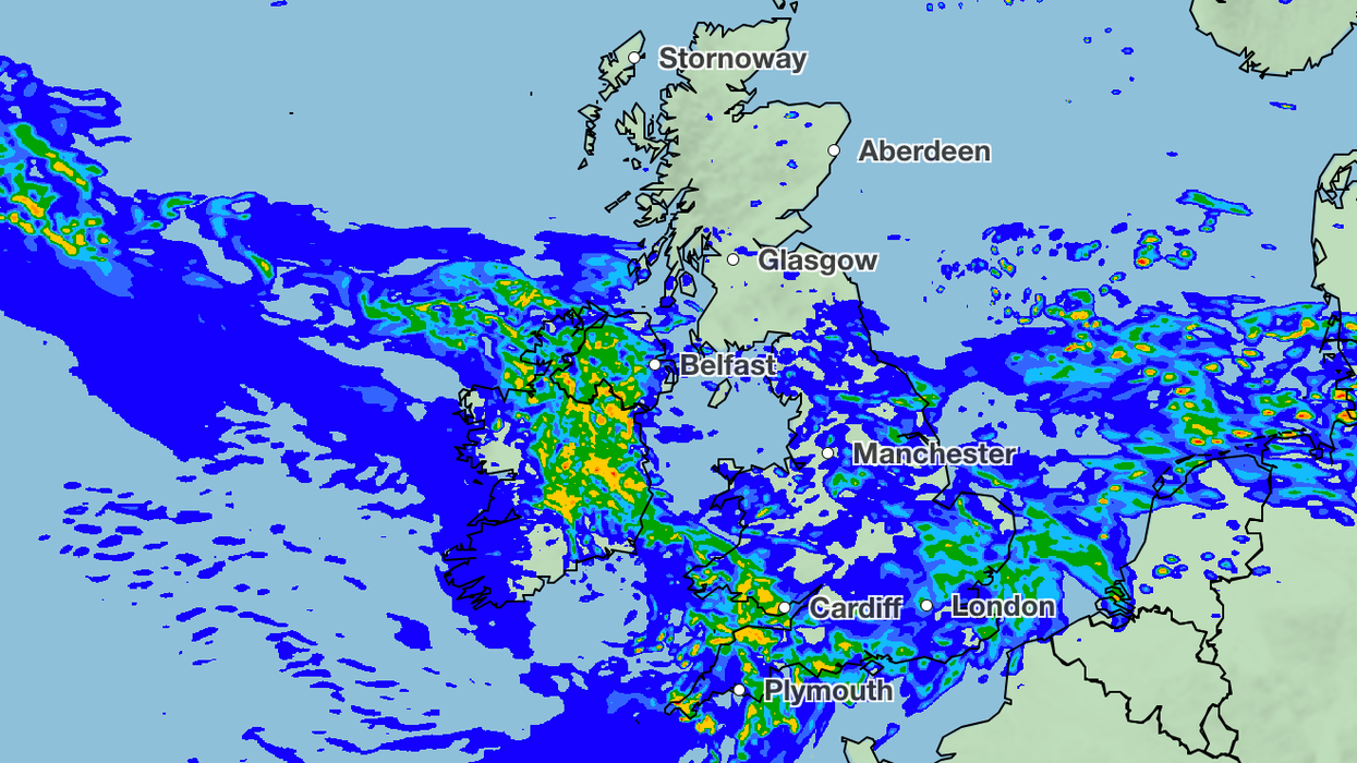
Strong winds will also strike for the rest of the month
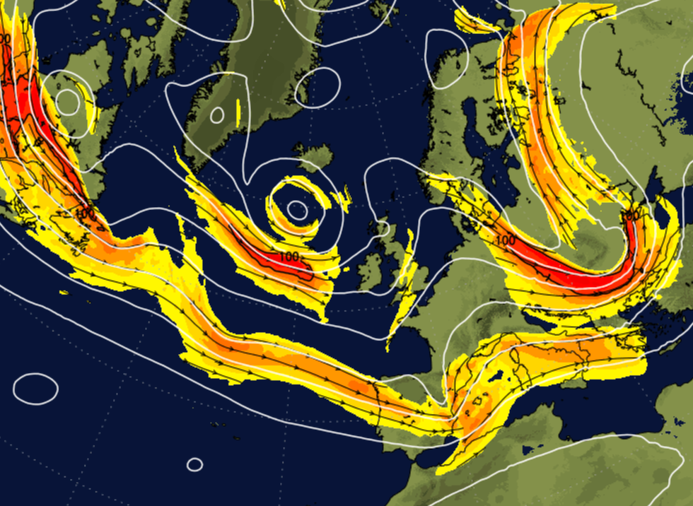
|WX Charts
"When the jet stream is particularly loopy, when it's got five to seven ridges and troughs in it, it becomes very slow moving. Basically heatwaves get stuck in the same place and we see the troughs.
"The unsettled weather gets stuck in the same place, so this time last year we had persistent heatwaves, this year we've got persistent heatwaves.
"But the main difference for the UK is we're now on the cool side of the jet stream, we're in one of these dips. Because of this very loopy jet stream, things aren't progressing - the weather essentially is stuck.
"That doesn't mean it's going to be raining every day for the next 10 days or so, just as we've seen so far this July, the weather will be mixed."
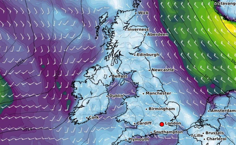
The UK is in a 'dip' in the jet stream, leading to unsettled conditions
|NetWeather
While the UK has seen disappointing conditions during July, on the continent countries such as Spain and Greece are experiencing highs of as much as 48C.
Forecasting the rest of July, McGivern added: "We'll have some showery days, we'll have some more unsettled days but essentially our weather will still come from the North West in the form of low pressure.
"We're still going to be to the north of the jet stream and over the next few days what that means is that we're going to see this cool, north-westerly airflow.
"Around the area of low pressure we've got this strong breeze and at times especially towards the South West, coastal gales, so all very unseasonal and not the kind of thing you might fancy for the middle of July if you've got outdoor plans and activities arranged for the weekend.
"Into the start of next week that low moves away but we've got this straddling weather front and occluded system which is likely to bring some persistent rain continuing through central parts but essentially that turns more showery."
According to the Met Office forecaster, come August the jet stream will start to move and Britain will finally start to see higher temperatures and more sunshine.
While McGivern said the changes would be "subtly at first", he explained the conditions would improve throughout the month.
"Summer is certainly not over yet but we've got an awful lot of changeable weather to come through over the next 10 to 14 days first," he added.