


Britons can expect a chilly start to Spring, with temperatures dipping below freezing before quickly soaring to 16C just a day later.
New weather maps released by WX Charts show parts of northern England and Scotland turning blue as icy temperatures plummet to as low as -3C on April 5.
However, the frosty spell will not linger, as a day later, most of the UK will see the mercury reach into the mid teens.
In Norwich, Britons can ditch the layers as highs of up to 16C are expected on April 6.
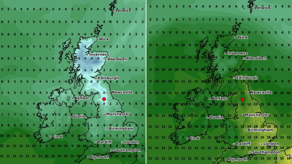
Below-freezing temperatures will quickly soar over the space of just a day
|WX Charts
As the weekend begins, Londoners can also bask in the balmy weather, with highs of 15C predicted by the weather forecaster.
The lowest expected temperature that day will be in the Scottish Highlands, where 6C is forecast.
This is a 9C difference from the mercury predicted for the day prior, where an icy low of -3C is forecast.
However, despite the warm weather predicted as the weekend begins, April is still forecast to be a largely wet month.
WEATHER LATEST:
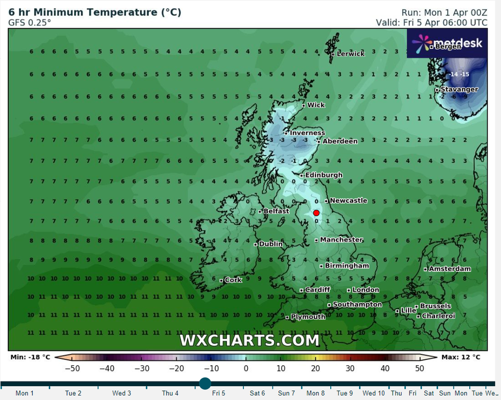
Lows of -3C will be felt on April 5
|WX Charts
In their forecast for later in the week, the Met Office said it will be “largely unsettled and cloudy with showers and longer spells of rain on Wednesday, but drier in the far north. Further rain from the west on Thursday and Friday. Average temperatures”.
Temperatures are expected to remain average with rain arriving from the West later in the week.
Deputy Chief Meteorologist Dan Harris said: “[There will be] A further spell through early April of unsettled weather focussed particularly across southern areas; best chance of any more settled conditions, and probably colder conditions, will be across the north of the UK.”
The Met Office said: “The ongoing unsettled spell of weather seems likely to continue into this period with little sign of any dramatic change.
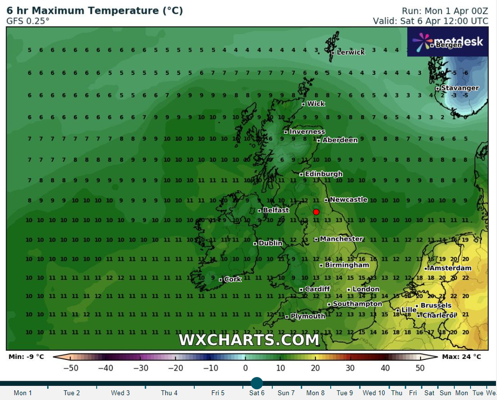
A day later, highs of up to 16C will be felt across the UK
|WX Charts
“Areas of rain are likely to become more widespread across the UK through the first few days of the period, with western hills likely to see the largest rainfall totals. Probably widely windy, with a risk of spells of gales, or even severe gales at first in the exposed west and south.
“Over the following week, there may be a trend towards slightly longer spells of more settled weather from the south east, pushing the focus of most frequent rain towards the northwest. Whilst possibly cold in the extreme north at first, above average temperatures, albeit tempered by cloud and rain, will prevail overall.”
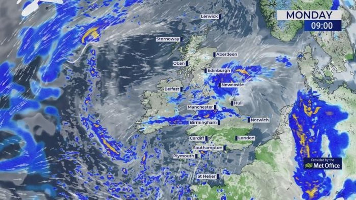
Heavy rain was present in large parts of the UK on Easter Sunday and on Saturday.
More than 12mm hammered parts of the Scottish Highlands on Saturday alone, according to Met Office data.
Up to 12mm of rain was also recorded in the Isles of Scilly, whilst parts of Cumbria saw a downpour.