


Britain is taking cover for autumn’s stormy awakening as rain and gales "whipped up" by the jet stream plough the nation.
A powerful cyclonic weather system will "barrel" through from the Atlantic today with the rest of the week threatening heavy downpours.
Turbulent weather will be fuelled by the jet stream as it shifts position and feeds energy into Atlantic low-pressure storms.
Swathes of the country face an ‘autumnal’ drenching while coastal regions brace for gales.
A Government alert for inches of rain across southern Britain today warns of flash floods, disruption to travel and power cuts.
Met Office meteorologist Alex Deakin said: “The next few days will be dominated by rainfall, and this will be heavy across some places, across Wales, southwest England, pushing into the southeast and East Anglia.
“Out to the west, a weather system is being spun up by the jet stream, and this set of weather fronts is going to bring a wet start to Wednesday.
“There will be some hefty downpours, and it is going to be windy and there will be some pretty strong gusts along the south coast thanks to that area of low pressure.”
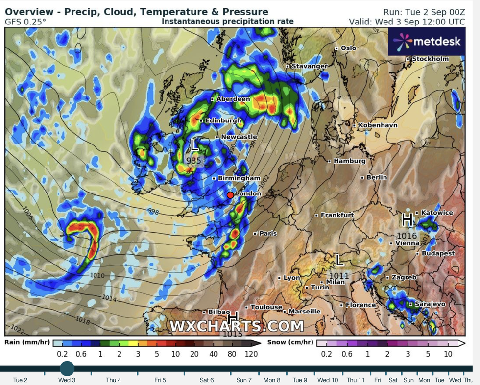
WXCHARTS has tracked this week's washout starting today
|WXCHARTS
Stormy weather this week will be driven by a southerly nudged jet stream before it pushes north ahead of the weekend, he explained.
Drier conditions by the weekend could arrive with a boost in temperatures as warm air floods in from the south, he added.
He said: “We have a classic autumnal set up dominating the UK and a south-shifted jet stream that pushes the weather systems our way.
“There are then signs that the jet stream pushes further north and by the time we get to Friday, high pressure to the south should offer something a little drier.
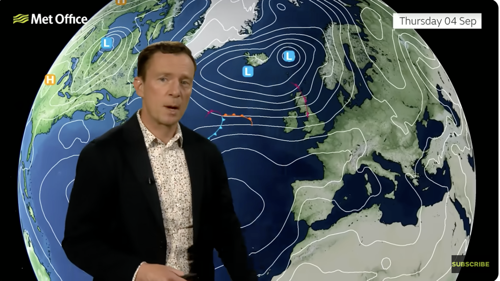
Met Office’s Alex Deakin shows a low pressure line up to hit UK
|MET OFFICE
“As we head into the weekend, we have high pressure to the east and low pressure to the west, but also some warmer air is pushing in from the south and it could be that Saturday is quite warm before this weather system comes in.”
The first hammering of the season comes as the Met Office announces its annual list of storm names.
While no name has been issued this week, the first would be ‘Amy’ followed by ‘Bram’, ‘Chandra’, and ‘Dave’
However, meteorologists warn the Atlantic is ‘waking up’ and could imminently spit out the first significant storm.
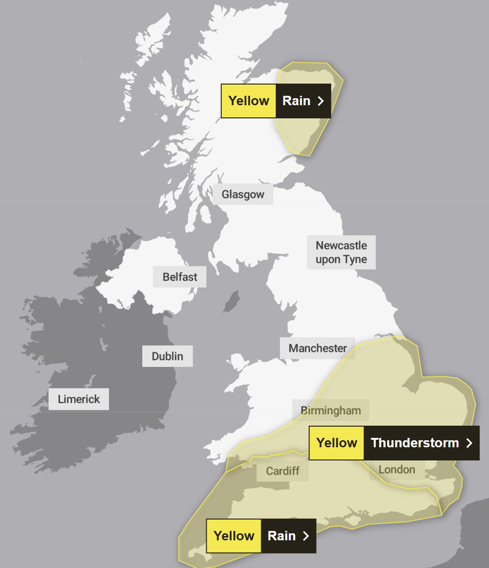
The Met Office has issued three weather warnings for Wednesday
|MET OFFICE
Jim Dale, of British Weather Services and co-author of ‘Surviving Extreme Weather’, said: “There is going to be some pretty heavy rain and high winds through the middle of the week, and while there is yet no name, I would expect to see warnings as this low-pressure develops.
“The Atlantic is waking up, and we are expecting to see more unsettled weather through the week with this theme possibly to continue through the start of the season.
“This is, however, quite a typical transition from summer to autumn, with a lot of energy in the atmosphere after the hot weather fuelling frontal systems as they come through.”
Summer will end as UK meteorologists confirm it has been the hottest on record.
The UK has also been drier than average, the Met Office confirmed, recording just 84 per cent of the seasonal norm.
Dr Mark McCarthy, Met Office head of climate attribution, said: “Our analysis suggests that while 2025 has set a new record, we could plausibly experience much hotter summers in our current and near-future climate and shows how what would have been seen as extremes in the past are becoming more common in our changing climate.”