


Britain is facing an Easter soaking with a ‘conveyor belt’ of rain-laden weather systems threatening spring floods.
Cyclonic low-pressure driven from the Atlantic on a strengthening jet stream could dominate the weather into April.
Bands of heavy rain from the west will hit saturated ground, sparking warnings to be prepared for possible flooding.
Jim Dale, meteorologist for British Weather Services and social commentator, said: “We are in an environment of changeable weather, and over the next week, we are looking at the risk of further rain with low pressure never that far away, carried towards Britain on the jet stream.
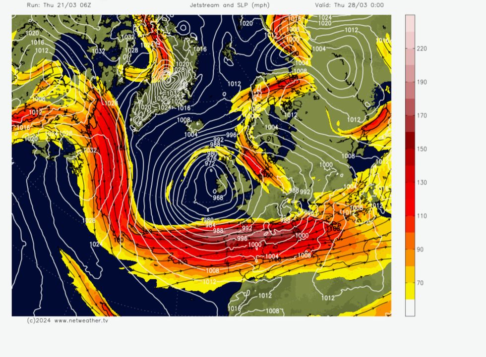
Jet stream straightens out and pulls low pressure towards the UK
|Netweather
“Water tables are already high, so it won’t take much to bring the risk of flooding, especially if we see more persistent rain.
“If this conveyor belt continues, then the risk will persist going forward into the middle of spring.”
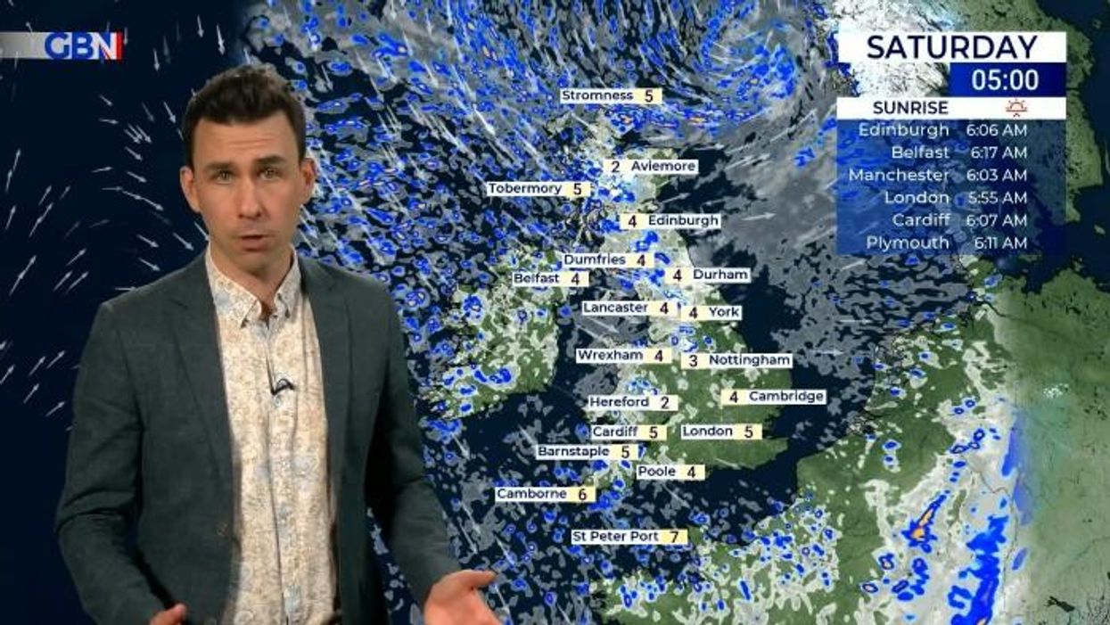
Wet weather will follow a cold snap this weekend as temperatures fall from the balmy 18C highs seen over the past days.
Thermometers will widely dip to single figures, with more exposed regions braced for frosts and even a flurry of snow over high ground.
Another U-turn next week will see temperatures recover to around normal for early spring, although it will turn wetter.
The change will be driven by a ‘zonal’ jet stream–the jet will straighten and build strength as core wind speeds increase.
LATEST DEVELOPMENTS:
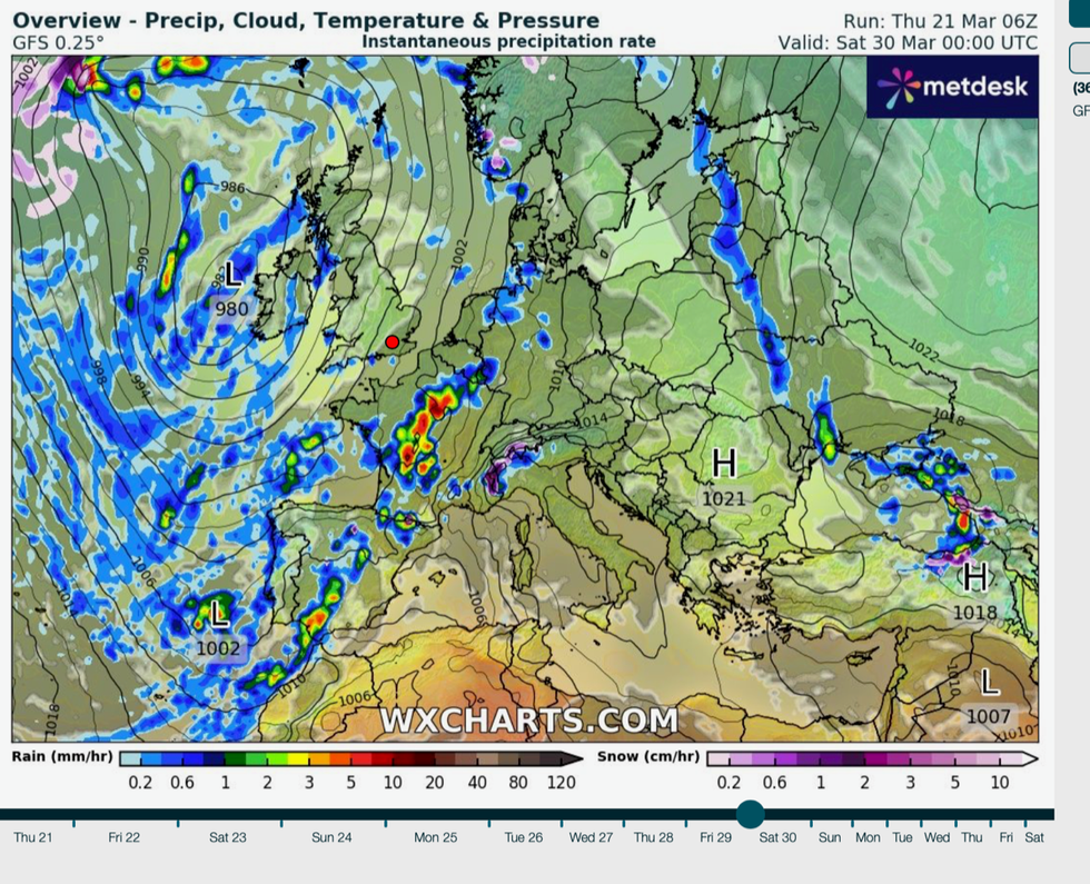
Low pressure dominates UK weather
|WXCharts
A zonal pattern encourages low pressure from the Atlantic, while a wavier ‘meridional’ jet builds high pressure and colder winter weather.
It is the southerly position of the jet with higher pressure to the south that will pull in northerly winds from Scandinavia this weekend.
Northern England and Scotland could get a late flurry of snow over the hills, although this is normal for late March, according to the Met Office.
Met Office meteorologist Aidan McGivern said: “The winds of winter return this weekend, it is going to feel cold as a cold front crosses the country.
“It is going to feel much colder, and temperatures in main urban areas will be around 2C but in rural spots, out of the wind, they will be down to -1C or -2C.
“The air will be cold enough for showers to be falling as snow above 400-500 metres across northern England and Scotland.”
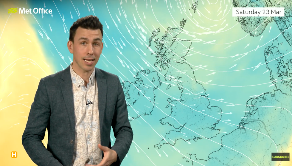
Aidan McGivern warns it will turn colder this weekend
|Met Office
Temperatures will recover slightly in the south towards the end of the weekend, although a north-easterly wind will bring a coastal chill, he said.
Rain will return later next week as low pressure re-builds to the west of the county, he added.
He said: “There is a higher degree of confidence that low pressure will be higher to the UK for much of next week.
“It is likely to be unsettled with winds coming from the southwest, perhaps increasing the temperatures gradually through next week, but keeping things unsettled.
“But between the bands of showers there will always be some dry interludes, but there is no sign of any prolonged settled spell into the start of the Easter weekend.”
The Environment Agency has 66 flood alerts in place and four more serious flood warnings across southern England and on the south coast.