


A tropical heat dome stretching from the mid-Atlantic to Spain will scrape the edge of Britain, triggering a fortnight of wind, rain and yo-yo temperatures.
Sandwiched between tussling pressure systems, the UK is about to be put through a weather washing machine.
Frantic meteorologists predict two weeks of gales, rain, plunging temperatures and frost, and balmy blasts from the tropics.
A high-pressure dome swelling from the tropical Azores, will keep far enough away to hold Britain in sniffing distance of warmth.
TRENDING
Stories
Videos
Your Say
The turbulent outlook means Britons making plans for the Easter bank holiday should prepare for all weathers.
Met Office meteorologist Annie Shuttleworth said: “It is looking more likely that we could see dry weather for a few days or so, but whether it is going to be warm, unfortunately, that is where the most uncertainty lies.
“It is looking like the beginning of the week is getting a little bit drier and warmer, but by the time we get to the bank holiday, low pressure is set to dominate across more northern areas.
“There is a mixed picture through the next two weeks or so.”
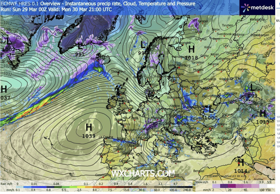
Huge Azores High stretches towards Britain
|WX CHARTS
Southern regions may, over the coming days, catch the warmth of the Azores High – a dome of high pressure typical for summer, reaching across the Atlantic towards Britain.
But its effect will be limited, experts warn, with a continuing battle between storms to the north keeping temperatures stifled.
Ms Shuttleworth said: “High pressure dominates into Monday, so it will be a cold start with a risk of frost.
“Then a weather front pushes up through the north and west, introducing milder air, so it is an incredibly repetitive pattern through the next few days.
LATEST DEVELOPMENTS:
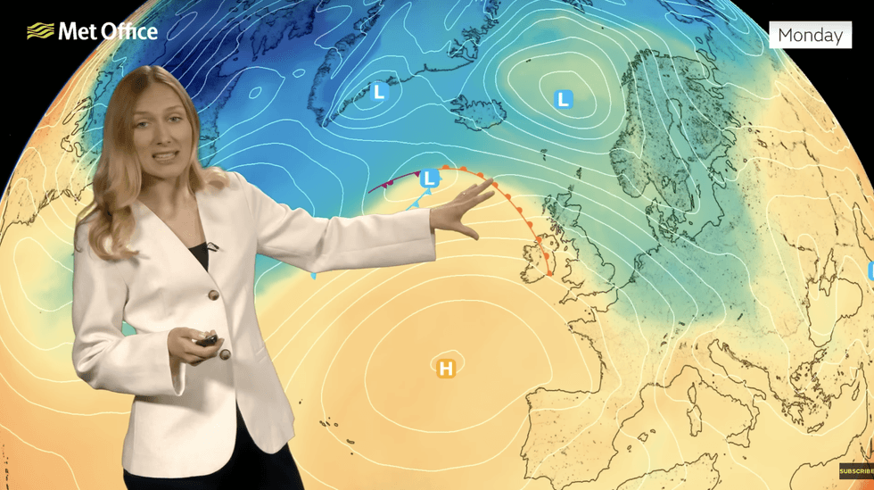
Annie Shuttleworth describes the high to the south battling lows to the north
|MET OFFICE
“High pressure continues to dominate across more southwestern areas, and there is a chance that it starts to shift position.
“For much of the Easter holiday, we will be situated between high pressure and low pressure.”
The four-day break may come under the cosh of a more severe blast of wind and rain, depending on how pressure patterns shift.
A stormy cyclonic low off the tip of Scotland may nudge further south to unleash a weekend of wind and rain.
Jim Dale, meteorologist for British Weather Services and co-author of ‘Surviving Extreme Weather’, said: “This is something we are keeping our eye on, because depending on where this low tracks could have a disruptive effect on the bank holiday.
“If it moves further south, then we are looking at some very strong winds, and the risk of stormy conditions.”
In the meantime, battling weather patterns in the run-up to Easter will bring a mixed bag of all sorts.
For most, it is a dry few days ahead as high pressure to the south keeps a lid on the rain.
Mr Dale said: “The Azores High is just ridging in from the south, so for the next few days it is largely dry, especially to the south, with the risk of showers further north.
“Temperatures will be average, although it will feel pleasant in the sun.”