


A ‘warm-sector’ of tropical winds will deliver one more day of spring joy before temperatures plunge ahead of a 70mph Easter storm.
Temperatures in parts of Britain will lift back into the mid-teens today before a cold front plummets the mercury.
The UK will become a battleground for two tussling weather fronts, between which a slice of warm will briefly hold off the cold.
But it is all change in the run-up to the weekend, with icy winds paving the way for a stormy blast.
TRENDING
Stories
Videos
Your Say
Met Office meteorologist Aidan McGivern said: “We are in between a warm front and a cold front, with warm-sector conditions, and on Wednesday it stays mild, not quite as mild as Tuesday with temperatures of 15C or 16C.
“Then, the cloud turns thicker, the breeze starts to increase, and heavier and more persistent rain starts to move in, especially for central and northern Scotland, and that will fall as snow over the hills and mountains.
“We have colder air returning from a north-westerly direction, so on Thursday, there will be a touch of frost first thing across northern and western parts of the UK, where clearer skies will be.”
A deepening storm hurtling in from the Atlantic will stir things up for the bank holiday weekend, he warned.
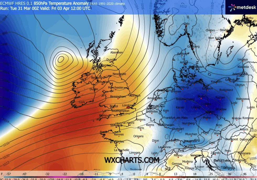
Warm sector simmers over Britain
|WX CHARTS
Northern regions face the strongest winds from Friday, although most of the country is bracing for an Easter washout, he added.
He said: “The winds really strengthen during the day, with the risk of the strongest winds for north and northwest Scotland.
“Winds will peak during the second half of Good Friday, with 60mph or 70mph gusts, but a lot hinges on the depth of the low and its track, but it looks likely that low pressure will stay in charge.
“And it doesn’t improve much during the rest of the weekend, as the jet stream remains in charge and picks up weather systems.”
LATEST DEVELOPMENTS:
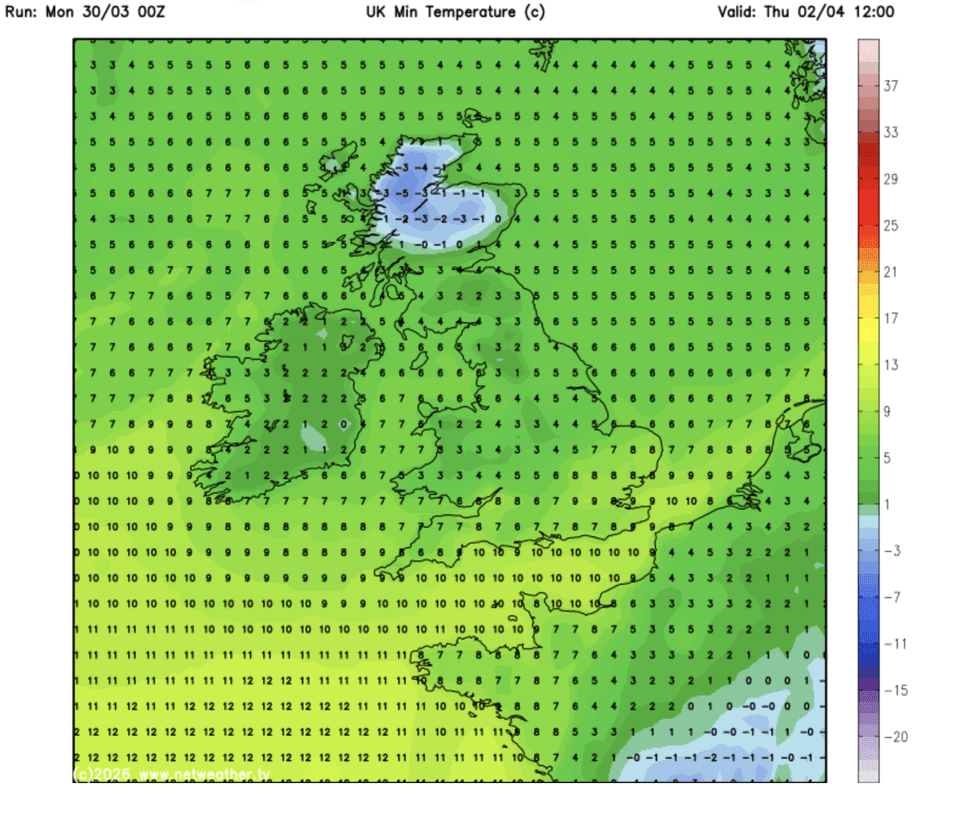
Temperatures will then plunge across the UK on Thursday
|NETWEATER
Temperatures today across southern Britain will nudge 16C with Scotland and northern England just touching double figures.
It will turn cooler everywhere through the coming days, with parts of the north dipping below freezing overnight.
However, meteorologists’ main worry is stormy weather heading in for the bank holiday.
With millions of people expected to hit the roads and transport networks, experts warn of possible disruption.
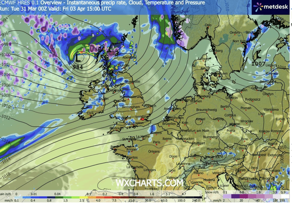
Temperatures will fall as the Easter storm rolls in
|WX CHARTS
Jim Dale, meteorologist for British Weather Services and co-author of ‘Surviving Extreme Weather’, said: “This is looking like a major storm, and will be arriving during a time when it could have significant impact.
“The storm will pass to the north of the UK, and that is where there will be the strongest winds, but it is looking unsettled across the country.
“We are still keeping our eyes on the track and intensity, but it is looking like this will be a disruptive event during the bank holiday.”