


Britain is about to heat up under the glow of a 1,500-mile "warm-sector" pulled on the tail of an Atlantic storm.
Thermometers will rocket to 15C in parts of the UK this week, although the temperature surge will be accompanied by wet and windy conditions.
Scotland is braced for heavy showers and gales, with coasts in the south of England also set for a dousing.
Elsewhere, the mercury will climb to spring-like highs across swathes of Britain.
TRENDING
Stories
Videos
Your Say
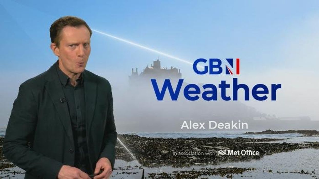
Met Office meteorologist Annie Shuttleworth said: “On Thursday, we are truly in the warm sector, and we are going to notice a big difference in the temperature by Thursday morning. Some areas are a good 10C warmer on Thursday morning, but that does come at the expense of sunshine. The winds will pick up on Thursday evening, and on the west coast of Scotland we could see gale-force winds, although temperature will climb to 13C or 14C.”
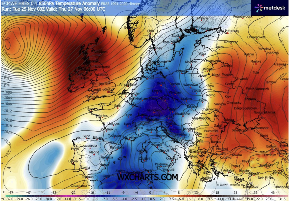
A low-pressure storm system passing the North will pull two trailing weather fronts across the country.
The cold and the hot fronts, spanning a distance from Greenland to Spain, will form the "warm sector" – a region of warmth squeezed between two air masses.
Warm sectors are chased by trailing cold fronts which eventually push away the tropical airmass, replacing it with lower temperatures.
Forcasters said is low pressure to the northwest
|WXCHARTS
Cooler air this weekend is expected to bring such a dip, although nothing like last week’s freezing snap when the country experinced cold as low as -12C.
Ms Shuttleworth said: “As we head towards the weekend, it is going to be staying on the unsettled side of things, and it is probably going to be turning a bit colder again. The next weather front brings further uncertainty, and there is a more unsettled day to come by Friday, but with temperatures on the milder side of things. But it will be another breezy day, with gale-force winds across the northwest of Scotland, and quite breezy along the south coast.”
The run up to Christmas is likely to be mild and stormy rather than calm and snowy, according to latest forecasts.
The Met Office’s three-month outlook predicts an equal, slim chance of overly warm or cold weather.
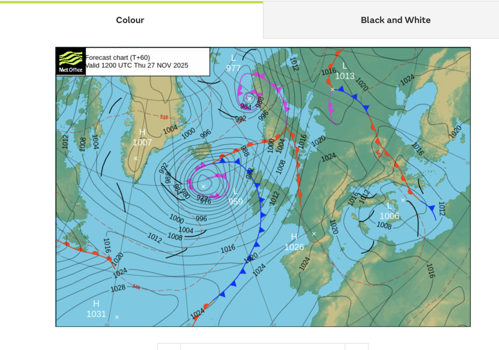
Trailing weather fronts are creating a 'warm sector'
|MET OFFICE
However, forecasters are erring towards a mild run up to the big day.
Jim Dale, meteorologist for British Weather Services and co-author of ‘Surviving Extreme Weather’, said: “It is a while off still, but things seem to be pointing towards wetter and windier conditions through the start of December, driven from the Atlantic, rather than cold."
He added: "There is nothing in the forecast at the moment to suggest that we will get a cold December, or a White Christmas. This is not unusual, as it is more common to get snow later in the season, around February.”
A Met Office spokesman added: “Looking ahead to the weekend, the weather remains unsettled. Temperatures are likely to dip again, but there is considerable uncertainty in the forecast. An area of low pressure is expected to develop in the Atlantic and move towards the UK, but computer models differ on its exact track and intensity.”
Our Standards: The GB News Editorial Charter