


A raging battle between Atlantic storms and a tropical heat dome will keep summer’s return teetering in the balance.
Steering the conflict is a wavering jet stream, veering to the north of the UK and pulling bands of rain into the UK.
Temperatures will rise over the coming days as high pressure, the driver of sunshine, locks horns with rainy low pressure.
Southern and eastern regions could hit the high-20Cs by the end of the week while the rest of the country struggles to catch up.
Met Office meteorologist Aidan McGivern said: “By Friday, many places will be drier and the best of the sunshine towards the east and the southeast with 27C possible.
“By Saturday, we have showers across Scotland and Northern Ireland but feeling warm with temperatures in the low- to mid-20Cs.
“Next week, low pressure is close to the UK, but higher pressure extends to the southwest with more unsettled weather towards the north and the east.
“We have low pressure over the near Continent with a build of higher pressure towards the southwest, and that trend tends to continue into the second week of August with higher pressure becoming more prevalent over the UK.”
LATEST DEVELOPMENTS: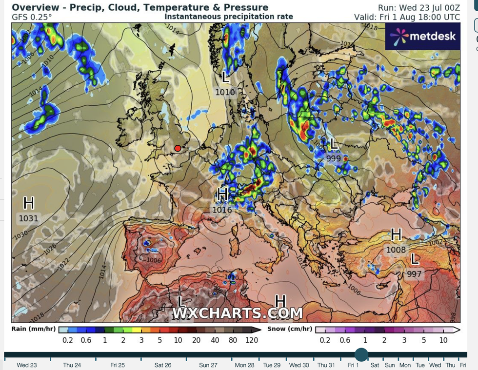
Weather maps show Britain to be stuck between high and low pressure
|WX CHARTS
Swathes of the country will be drenched with stubborn rainfall in the run-up to the weekend.
Southwestern regions will see temperatures increase, although rain will blight Scotland and Northern Ireland.
McGivern said: “It looks like warmer air is coming into western UK and is starting to appear towards the southwest.
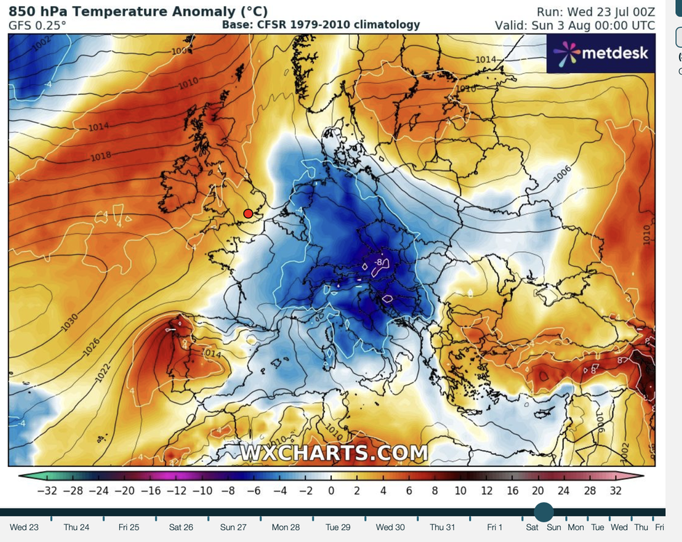
Britons will bask in the glorious heat
|WX CHARTS
“We have higher temperatures moving in from the southwest and a ridge of high pressure building in, and that leads to a change across the UK as we go into the weekend.
“I suspect that through next week the UK will be subject to the jet stream lying to the north of the UK, and it will be changeable across Scotland and Northern Ireland.
“As we go into August, there are signs that pressure will build to the west and the southwest of the UK, bringing more widespread, more settled weather and higher temperatures.”
While a heatwave is unlikely, which would need temperatures to breach threshold levels for three days, parts of Britain could nudge 30C.
However, sun-seeking Britons may have to wait until the last stretch of summer for another scorcher.
Jim Dale, meteorologist for British Weather Services and co-author of ‘Surviving Extreme Weather’, said: “Over the next couple of days, we are expecting pleasant summer weather at times, although there will be a risk of rain.
“As we go through the very end of the month and into the start of August, there is every possibility that we will see a return of the hot weather.
“During this period, I would not be surprised to see 30C or higher.”
A high-level ‘upper-vortex’ pressure cyclone will hover over Britain before shifting to nudge a change in the weather.
McGivern said: “As we go into Thursday, things start to change, and we have still got some showers around the central spine of England and east Anglia as an upper vortex moves away to the east, but meanwhile things are changing out to the west.
“We are going to see more slow-moving downpours through the next few days.”