


Britain will shift from drought to floods as inches of rain descend in an explosive tropical deluge.
Heavy thunderstorms will smash parts of the country through the next 48 hours, carried on a volatile plume from the Bay of Biscay.
Yellow weather warnings have been issued from the Met Office and are due to be in place from midday today until 10pm tonight.
Southern and southwestern regions are in the firing line for the heaviest downpours as warm air sweeps up from France.

The heaviest downpours will hit the south and the southwest
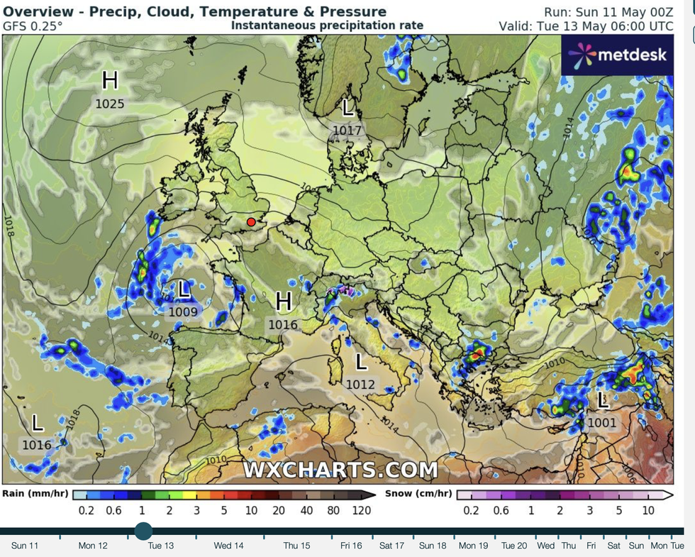
|WXCHARTS
Met Office meteorologist Honor Criswick said: “There is a risk of seeing some heavy, thundery downpours at times.
“If you do catch one of those heavy, thundery downpours, you could see between 20mm to 30mm of rain in an hour or less.
“Over two to three hours, there is a possibility of seeing around 50mm of rain, so some very heavy downpours and this can lead to surface water impacts.”
Spectacular thunderstorms frequently erupt in plumes of volatility, but their location is notoriously difficult to predict.
While southern Britain is most likely to feel the crackle, much of the country is at risk over the next 48 hours.
Criswick said: “When we get this kind of weather, this warm moist air, this can lead to the risk of thunderstorms, but they can be tricky to forecast because they tend to be hit and miss.
LATEST DEVELOPMENTS:
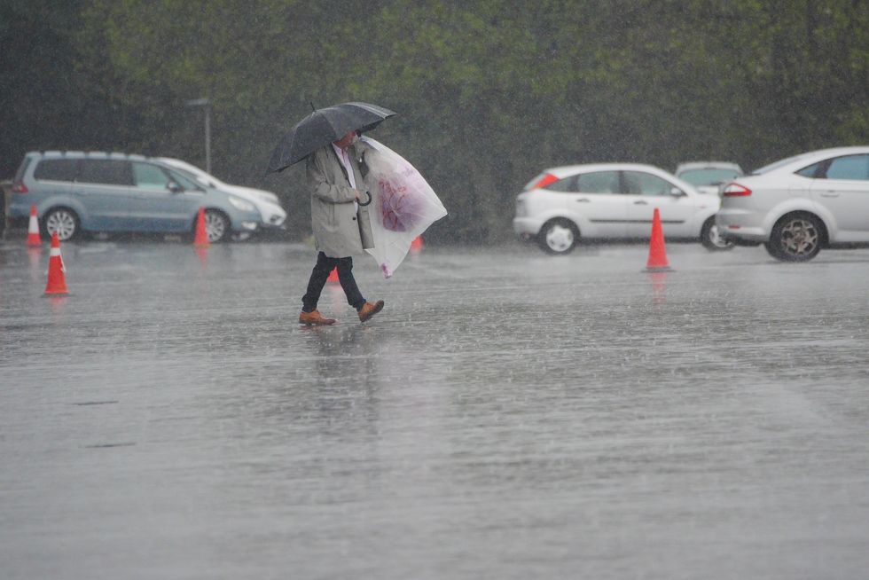
After weeks of rainless weather, bone-dry ground has become susceptible to surface-water runoff
|WXCHARTS
“So, yes possibly you could see a thunderstorm, but they are very hit and miss and there is fairly low confidence where exactly those thunderstorms will be.”
After weeks of rainless weather, bone-dry ground has become susceptible to surface-water runoff.
Heavy rain, instead of soaking into the water table, will gush in torrents putting at-risk regions into flooding territory.
Jim Dale, meteorologist for British Weather Services and co-author of ‘Surviving Extreme Weather’, said: “Some of these showers will be quite heavy and will arrive with the added threat of thunderstorms, although it is difficult to predict exactly where these will happen.
“At the start of the week, showers will be most frequent to the southwest of the country, and then the risk will move to the west and across central parts of the country.
Spectacular thunderstorms frequently erupt in plumes of volatility, but their location is notoriously difficult to predict
|PA
“Because this is coming after weeks of dry weather, the ground is rock hard, and so rainfall will run off rather than soaking in, and this is where you see the risk of localised flooding.”
The Environment Agency has flood alerts in force through the start of the week across parts of southern England and the West Midlands.
While confined to a relatively small area, ‘land, roads and property may flood’, it warned.
A spokesman said: “Localised flooding is possible on Monday in parts of the South and East of England, including London, and the Midlands.”
Jason Nicholls, lead international forecaster for AccuWeather, said: “Low pressure in the south will bring showery periods in Wales and southern England through the start of the week.”