


Savage blizzards crippling Canada and the US will send a battering-ram jet stream across the Atlantic to ward off the looming risk of a UK cold snap.
Fears of imminent snow have eased as the Scandinavian ‘anticyclonic high’ behind the threat retreats from a barrage of westerly storms.
Britons still face sub-par temperatures this week, although a no-show for now is forecast for freezing gales and ‘snow bombs’.
Met Office meteorologist Alex Deakin said: “The jet stream is active across the Atlantic, coming out of Canada, but it is weakening across the UK, and that means that our weather patterns are slow-moving.
TRENDING
Stories
Videos
Your Say
“There are slow-moving areas of low pressure, and one of the reasons for that is a big blocking high pressure over northern Europe.
“We are going to have the winds coming from the south with some showery rain, and for most of the week, temperatures are going to be around or a touch below average.”
Tussling weather patterns have turned Britain into a battleground, triggering yo-yoing bouts of cold then mild weather.
High pressure to the east, locking horns with low pressure to the west, brought freezing temperatures over Christmas before opening the gates to Storm Goretti.
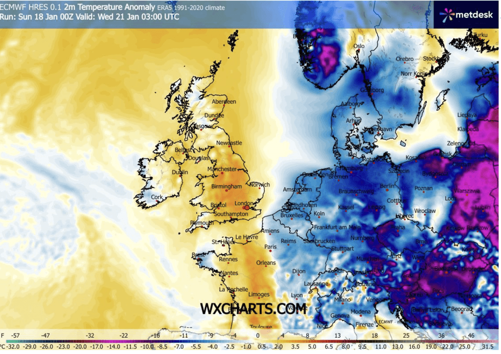
Cold held at bay while UK stays milder
|WX CHARTS
High pressure will stay tucked to the east through the coming days, although a shift after the weekend could revamp the threat of cold and snow.
Deakin said: “As we go into next weekend, the most likely pattern is for a Scandinavian high, and that will perhaps tap into a bit of an easterly.”
Britain’s weather this week is likely to come under the influence of a severe cold snap locking its jaws on Canada and the eastern United States.
Plummeting temperatures to the north of the US will meet milder conditions to the south boosting the jet stream.
LATEST DEVELOPMENTS:
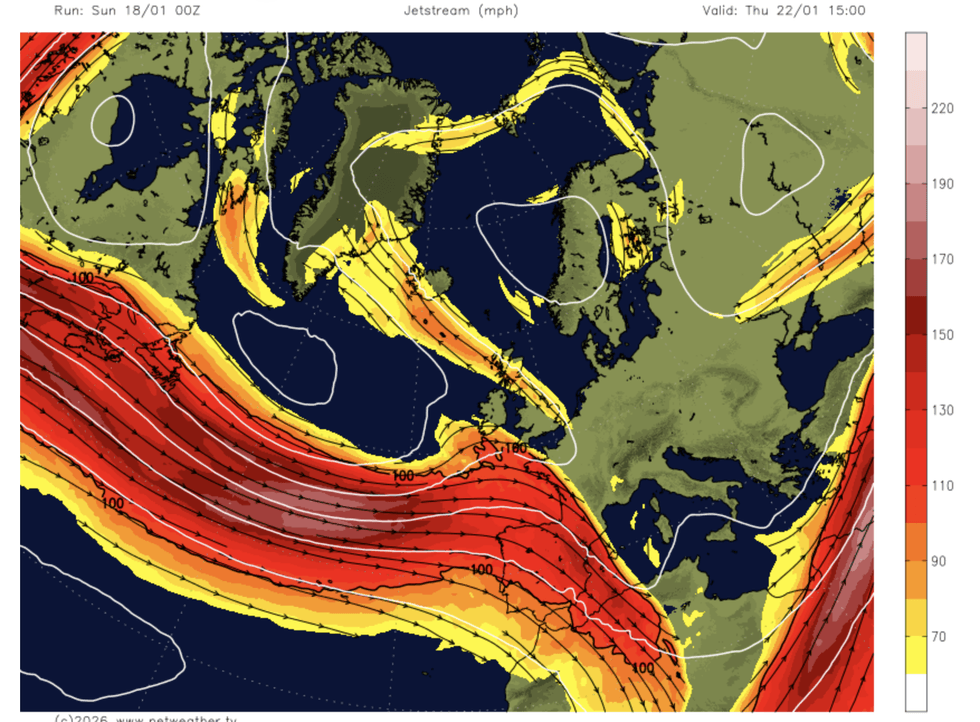
Powerful jet stream pushes out of US and Canada
|NETWEATHER
As the jet hurtles across the Atlantic with low pressure in tow, high pressure to the east will hold far enough away to push Britain into a cold snap.
Jim Dale, meteorologist for British Weather Services and co-author of ‘Surviving Extreme Weather’, said: “We are back into the proverbial battleground this week, although it will be colder in parts as we get something in from the north.
“The jet stream could end up over Spain or even split, sending an arm over Iceland and Norway.
“It is likely this week to help keep the very cold weather to the east.”
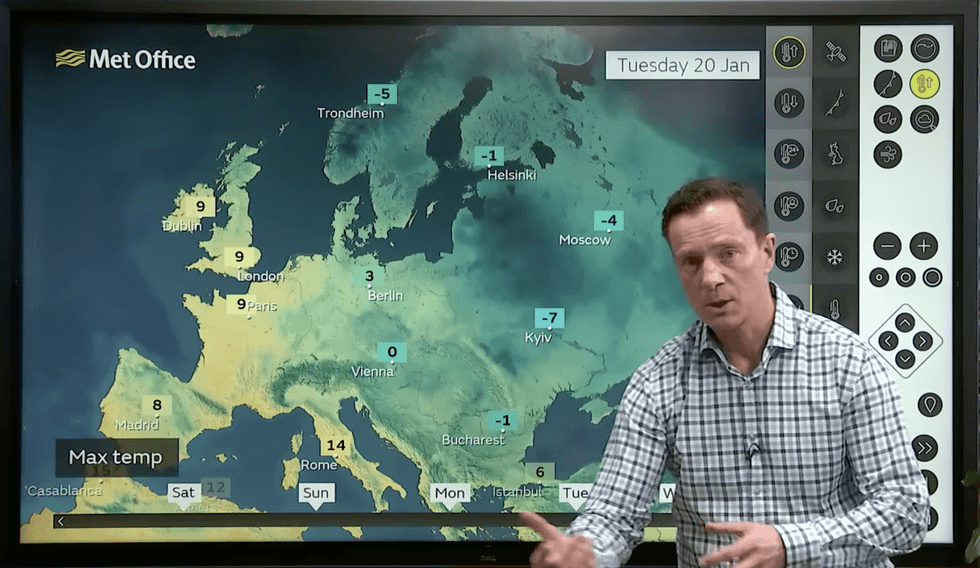
Alex Deakin describes cold holding to the east while UK is slightly milder
|MET OFFICE
But Britain is not out of the woods, he warned, with the risk of cold and snow returning next week.
He said: “After the weekend, there are signs that we could get something back in from the east.
“We are not talking a major Beast from the East, but possibly the return of something much colder with snow over the Highlands and to the north of the country.”
Netweather meteorologist Ian Simpson added: “During the next few days, a substantial cold northerly outbreak is forecast for the east of Canada and North America, which will particularly affect the north-east of North America.
“Sometimes the cold air coming out of Canada and North America can power up the jet stream and help keep the Icelandic low in place, which hinders the chances of the Scandinavian high sending cold air all the way west to the British Isles.”