


A ‘complex’ union of a tropical hurricane trapped in an ‘agitated’ loop of the jet stream threatens a week of cyclonic chaos.
Britain is playing a waiting game as Hurricane Erin sweeps up the coast of America before hitching a ride east on powerful winds.
A calm before the storm will see warm temperatures and settled conditions over the Bank Holiday before the weather goes downhill.
**ARE YOU READING THIS ON OUR APP? DOWNLOAD NOW FOR THE BEST GB NEWS EXPERIENCE**
Ex-Erin’s chaotic movements between now and the middle of next week have frantic meteorologists screaming at their synoptic charts.
The Met Office’s Alex Deakin said: “There is quite a complex interaction going on with ex-Hurricane Erin, and this does some uncertainty with the forecast.
“Things are starting to stir out in the Atlantic because the jet stream is becoming a little agitated, and the reason for that is tied to an area of low pressure, which is currently Hurricane Erin.
“After the Bank Holiday, we are likely to see a change, and the most likely weather set up for Tuesday, Wednesday and Friday is for low pressure to the west or across southern parts of the UK, and that generates more cloud and some outbreaks of rain.”
Ex-Erin will most likely hover to the west of Britain in a loop of the jet stream – the fast-flowing ribbon of air high in the atmosphere – hurling out bouts of wind and rain, he said.
LATEST DEVELOPMENTS: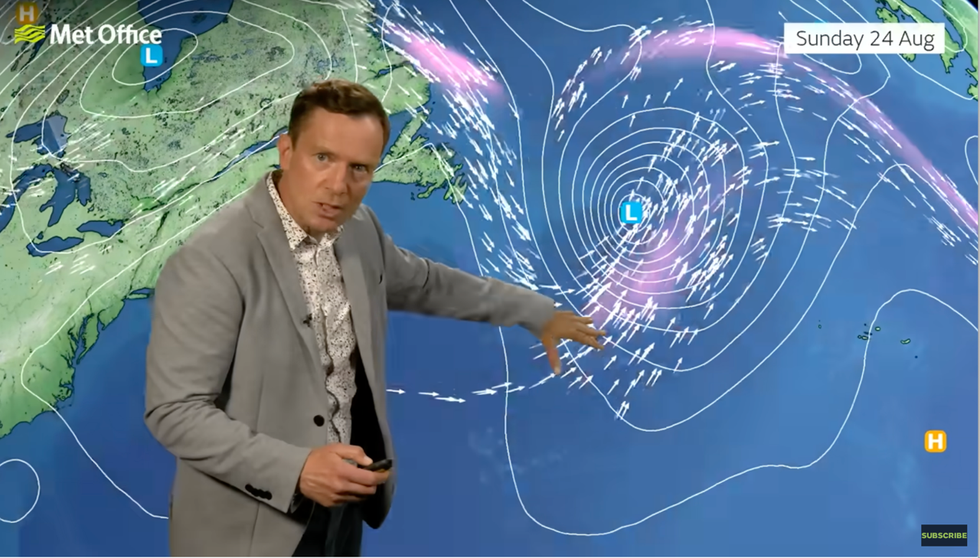
Alex Deakin describes the interaction between Erin and the jet
|MET OFFICE
It will be fuelled by colliding bodies of warm and cold air, strengthening the jet and firing up low pressure left from the hurricane, he added.
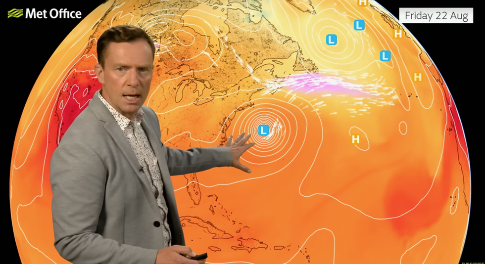
He said: “As Erin changes from a hurricane to an area of low pressure, it draws in colder air behind it, and the jet stream becomes more active to the south.
“Most models agree that the jet dips down, and the low pressure heads out into the mid-Atlantic, and the jet doesn’t push the system along, it sits still out in the mid-Atlantic.
“The probability forecast through next week shows a trend of more unsettled weather dictated by low pressure getting closer to the UK.”
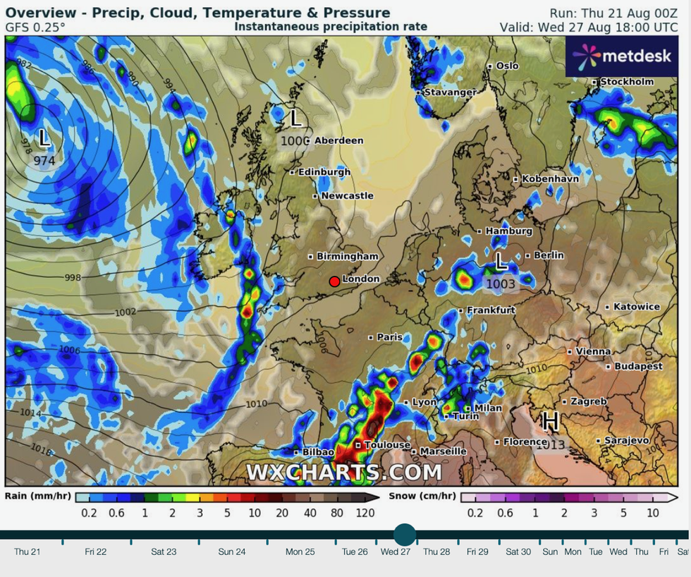
Ex-Erin sits out to the west
|WX CHARTS
Meanwhile, Britons can look forward to a calm and pleasantly warm Bank Holiday with temperatures in the mid-20Cs.
Deakin said: “High pressure will control our weather through the end of the week and into the weekend, which means there will be a lot of dry weather.
“This weekend in the south, we could see temperatures getting up to 24C or 25C, rising with the help of insulation and a bit more sun and by Sunday, more widely over 20C, but in the south possibly even 26C.”
Hurricane Erin could be about to draw a veil across the Mediterranean summer with a switch to grey skies and rain.
Alex Deakin plots path of Hurricane Erin
|MET OFFICE
Jim Dale, meteorologist for British Weather Services and social commentator, said: “The Bank Holiday could mark the end of the Mediterranean summer, with the remains of Erin marking a switch to more prolonged unsettled weather.
“It is likely that this is the theme going through the end of summer and into the start of September.”
The chopping and changing weather will keep British tongues wagging with new Met Office research confirming it is the nation’s official obsession.
Britons spend around 57 hours a year doing nothing but talking about the weather, most of us once a week.
It is the national icebreaker and conversation starter, beating politics, family gossip and holiday chat.
Alex Deakin said: “Weather has always helped bring people together and this research underlines how talking about the weather is more than a curiosity, but a necessity for many people.”