


Britain is just days away from another blast of heatwave hell, with the mercury this weekend threatening to bubble to 34C.
Sun-weary Britons are urged to make the most of fresher conditions over the next couple of days before temperatures rocket.
Weather models for the weekend hint at 34C across the south with highs elsewhere widely in the upper-20Cs.
Jim Dale, meteorologist for British Weather Services, said: “As we go towards the end of the month and into the start of July, we will be knocking back on the door of the 30Cs.
“I would not be surprised if we do not come in with one of the warmest Junes on record, when all the figures are in, with above average temperatures and sunshine.
“Southern and southeastern regions are likely to see the highest temperatures through the end of the month, with weather fronts passing the north to bring fresher conditions.”
Temperatures in parts of the country are expected to smash the 33.2C recorded last week at Charlwood, Surrey.
High pressure building from the south will drive blue skies, sunshine and searing temperatures.
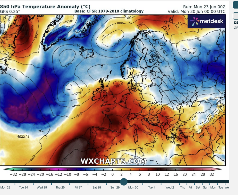
Heat returns for the weekend
|WX CHARTS
Dale said: “High pressure will probably grow by the end of the month, and this will bring higher temperatures.
“In the southeast, we are likely to see higher levels of humidity as the temperatures rise, and this will bring the risk of instability and thunderstorms.”
Meanwhile, a north-south split will keep dry warmth across the south this week as Scotland and the north turn unsettled.
A conveyor belt of low-pressure storm systems passing north of the UK will sweep western Britain with bands of wind and rain.
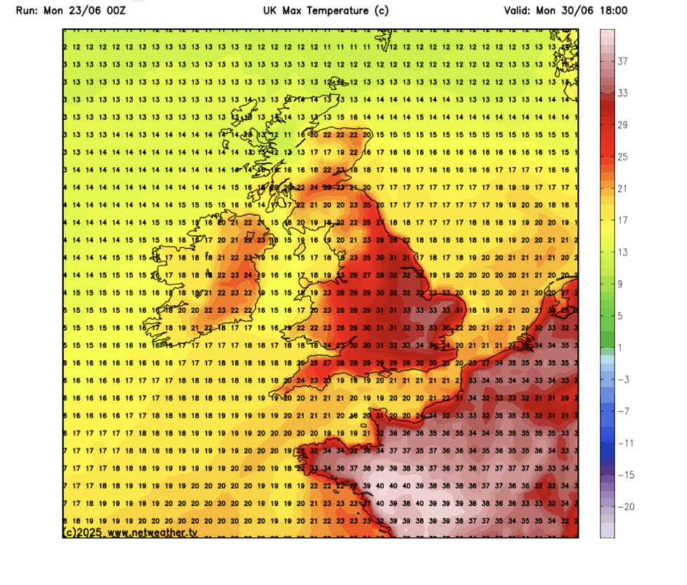
Temperatures back into the 30Cs
|NETWEATHER
Temperatures will drop almost 10C across northern regions before the mercury rises again at the weekend.
Met Office meteorologist Jonathan Vautrey said: “The heaviest of the rain on Tuesday will be across western regions, and eastern areas may manage to stay largely dry for most of the day but there is going to be more cloud around for most of us on Tuesday.
“It is still going to be blustery for many of us, and with those winds coming in from the southwest, we will start to see temperatures climbing up a little bit more across parts of England and Wales.”
Southern Britain will turn drier into the weekend while the threat of rain persists further north.
Jason Nicholls, lead international forecaster for AccuWeather, said: “Through the middle of the week, we expect sunny periods and scattered showers with a front spreading southwards on Tuesday, bringing some thundery outbreaks.
“There may be additional showers in northern areas on Friday and into the weekend, but the south should turn drier and brighter.”