


Temperatures look set to plummet to as low as -10C next week as Britons brace for snow and heavy rain, new weather maps have shown.
WX Charts predicted mercury to fall below freezing and snow to hit parts of the UK.
Temperatures could fall to as low as -10C in Scotland on the morning of April 3.
The entirety of the UK will witness mercury drop below freezing the following day, with lows of -4C in Wales, -6C in Scotland and -6C in northern England.
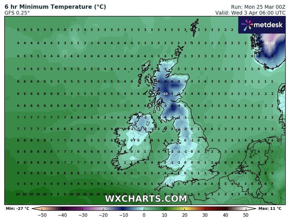
Temperatures could drop to as low as -10C
|WXCHARTS
WX Charts has also suggested snow will fall across Scotland, north Wales and parts of the north of England.
Snow will hit southern England by April 7, with wintery conditions likely to remain until April 10.
Scotland will also witness snow later this week, with four centimetres expected on Wednesday morning.
The rare phenomenon of freezing rain may also be witnessed in parts of the country.
This occurs when temperatures are so cold that rain freezes before it has even hit the ground.
The Met Office opted to issue a yellow rain and snow warning in response to the situation.
“A band of persistent rain and snow will move north across Scotland overnight Monday into Tuesday,” the UK’s national weather service said.
LATEST DEVELOPMENTS: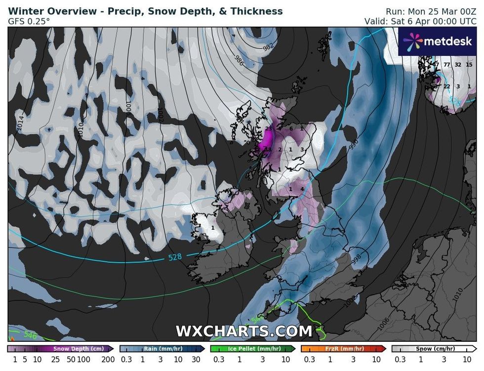
Snow will hit parts of the UK next week
|WXCHARTS
“At low elevations (below 150-200 metres) this will fall mostly as rain, with 35-45 mm falling quite widely over Fife, Angus and Aberdeenshire and perhaps more than 50 mm in some locations with surface water causing some spray on roads.
“At moderate elevations (above 150-200 metres) snow is more likely, mainly 1-2 cm of slushy deposits, but 2-5 cm possible in some places affecting higher transport routes.
“At higher elevations (above 300 metres ) 10-20 cm may fall causing travel issues on higher routes.”
Significantly more snow will fall later this month.
However, the Met Office is forecasting for unsettled conditions, including rain and showers.
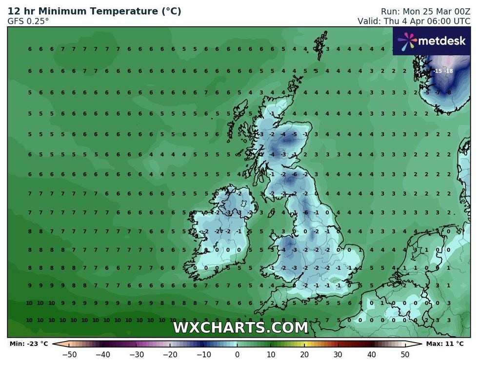
Temperatures will drop across the UK next week
|WXCHARTS
In its long range forecast, the UK’s national weather service said: “The Easter weekend is likely to be unsettled with rain or showers in most regions at times, but also some drier and brighter spells.
“The heaviest and most frequent showers are more likely to be in southern and western areas.
“Later in the weekend, there is a chance of northern areas becoming drier with increasing amounts of sunshine.
“Compared to the coming week, the Easter weekend is likely to be a little warmer.
“Into the following week, continued unsettled or changeable weather remains the most likely outcome.
“All areas are likely to see further rain or showers at times, with some drier spells in between, but wet weather will tend to favour the south whilst northern parts remain a bit drier on average.”