
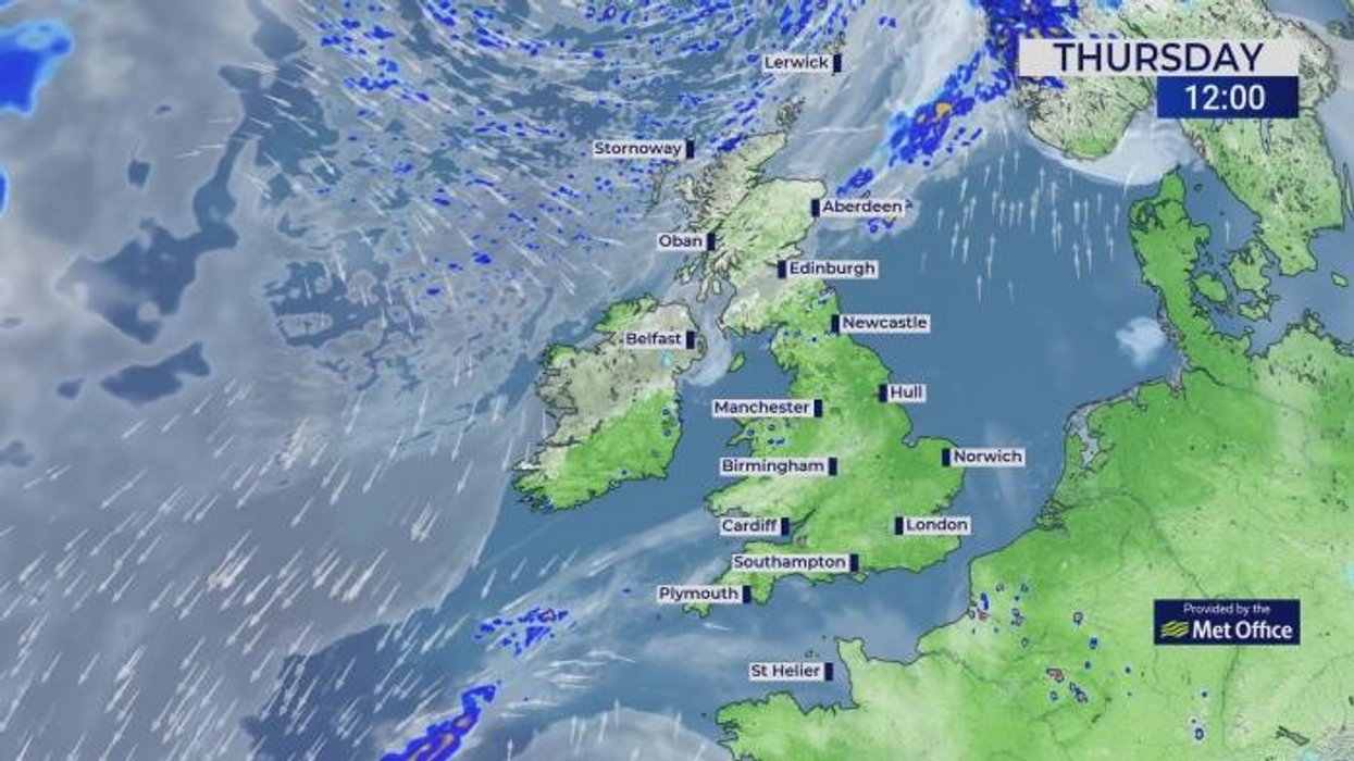


Britain could today bake in the earliest spring heat blast ever seen with temperatures poised to smash a possible 30C.
Although the mercury is likely to nudge widely into the high 20Cs, parts of the country could topple the record.
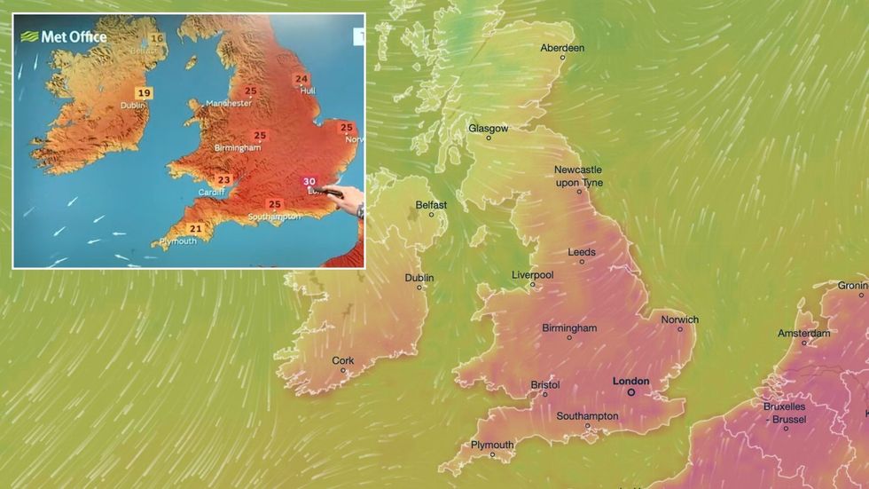
The top May temperature is just under 33C, but a 30C somewhere would be the earliest break from the 20Cs recorded in the UK.
Met Office meteorologist Aidan McGivern said: “The most likely temperature we are expecting on Thursday is 29C, but there is the possibility of 30C.
Britain could today bake in the earliest spring heat blast ever seen with temperatures poised to smash a possible 30C
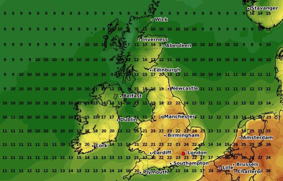
|Met Office/ Ventusky
“That would be remarkable because if we saw 30C recorded on the first of May, it would be the earliest 30C had ever been recorded in the UK.”
Temperatures today will rocket well above average for the time of year as the mini heatwave reaches a climax.
Southern and southeastern regions will enjoy the warmest weather with slightly cooler winds across the northwest.
High pressure sitting over the UK will act like a heat dome, warming ground-level air as it falls from higher in the atmosphere.
Temperatures are set to peak today before a cold front arrives to pull the plug on the very hot weather.
McGivern said: “A subtle change takes place during Thursday, and a cold front begins to drift south across Scotland and Northern Ireland.
LATEST DEVELOPMENTS:
“By Friday, temperatures are lowering across the UK, although there is still the possibility of the mid-20Cs, even 27C in the far southeast of England but it is significantly cooler further north and west, and by the weekend we are back towards average.
“By the weekend, cooler air is slowly making inroads across the whole of the UK, and temperatures for most are back to average, and by Sunday we have more of an easterly or northeasterly airflow for much of the UK, particularly towards the east, so temperatures below average by this stage and feeling much cooler on the northeast coast.”
Although it will feel widely cooler by the weekend, much of the country will continue in the mild, dry weather.
A cold front moving into rising temperatures will trigger atmospheric instability and the risk of hail and thunder.
Shifting weather patterns over the north Atlantic will put southern parts of the country in the firing line for rain.
The top May temperature is just under 33C, but a 30C somewhere would be the earliest break from the 20Cs recorded in the UK
|WXCHARTS
Jim Dale, meteorologist for British Weather Services and social commentator, said: “Thursday will bring the peak of the temperatures, and we could see 29C or higher in parts of the country.
“However, there will be some atmospheric instability and with that the risk of thunderstorms.
“These will be very isolated where they do occur, but they could be lively.”
Jason Nicholls, AccuWeather’s lead international forecaster, said: “High pressure will bring warm dry weather, but showers may return later in the week.
“It is forecast to stay warm, although it may feel cooler by the weekend.”