


A 30C heatwave will reboot summer amid predictions a surge of ‘African plumes’ could roast the UK until deep into autumn.
Rain-swept Britons will ditch umbrellas for sun-cream next week as wind and rain give way to sunshine and blue skies which are tipped to hold out through September.
Temperatures between now and the end of next week are expected to rocket around 15C as the jet stream sweeps north pulling hot air in from Europe.
While the UK will dodge the unbearable heat which has gripped swathes of the Continent, thermometers will surge higher than average for late summer.
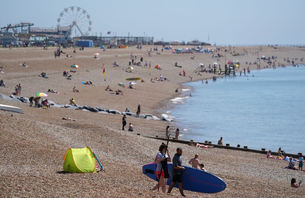 People enjoy the warm weather on Hastings beach in East Sussex. Picture date: Sunday June 13, 2021. | gbnews
Jim Dale, meteorologist for British Weather Services, said: “We are about to get a sea change from very unseasonable wet and windy weather to something much more like summer, with temperatures possibly heading towards 30C by the middle of next week.
“I think the peak of the temperatures will happen between Friday and next Saturday, and we should be able to call this a mini heatwave.
“Although a heatwave must last three days or longer, we could see warm weather holding out for around five days to start with, particularly in the southeast which will see the best of the temperatures.
“Looking further, high pressure responsible for the change in weather may hold out through August, particularly in south-eastern regions.
“So summer is certainly not lost.”
A ‘balancing’ trend of the weather may then see sunshine and warmth hold out through September, he added.
He said: “September is fast becoming the new summer month, and there is no reason we should not see 30C during the month.
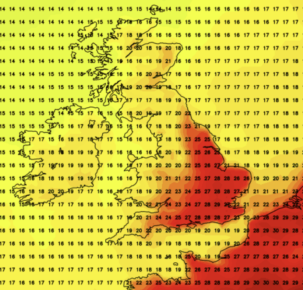
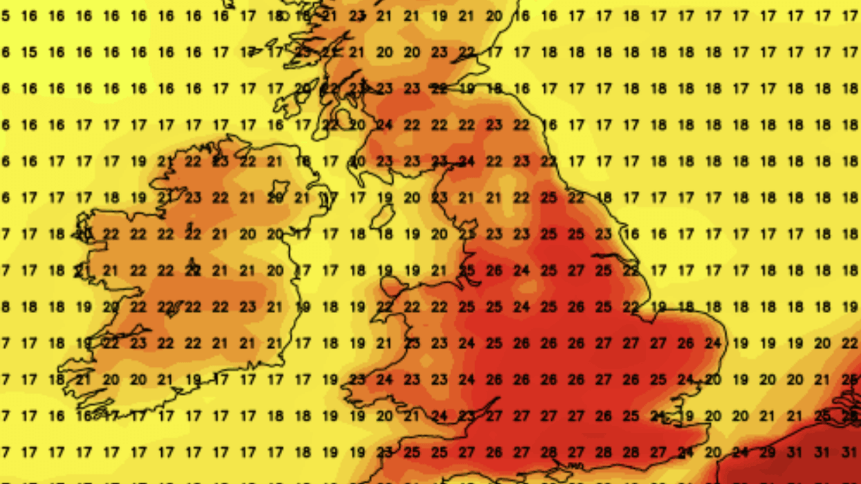
Temperatures on August 14 will also be hot, according to NetWeather
|NetWeather
“We have had very unseasonable conditions during July, and as the weather balances through the rest of the season, it is possible we may see warm weather continue through September.”
The outlook for the next week is less cheery as Britain becomes a ‘battle ground’ between Atlantic and jet-stream driven storms and systems pushing up from the south.
Swathes of Britain are under a raft of weekend weather warnings with 65mph gales threatening London and the southeast, southwest England, Wales and the West Midlands, while Northern Ireland braces for rain.
Mr Dale said: “Before the warmth arrives, we can expect one more stab of poor weather this weekend, then hopefully it will improve thereafter.
“At the moment we are looking at a battle between the Atlantic, which is ruling the roost at the moment, and the push of high pressure from the south.”
Britain’s weather is currently influenced by low pressure boosted by the jet stream which has dipped unusually far south for the time of year.
Unsettled low-pressure ‘cyclones’ have hitched a ride on the jet to bring relentless bouts of wet and windy weather to the UK.
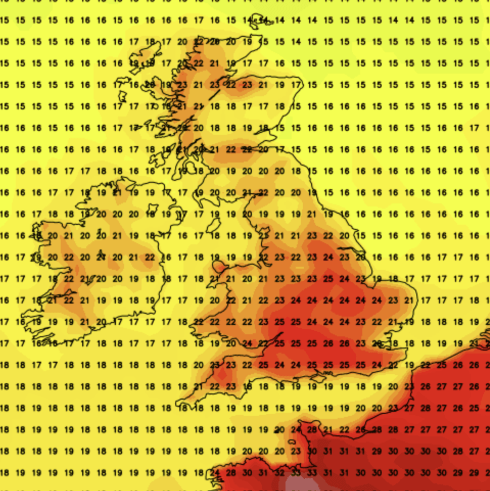
NetWeather has suggested temperatures could start to soar in the coming weeks
|NetWeather
On the south side of the jet stream, Europe has roasted under prolonged high pressure driven by clear skies and unbroken strong sunshine.
The jet stream is forecast to shift during the second half of August, allowing high pressure to build across Britain and temperatures to rise.
This could trigger a spate of ‘African plumes’, pushing temperatures above average through September.
The best of the temperatures will hit southern regions, while Scotland and northern England remain closer to average.
Exacta Weather forecaster James Madden said: “There are consistent projections for a return of high pressure and some very potentially very hot temperatures by mid-August.
“This could throw us back into heatwave territory on a number of occasions during the second half of the month and the final part of the meteorological summer.
“It could also pave the way for a warm to hot September as a number of potential African plumes bake our shores.”
Meanwhile, Britons are taking cover for another week of foul weather with wind and rain forecast to hold out into next week.
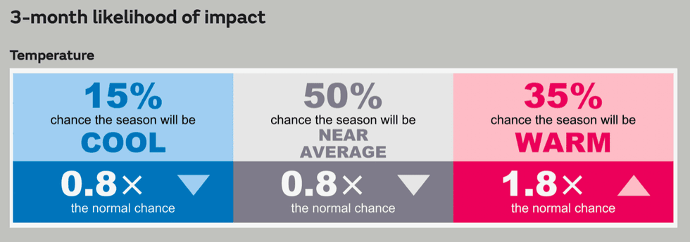
Met Office's three month likelihood impact
|Met Office
The Met Office has issued warnings for more than two inches of rain across Northern Ireland on Saturday morning.
Wind will lash the southwest prompting warnings for power cuts, travel disruption and floods from large coastal waves.
Met Office deputy chief meteorologist Steven Keates said: “There’s some potentially disruptive weather on the way on Saturday as a deep area of low pressure for the time of year moves from west to east across central areas of the UK
“The strongest winds are more likely in southwestern areas of the UK, including parts of Wales, southwest England and along the south coast of England.
“With trees in full leaf, wet ground and the likelihood of a number of outdoor events, the impacts of this weather are likely to greater than if it were to occur during the autumn or winter.
“Winds are expected to ease from the west later in the day.”
The Met Office’s longer term outlook suggests a 35-per cent chance of warmer than average weather through the start of autumn, a 15-per cent chance of cool weather, and a 50-per cent chance of average weather.
A spokesman said: “There is a small increase in the chance of heatwaves during August, although the overall risk is not as high as in recent years.”