


Britons are set to bask in warm temperatures over a three week period as a "high-pressure ridge" extends across the UK, according to the Met Office.
The exact date that the heatwave will hit has been unveiled by weather forecasters following a month of drizzly conditions, low temperatures and even thunder and lightning.
The Met Office predicts that temperatures will rise later this month, on May 19.
A spokesperson said: "A high-pressure ridge is most likely to extend across the UK, resulting in a good amount of fine and dry weather for most.
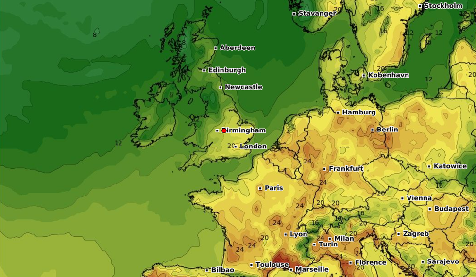
Temperatures are set to rise from May 19, according to the Met Office
|WXCHARTS
“Temperatures most likely above average overall, although most likely closer to average in the southeast.
“Into June, high pressure is predicted to remain dominant, especially for northern areas, with cloud, rain and showers more likely to the south, although there is a level of uncertainty associated with this.
“An increased likelihood of above average temperatures for many.”
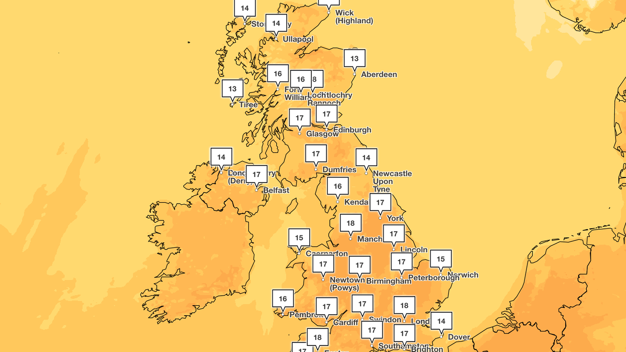
It follows several warm days for many parts of the country as people headed out to enjoy the sunshine.
But before temperatures rise again, Britons are being warned of cooler temperatures and showers making an abrupt return.
Met Office forecaster Stephen Keates said: "We've had plenty of sunshine around over the weekend. We're going to hold onto a decent segment of that fine weather but there will be the odd scattered shower about.
"Some of them will be heavy at times. It's also going to feel cooler than what it has been with temperatures dropping slightly."
Rain showers are set to move across the country and there could be mist and fog on Tuesday morning.
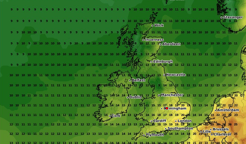
The beginning of June is expected to see 'warmer than average' temperatures
|WXCHARTS
Looking ahead to the beginning of June, the Met Office added: "The most likely scenario for the end of May is for drier weather in the north, with an increased chance of periods of rain and possibly thunder in the south and southwest.
"Into June, high pressure is predicted to remain dominant, especially for northern areas, with cloud, rain and showers more likely to the south, although there is a level of uncertainty associated with this.
"An increased likelihood of above average temperatures for many."