


A Friday the thirteenth horror show will unleash rain, sleet, snow and hail as Britain braces for winter’s return.
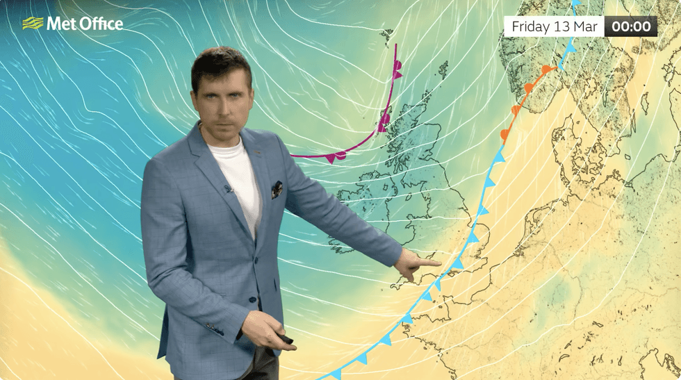
Arctic air sweeping the UK will battle raging jet stream winds, clobbering the calm start to spring.
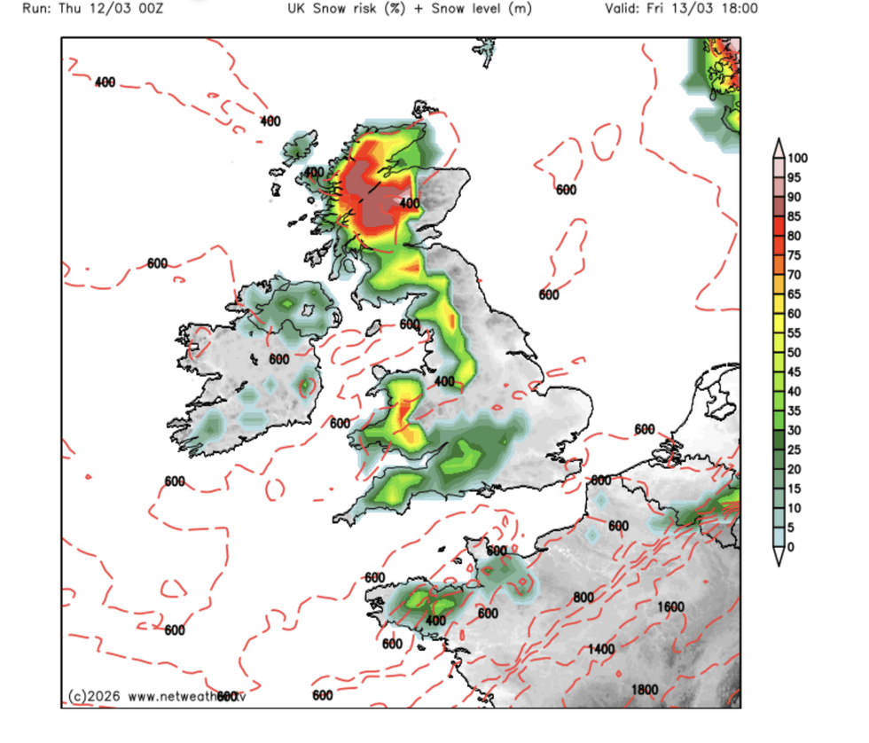
Scotland is on alert for potentially disruptive snowfall, while the rest of the UK faces heavy rain and winds.
Met Office meteorologist Alex Burkill said: “The jet stream is running across the Atlantic and across the UK, and it is going to drive some pretty unsettled weather.
“We have a new air mass across us, and it is cold Arctic air which is why we may see some sleet or snow, particularly over Scotland.
“On Friday, a colder front is coming in, and it will be wet over the southeast and there will be some brighter weather, but also rain, sleet and snow.”
Britain’s weather U-turn is in part thanks to a cold plunge over the north US supercharging the jet stream ahead of its Atlantic passage.
The jet is acting as a conveyor belt, picking up low-pressure storms and fuelling them towards the UK.
Snow back in the charts
|NETWEATHER
A brief respite in the deluge on Saturday will give way to more rain on Sunday as the next system barrels in.
Burkill said: “The rain could be a bit heavy at times, and most of us will see some rain, and on Sunday another feature is developing and there could be some sleet or snow, particularly over Scotland.
“Most of the snow will be largely confined to high ground, but there could be some to lower levels so there could be some impacts.
“Temperatures on Friday will widely be lower than Thursday, and with the brisk winds it is going to feel pretty raw at times.
LATEST DEVELOPMENTS:
Alex Burkill warns the cold and wet is coming through
|MET OFFICE
“Colder air is across us, and that is why there is a reasonable chance of seeing something wintry.”
As temperatures tumble, bookmakers have rejigged the odds to put snow back in the running.
Coral is now 1-2 on wintry showers anywhere across the country by the end of the week.
Spokesman John Hill said: “Meteorological spring may have arrived, but we are not out of the woods just yet for the wintry conditions.
“We make it odds-on for snow to fall on any major UK city this week.”
While early signals show hints of a return to something calmer during the second half of March, the outlook for next week is more of the same.
Further cyclonic weather systems will bring rain from the Atlantic, although temperatures will climb.
In the meantime, experts warn sun-ready Britons to wrap up for a cold and wet weekend.
Jim Dale, meteorologist for British Weather Services and co-author of ‘Surviving Extreme Weather’, said: “We are now in an Arctic airmass, so when fronts come in from the west there is going to be a risk of snow, particularly over the Highlands of Scotland, but we can’t rule out something to lower levels.
“To the west of the country, the issue is rain, and this could be heavy at times coming after wet weather during winter on ground that is still saturated.
“This is going to be a reminder that we are in March, not May, and we are not out of the woods yet.”