


Spring will be ‘put on hold’ in a hammering of wind and rain before plunging temperatures bring flurries of snow.
Britain’s weather is about to take a wintry U-turn as gales and torrential rain blow in from the Atlantic.
Polar winds ahead of the weekend will plunge the mercury below average for early spring, as Scotland and northern England brace for wintry showers.
Jim Dale, meteorologist for British Weather Services, said: “Spring is going to be put on hold this week as we go into something a bit more wintry compared to what we have seen during the start of March.
TRENDING
Stories
Videos
Your Say
“It will turn more unsettled towards the middle of the week, with wind and rain coming in from the Atlantic, and this could be something that we need to watch.
“Then, towards the end of the week, it is going to turn colder, and we are talking about temperatures widely at freezing or below with the risk of snow over the Highlands and glens of Scotland, or even a bit further south.”
Warm winds from the southern tropics will be nudged out for bitter gusts from the Polar region, he warned.
Parts of the country could nosedive to -5C or lower over the weekend as exposed regions nudge -10C, he added.
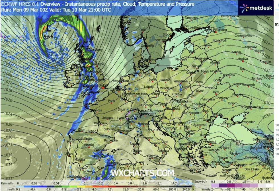
Stormy weather sweeps in from the Atlantic
|WX CHARTS
He said: “We are going to see a return of the Polar airstream that is more usual during winter, and this is going to be very noticeable as we get closer to the weekend.
“Widespread frosts and ice may be an issue, and for some, this week will see a return to scraping cars first thing in the morning.
“However, this is a reminder that we are in March, and we have a while to go before we are out of the woods as far as a return to wintry weather.”
Britain will feel the first bite of winter’s return mid-week as winds pick up and bands of rain sweep in from the west.
LATEST DEVELOPMENTS:
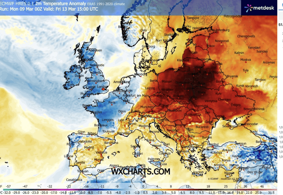
Then the cold moves back in
|WX CHARTS
Temperatures will hover around average or above through the start of the week, with highs in parts of 15C.
Met Office meteorologist Craig Snell said: “For most, with winds coming in from the south, Tuesday will be another mild day, and we could see highs of 14C or 15C in the southeast.
“Then for the rest of the week, Wednesday and Thursday turns much more unsettled as we see bands of rain move in from the Atlantic with fairly strong winds, and Thursday could be wet for some of us before it turns colder.
“Winds coming from the north will bring temperatures to around average or below average in places with possibly some winteriness over high ground of the north.”
It will follow a foggy start to the week as a dome of high pressure traps Britain under a shroud of grey cloud and fog.
Winds from the west will shift the gloom through today, giving a flicker of sunshine before the cold sets in.
Snell added: “There will be plenty of cloud around, but there may be some brighter spells a bit more widely compared to Monday.”