


Britain is heading back into storm season as yo-yoing pressure ripples across the Atlantic fired up by a ferocious jet stream.
Spring sunshine is on hold for the next week as the nation braces for torrential rain and a wintry cold snap.
After a relatively calm end to winter, a turbulent run into mid-March awaits as ‘low-pressure system after low-pressure system’ ploughs through.
Rather than stalling over the West Country as is the case during winter, cyclonic storms will hurtle into Europe, rattling Britain in their wake.
Met Office meteorologist Aidan McGivern said: “The weather is unsettled through the next week or so, but it is a different flavour of unsettled compared to the first two months of the year.
“We have the jet stream coming in on a more typical path and these weather systems are moving through.
“Because we have the increase in the westerly winds, and the more powerful jet stream, and low after low after low, it is going to be more blustery with the risk of gales.
“The winds will be accompanied by spells of rain at times, and a swathe of gales crossing the UK during Thursday, and Thursday is going to be a very unsettled day.”
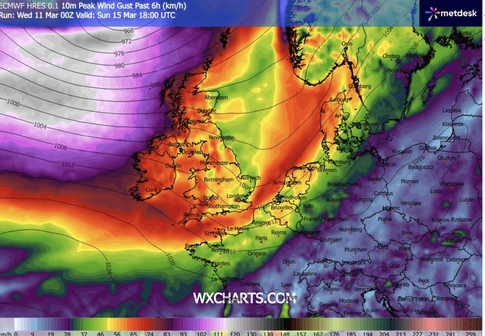
Winds pick up into the weekend
|WX CHARTS
Britain’s weather is about to come under the cosh from strengthening pressure waves spanning the Atlantic.
The so-called North Atlantic Oscillation (NAO) will enter a positive phase – a tipping of the balance between low pressure over Iceland and high pressure to the south.
In its positive phase, the NAO drives a stronger-than-usual jet stream, boosting and steering stormy weather systems.
McGivern said: “A positive North Atlantic Oscillation will start to dominate the weather across the UK during the next few days.
LATEST DEVELOPMENTS:
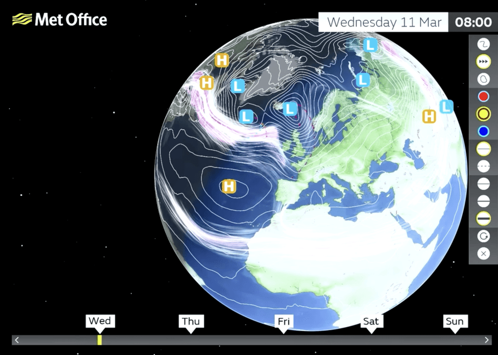
Jet stream pulls low pressure storms into UK
|MET OFFICE
“We have a strong jet stream moving in, and that tends to move lows through the UK into Europe, and there is a signal through next week for higher pressure to start to emerge, deflecting the jet stream a little more.
“The jet stream has been activated by severe storms over the US in recent days, and now it is active and heading our way.”
As spring gives way to wind and rain, another twist in the tale will bring a late bite of winter.
Temperatures in parts ahead of the weekend will nosedive to -10C with snow forecast for the Scottish Highlands.
A freezing plume from the North Pole, pulled in by spiralling low-pressure storms, will have Britons back in winter coats.
Jim Dale, meteorologist for British Weather Services and co-author of ‘Surviving Extreme Weather’, said: “We are going to see lows of -8C or below in exposed regions to the north of the country, but everywhere by the end of the week it is going to feel colder.
“Frosts and ice may be an issue into the weekend, as we go back into a Polar airflow.
“We are going to get the opposite of what we had last week, with snow possible over the Highlands.”