


The UK is on alert for a weekend wipeout as Storm Isha threatens to bring 80 miles per hour winds, the Met Office has warned.
Britons are bracing for a battering on Sunday with wind and rain warnings set to wreak havoc.
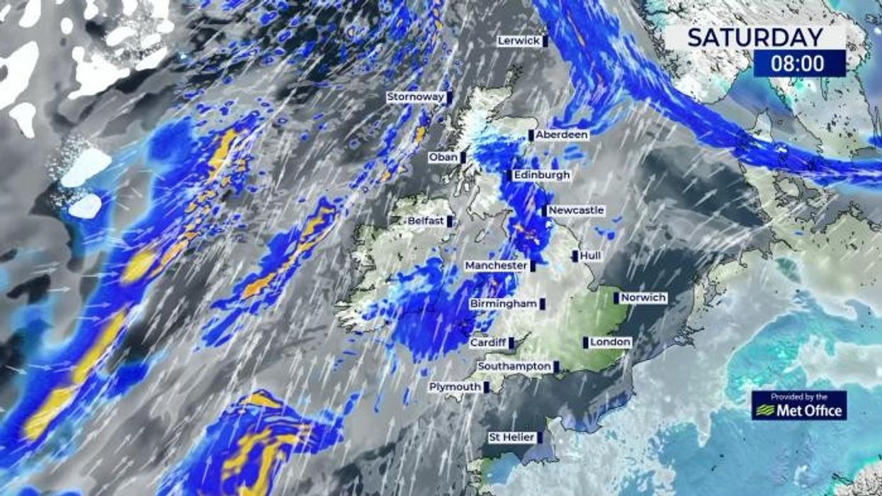
A single yellow rain warning is in place for Saturday, covering parts of Central, Tayside & Fife, Highlands & Eilean Siar and Strathclyde.
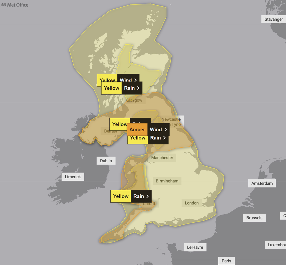
However, Sunday and Monday will likely prove much damper and windier with the UK's national weather service issuing five warnings across Great Britain and Northern Ireland.
The Met Office has issued a number of alerts on Sunday
|MET OFFICE
Amber wind warnings will cover Central, Tayside & Fife, North East England, North West England, Northern Ireland, SW Scotland, Lothian Borders, South West England, Strathclyde, Wales, Yorkshire & Humber from 6pm tomorrow to 9am on Monday.
The Met Office said: "Very strong southwesterly winds will develop widely across Northern Ireland, western parts of England, Wales and the southern half of Scotland during Sunday evening.
"Gusts will frequently reach 50-60 mph, perhaps 70 mph at times in a few locations and, along exposed coastal stretches 80 mph is possible at times.
"During the early hours of Monday winds will turn westerly and affect a wider area of southern Scotland and northern England, before easing through the morning.
LATEST DEVELOPMENTS:
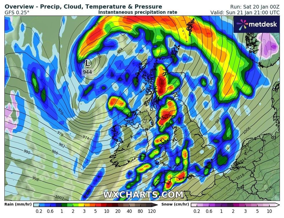
WXCHARTS' weather overview for Sunday
|WXCHARTS
The UK's national weather service warned there is a "good chance" of power cuts, damage to buildings, longer journey times, issues on British roads and "danger to life" from large waves and beach material.
A separate wind warning has been issued from midnight on Sunday until 9am covering South East England.
The Met Office added: "Very strong southwesterly winds, associated with Storm Isha, will develop across parts of Sussex and Kent during Monday morning. Gusts of 50-60 mph are likely widely with 70 mph possible in a few locations.
"Along exposed coastal stretches winds may gust up to 80 mph a times. Winds will turn westerly around mid-morning on Monday and ease."
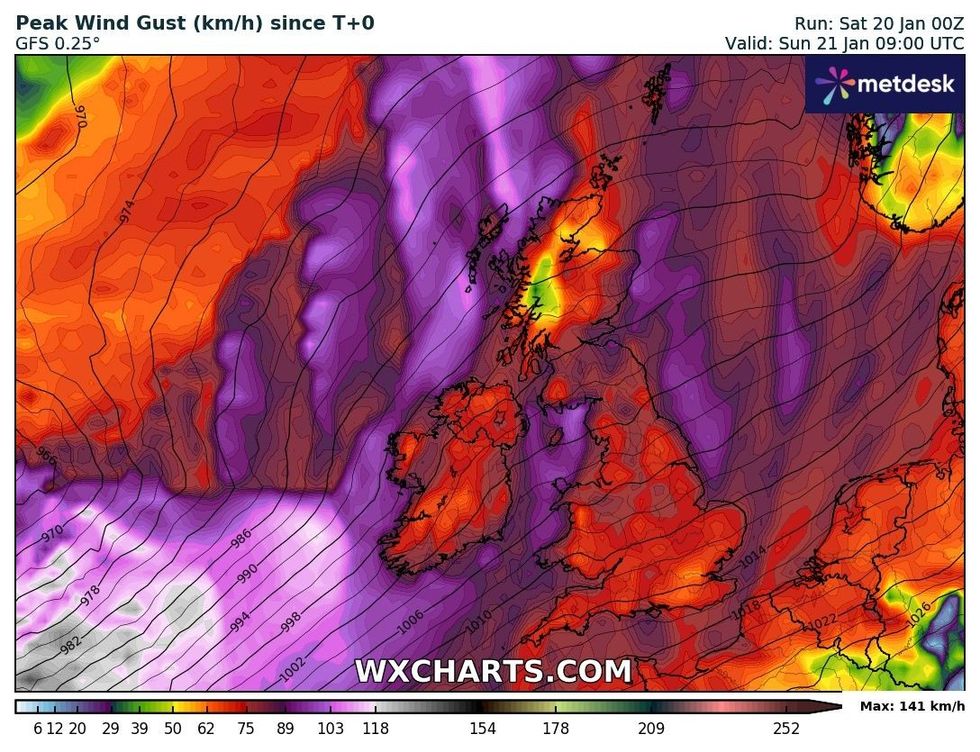
Max gusts across the UK on Sunday
|WXCHARTS
Three yellow rain warnings will bring further disruption to the Britons in Central, Tayside & Fife, Grampian, Highlands & Eilean Siar, SW Scotland, Lothian Borders, Strathclyde, North East England, North West England, Yorkshire & Humber and Wales.
A wider yellow wind alert was also issued covering the entirety of Great Britain, with gusts of up to 70mph expected along the UK's coastline.
The Met Office's wider forecast for today said: "A cloudy and breezy start for many and milder than recent days.
"Patchy rain turning more persistent in the west later. Staying dry for much of the east of England and Scotland. Milder with any lying snow continuing to melt.
"Winds strengthening through the evening with gales and possibly severe gales for exposed western coasts.
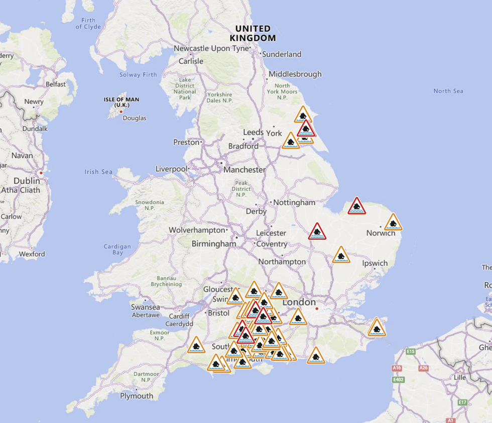
England's Environment Agency issued a number of flood warnings and alerts
|ENVIRONMENT AGENCY
"Further pulses of heavy rain especially for western parts. Largely dry for the southeast. Mild."
In its forecast for Sunday, the UK's national weather service added: "Windy but largely dry at first.
"Winds strengthening as Storm Isha arrives from the west, bringing widespread rain, locally heavy at times. Gales or severe gales likely by evening."
The weekend wipeout comes just hours after England's Environment Agency and the Scottish Environment Protection Agency issued eight flood warnings and 57 flood alerts.