
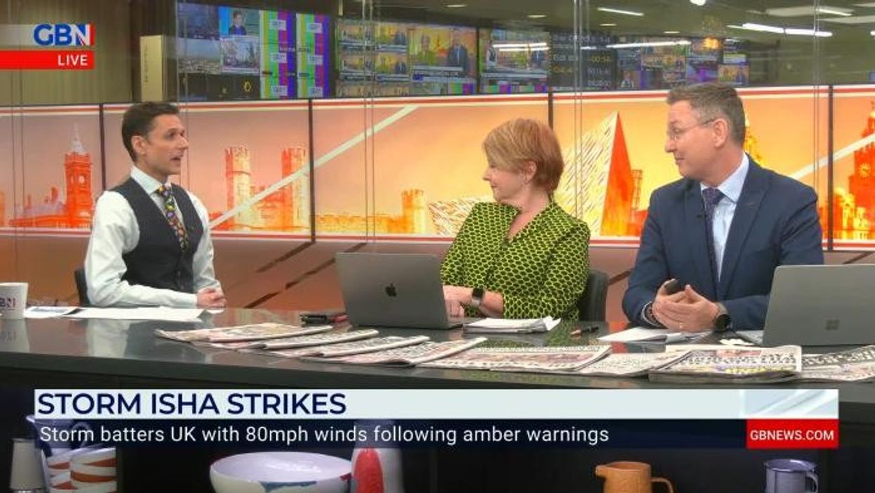


The Met Office has upgraded its weather warnings across the UK as an amber wind alert risks wreaking havoc with "severe winds" forecast for Sunday and Monday.
Two amber wind alerts have been issued from 6pm tonight to 6am tomorrow morning.
The UK's national weather service claimed gusts could peak at 90 miles per hour in exposed and hilly areas.
Central, Tayside & Fife, Grampian, Highlands & Eilean Siar, North East England, North West England, Northern Ireland, Orkney & Shetland, SW Scotland, Lothian Borders, Strathclyde and Yorkshire & Humber will face the brunt of the wind.
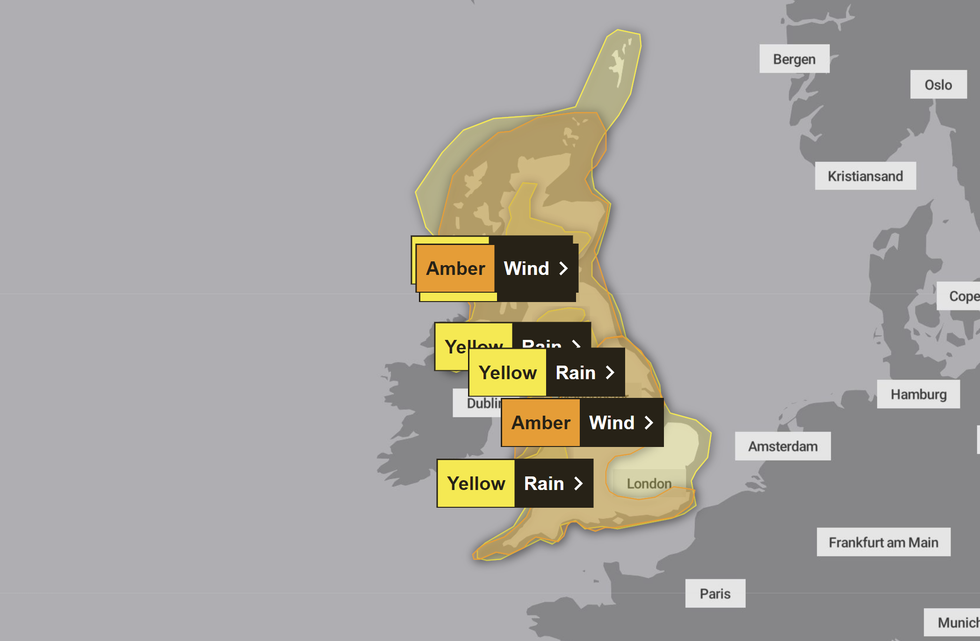
A number of alerts have been issued across the UK
|MET OFFICE
The Met Office said: "After a generally windy day on Sunday, winds are likely to increase further during the evening and overnight, this increase reaching Northern Ireland first.
"Winds are likely to gust to 60 to 70 mph quite widely in inland areas, and 70 to 80 mph around coasts.
"However there is the possibility of a narrower swathe of even stronger winds crossing parts of the warning area, with gusts of 70 to 80 mph possible inland and perhaps peaking around 90 mph in exposed coastal and hilly areas - this is perhaps more likely across parts of Scotland.
"Winds will subside during the early hours across Northern Ireland, and across the rest of the area on Monday morning, although staying windy and gusty."
LATEST DEVELOPMENTS: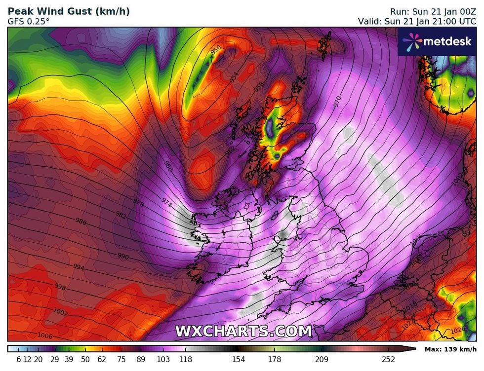
Peak wind gusts on Sunday
|WXCHARTS
A separate amber wind alert has been issued covering the East Midlands, East of England, South East England, North East England, North West England, South West England, Wales, West Midlands and Yorkshire & Humber.
The update, which looks to cover a larger area of England and Wales, added: "Very strong west or southwesterly winds will develop widely during Sunday evening, persisting overnight and into Monday morning.
"Gusts will frequently reach 50-60 mph, perhaps 70 mph at times in a few locations and, along exposed coastal stretches, 80 mph is possible at times. Wind will slowly ease through Monday morning."
Two rain warnings have also been issued by the Met Office in North East England, North West England, Yorkshire & Humber and Wales.
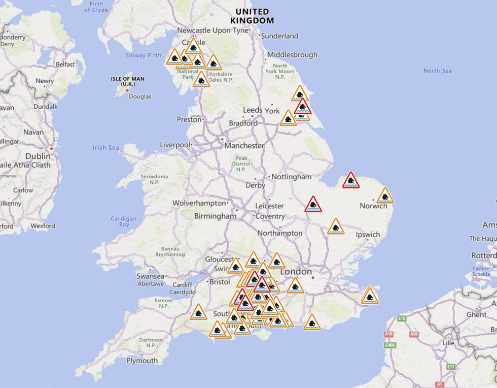
Flood alerts and warnings have been issued across England
|ENVIRONMENT AGENCY
However, the amber wind alerts threaten to bring the most havoc to British shores.
The UK's national weather service claimed there is a "good chance" of power cuts, probable damage to buildings, longer journey times, bridge closures and "danger to life" from large waves.
Central, Tayside & Fife, East Midlands, Grampian, Highlands & Eilean Siar, North East England, North West England, Northern Ireland, Orkney & Shetland, SW Scotland, Lothian Borders, Strathclyde, Wales and Yorkshire & Humber face will also face a yellow wind warning on Tuesday and Wednesday.
England's Environment Agency and the Scottish Environment Protection Agency issued 72 flood alerts and 19 flood warnings today.