


The Met Office has issued a fresh snow update as new weather maps suggest Britons could see temperatures plummet to as low as -10C.
Snow could return to the UK "within weeks" as communities continue to clean up the wreckage left by Storms Jocelyn and Isha.
Milder temperatures experienced in recent days might not last long, with colder spells expected between February 8 and February 22.
The forecast was issued just days after two "danger to life" alerts covered large swathes of the country.
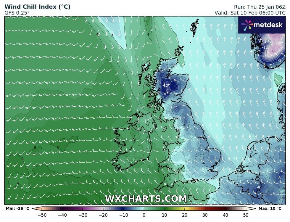
Temperatures could plummet as WXCHARTS' wind chill index drops drastically
|WXCHARTS
Gale-force winds and heavy rain led to power cuts, disruption to travel and flooding.
A father-of-five was even killed on Sunday after his car veered off a flooded road in County Mayo, Ireland.
An 84-year-old man died during Storm Isha after a car she was travelling in crashed into a fallen tree in Falkirk, Scotland.
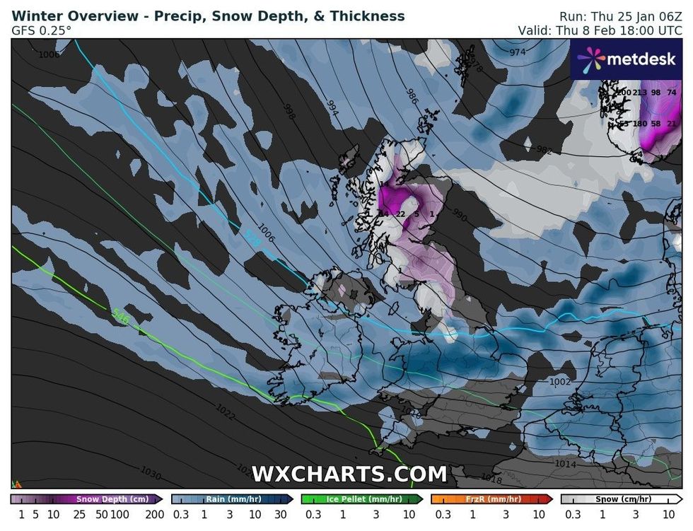
The UK's winter weather overview in early February, according to WXCHARTS
|WXCHARTS
However, the Met Office's forecast from February 8 to February 22 suggests snow could return to the UK.
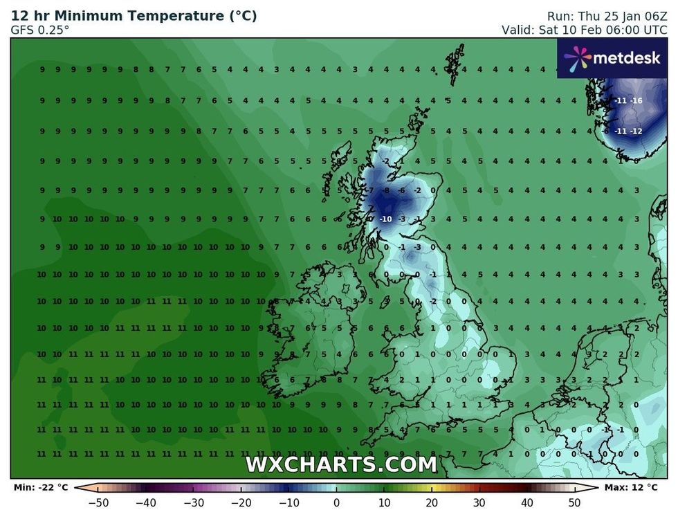
Weather maps suggest that as we enter the mid-February period, temperatures could drop sub-zero again and even drop as low as -10C in parts of Scotland.
The Met Office said: "Through the middle of February, changeable conditions are most likely with the wettest and windiest conditions in the north and northwest.
"It is likely to be drier further southeast, although some wet and windy spells are still possible here.
"Later in the month there is an increasing likelihood of winds from the north or east, which will increase the chance of some colder spells and perhaps snow."
Snow is not expected between now and then, with the UK's national weather service merely telling Britons to watch out for wind and rain.
LATEST DEVELOPMENTS:
Temperatures could drop to as low as -10C, according to WXCHARTS
|WXCHARTS
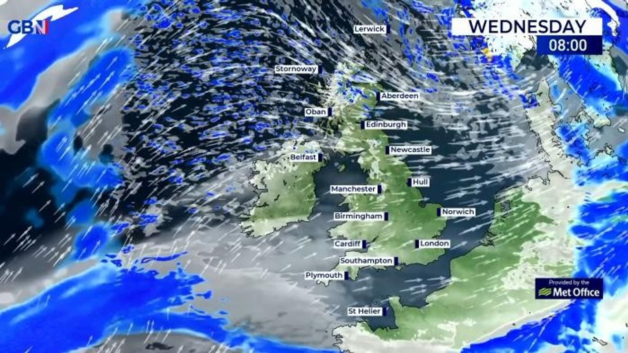
"Winds strengthening overnight as a band of rain moves eastwards, many areas seeing brief spells of heavy downpours and squally gusts," it said.
"Clearer spells developing from the west as rain passes. Cooler with some wintriness over high ground in the north."
England's Environment Agency has issued 14 flood warnings and 66 flood alerts as rain continues to batter Britain.
A further eight flood alerts and eight flood warnings have also been issued in Scotland.
Natural Resources Wales has put out two further flood alerts.