


A biblical mystery has been unravelled as scientists discovered the geological origins of a waterway mentioned in the Book of Genesis as flowing from the Garden of Eden.
Research published this week in Nature Geoscience revealed how the ancient Euphrates River came into existence after centuries of uncertainty.
Investigators described the study as a "previously hidden chapter in the story of a waterway central to biblical tradition".
The Euphrates stretches 1,900 miles, making it Western Asia's longest river, winding through the Fertile Crescent – spanning modern-day Iraq, Syria, Lebanon, Israel, Palestine, Jordan, and parts of Turkey and Iran.
Using seismic imaging, satellite data, geological surveys and sediment analysis from beneath the Mediterranean, the research team have reconstructed the river's formation for the first time.
For decades, the Euphrates' origins had remained concealed under sediment layers and obscured by recurring tectonic activity.
The new investigation uncovered two massive prehistoric waterways – the Paleo-Karasu and Paleo-Murat – once flowing through present-day Turkey and Syria as entirely separate river systems.
Powerful geological forces eventually redirected their paths, causing them to converge approximately 1.6 million years ago, and begin draining towards the Persian Gulf as the modern Euphrates.
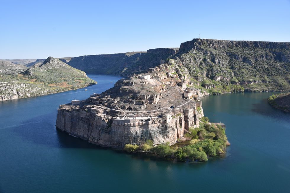
The Euphrates stretches 1,900 miles, making it Western Asia's longest river
| WIKIMEDIA COMMONSAccording to the analysis, the Paleo-Murat emerged over 16.5 million years ago, whilst the Paleo-Karasu formed between roughly 8.6 million and 5.9 million years ago.
During this period, both waterways emptied into a network of isolated lakes south of the North Anatolian Fault, remaining disconnected from what would become the Euphrates system.
A transformative geological event struck the Mediterranean region around 5.3 million years ago, forever changing the landscape.
LATEST DEVELOPMENTS
The Atlantic's connection to the Mediterranean became constricted near the present-day Strait of Gibraltar, causing vast portions of the sea to evaporate.
Water levels in the eastern Mediterranean plummeted by as much as one to 1.3 miles, though researchers calculated a descent of at least 2,600 feet would have been enough to trigger the observed changes.
This dramatic drop forced regional rivers to carve deeper channels as they adapted to the altered conditions.
Meanwhile, tectonic forces warped sections of Anatolia and reactivated dormant faults, intensifying erosion and boosting sediment transport towards the Mediterranean.
The discovery gives new found answers about the region, which earned its reputation as the cradle of civilisation by nurturing humanity's earliest societies.
Together with the 1,180 mile long Tigris River, the Euphrates birthed productive land amid otherwise barren terrain, enabling ancient peoples to establish thriving communities.
The Sumerians – the world's first urban civilisation – and Assyrians – indigenous to Mesopotamia – built flourishing settlements along these banks roughly 6,000 years ago.
Previous theories had suggested the Euphrates originated from a single river flowing into the Mediterranean or Turkish lakes, while others proposed it terminated on the Arabian Peninsula.