


The Met Office has issued a yellow weather warning for wind as Britons brace for Storm Floris.
The warning covers a large part of the UK and will be in place from 6am on Monday, August 4, until 6am the following day.
The storm is likely to result in "unseasonably strong and potentially disruptive" winds and could bring heavy rain, the Met Office said.
The strongest winds are likely to occur along exposed Scottish coastlines and hills, with inland gusts of 85 mph possible.
The whole of Scotland, parts of Wales, Northern Ireland and the north of England are covered by the weather warning.
The Met Office said winds will first start to ease in the west of the UK late on Monday but will remain "very strong" overnight until early Tuesday in the east.
Britons have been warned of possible travel disruption as a result of the storm, including to road, rail, air and ferry services.
Some roads and bridges may also close.
LATEST DEVELOPMENTS:
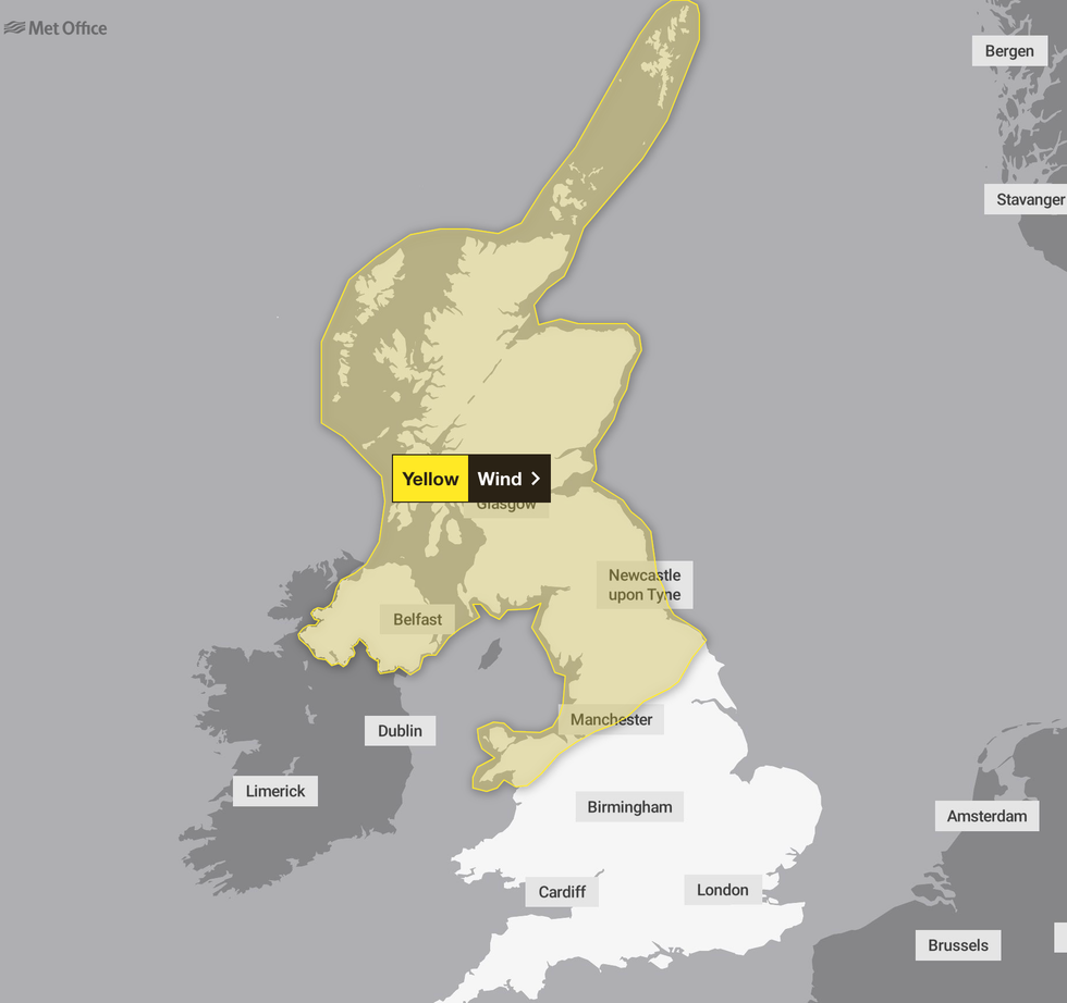
The areas of the UK affected by the weather warning
|Met Office
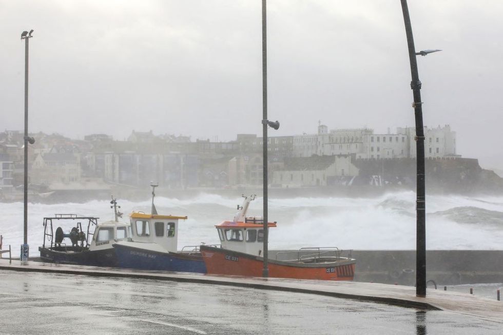
Injuries and "danger to life" from flying debris are possible, as well as from large waves and beach material being thrown onto sea fronts and coastal roads, according to the Met Office.
Power cuts could occur, while buildings may suffer some damage.
Chief Meteorologist Matthew Lehnert said: “Across the warning area, many inland areas are likely to see gusts of 40 to 50mph, with 60 to 70mph more likely at higher elevations and around exposed coasts in Scotland.
"There is a small chance that some locations here could even record gusts of 85mph.”
The Met Office has advised people living in areas covered by the weather warning to check road conditions and public transport timetables before travelling.
Loose items outside properties such as bins, garden furniture, trampolines, sheds, fences and tents should also be secured.
Storm Floris is the sixth named storm of the 2024/2025 Storm Naming season.
Storm Éowyn – which occurred in late January – was the last named storm to affect the UK.
Storm Éowyn was the last named storm to hit the UK in January
|GETTY
The stormy start to August could however recede later next week allowing the sunshine to return, according to Met Office meteorologist Alex Burkill.
High pressure is showing signs of building back from the south, meaning temperatures will rise, he explained.
Parts of the country could be back in the high-20Cs or 30C through the first fortnight of the month.
Jim Dale, meteorologist for British Weather Services and co-author of ‘Surviving Extreme Weather’, said: “We are probably not done with the heatwaves yet, and if we see high pressure return, we could easily get back to 30C."
More From GB News