


A "roller-coaster" start to August threatens Britons with plunging temperatures, torrential downpours and 80mph gales.
Wind and rain will whip up later this weekend before a powerful storm hits at the start of next week.
Meteorologists are warning of "unseasonably" stormy weather as a raging jet stream stirs a volatile mix of cold and tropical air.
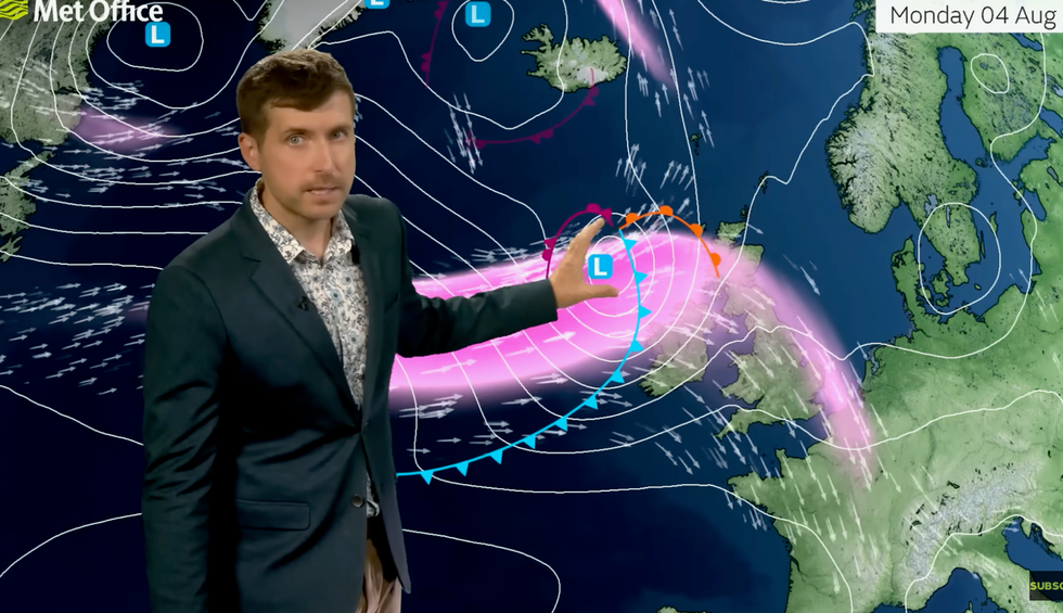
Met Office meteorologist Alex Burkill said: “Exactly what happens with this low pressure depends on the jet stream.
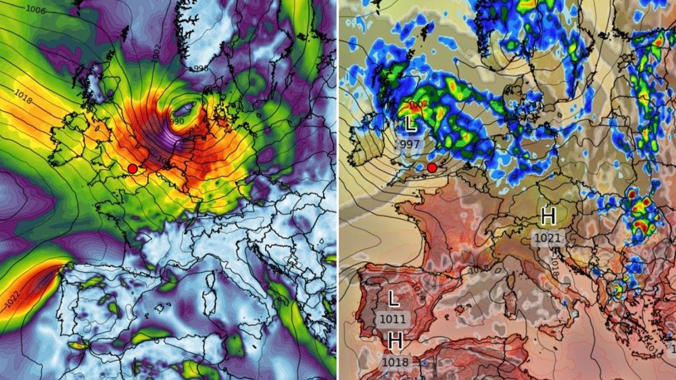
A 'roller-coaster' start to August threatens Britons with plunging temperatures, torrential downpours and 80mph gales
|WXCHARTS
“The Met Office weather model wants it to move across the Atlantic quite quickly and move across the jet stream, and by the time it comes towards us early next week it is likely to be on the northern side of the jet stream.
“If it does this, it could go through rapid cyclogenesis, so it could deepen very quickly and become an unseasonably deep area of low pressure by the time it reaches the UK.
“We could have some very wet and very windy weather pushing across the country.”
Gusts could widely reach 50mph or 60mph with 80mph possible in the worst hit regions, he warned.
He added: “The rain could be quite heavy, but it is the wind that we perhaps have to watch out for with 50 or 60mph gusts and 70mph or 80mph not out of the question.
“Buckle up, because our weather is about to go on a bit of a roller coaster ride.”
Ahead of the storm, a mixed bag of rain and chilly temperatures will arrive as weather systems push through the country.
Choppy conditions through the coming days will be fuelled by a powerful jet stream armed with an extra vicious ‘jet streak’.
Saturday is expected to be the better day of the weekend, before the rot sets in later on Sunday.
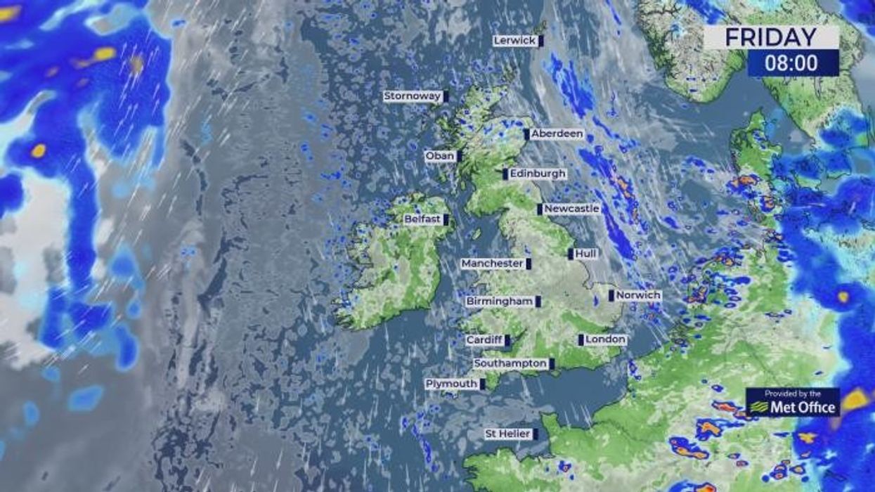
Burkill said: “On Friday, there is a trough feature pushing into eastern parts of the UK and that is bringing some showers, but there is also a jet streak that is pushing down across the country, and as that influences the trough towards the east, we are likely to see the showers invigorating.
“A low close to Iceland and an associated front is set to make its way south-eastwards across the country through Sunday, and there will be some fairly heavy rain which will be thundery at times.
“It is also going to be a bit fresher and cooler with temperatures lower still on Sunday compared to Friday and Saturday.”
Meteorologists are warning of 'unseasonably' stormy weather as a raging jet stream stirs a volatile mix of cold and tropical air
|Met Office
A stormy start to August, though, may recede later next week allowing the sunshine to return, he said.
High pressure is showing signs of building back from the south, meaning temperatures will rise, he added.
Parts of the country could be back in the high-20Cs or 30C through the first fortnight of the month.
Jim Dale, meteorologist for British Weather Services and co-author of ‘Surviving Extreme Weather’, said: “We are probably not done with the heatwaves yet, and if we see high pressure return, we could easily get back to 30C.
“The Azores High is still trying to edge in from the southwest, and this could push into Britain once we lose the influence of low pressure.”