US weather: Flood alert fears erupt as Tropical Storm Ernesto enters death throes

Flood alert fears erupt as Tropical Storm Ernesto enters death throes
|ACCUWEATHER

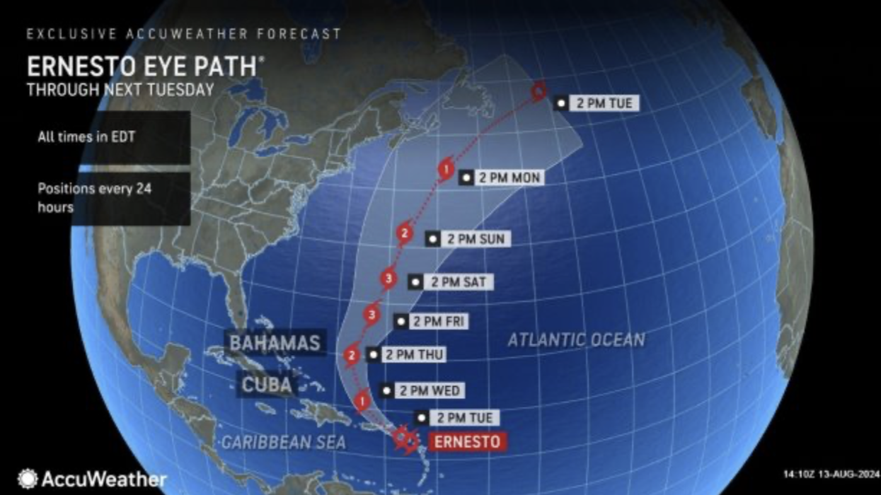
The storm will clip the US at the start of the week
Don't Miss
Most Read
Latest
Violent thunderstorms erupting in the death throes of Tropical Storm Ernesto will put thousands of miles of the US coast on flood alert.
Torrential downpours threaten eastern states as a mammoth ‘sea swell’ dragged in by the ex-hurricane drives ‘dangerous’ rip tides.
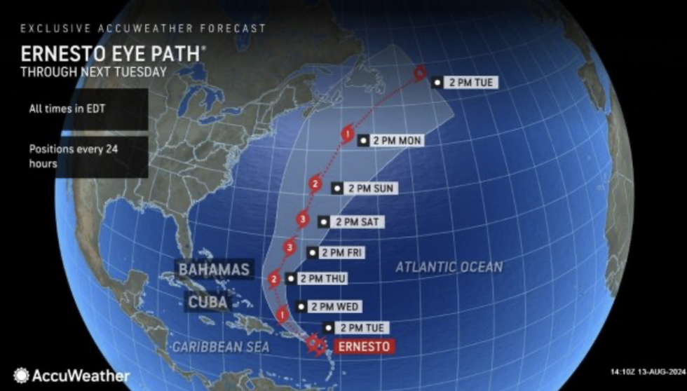
The tail end of Ernesto will clip the US at the start of the week before the jet stream leads the dying storm off into the Atlantic.
The US National Weather Service (NOAA) has flood alerts in force this week across Carolina, Virginia, New Jersey, Delaware and Pennsylvania.
 Flood alert fears erupt as Tropical Storm Ernesto enters death throes | ACCUWEATHER
Separate alerts cover the northwest coast where downpours will be swept off the Pacific by strong winds.
A NOAA spokesman said: “Unsettled conditions are forecast for portions of the eastern United States with the risk of strong to severe thunderstorms bringing areas of possible flash flooding.
“Western states will also be fairly active over the next few days with a slow moving upper-level trough off of the Pacific Northwest generating anomalous moisture and a favourable atmospheric profile for flash flooding and severe straight-line winds across portions of Utah and surrounding adjacent states.”
Ernesto was forecast to brush Bermuda at the weekend putting the US east coast at risk of deadly rip currents.
US LATEST:
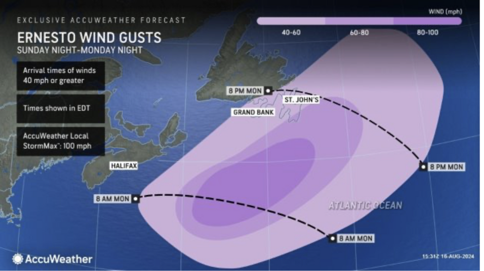
Ernesto wind gusts
|AccuWeather
The remains of the storm will veer away from the US at the start of the week putting a temporary lid on tropical activity in the Atlantic.
The larger risk through the coming days will be from inland thunderstorms and torrential rain.
Tropical air from the Gulf of Mexico will clash with cooler air to the north to unleash the deluge.
Jim Dale, US weather correspondent for British Weather Services and co-author of ‘Surviving Extreme Weather’, said: “Tropical air coming up from the Gulf of Mexico will mix with air from the north, and this will trigger heavy rain and the risk of thunder.
“Flooding will be a risk during heavy rain on the edge of the hottest regions, where the warmer and cooler air masses meet.
“Although the main risk of Ernesto will be gone after the start of the week, there will be some unusually strong rip tides along the east coast of the US.”

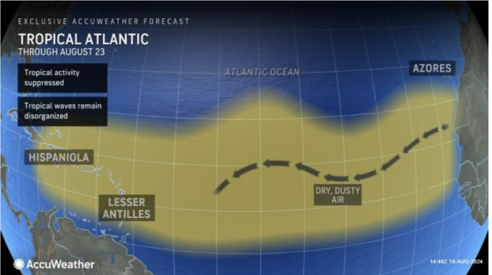
Saharan dust blowing across the Atlantic this week will stifle further tropical storm activity
|AccuWeather
AccuWeather meteorologist Alex DaSilva added: “A brief lull in tropical activity is expected after Ernesto blows by Atlantic Canada early this week.
“We believe Ernesto will be taking a north-northeast path as it approaches Atlantic Canada, and that brings up the possibility of a landfall in Newfoundland.
Saharan dust blowing across the Atlantic this week will stifle further tropical storm activity.
However, the sand cloud will clear by the end of the month clearing the path for the next tropical storm, experts warn.
AccuWeather meteorologist Jon Porter said: “We expect a brief lull from tropical activity after Ernesto lasting a week or so as a lot of Saharan dust is expected to blow off the coast of Africa.
“The amount of Saharan dust this season has reached near-record levels, and that has reduced the number of named storms, but it won’t last for long.
“We expect the Saharan dust to clear out after a week or so, clearing the way for more tropical threats by the end of August.”


