US weather: 'Deadly' heat dome will drive thunderstorms and 'monsoon' deluge as America hit with heatwave
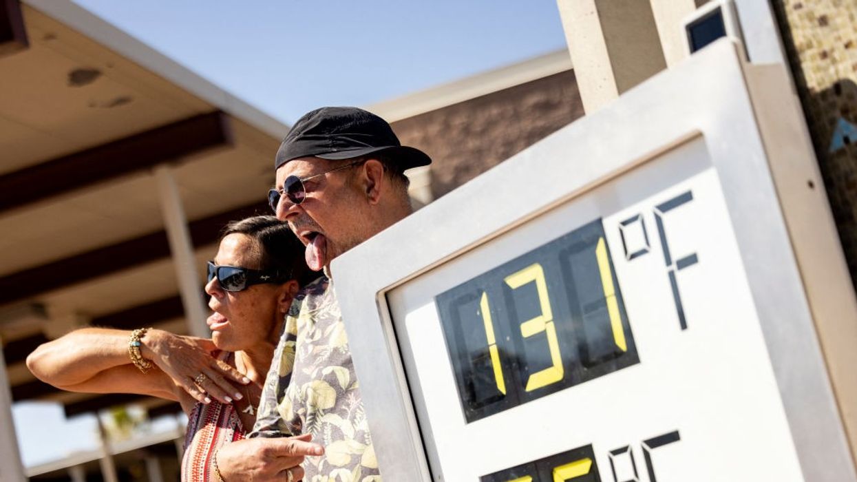
Temperatures reached as high as 131F earlier this month in California
|Getty

A plume of moisture from the Gulf of Mexico will rocket temperatures in parts past the 115F mark
Don't Miss
Most Read
Latest
Tropical humidity feeding into a ‘deadly’ heat dome will drive fierce thunderstorms and a ‘monsoon’ deluge.
The US heatwave is about to go bang amid warnings for ‘hazardous’ storms, frequent lighting, torrential downpours and floods.
A plume of moisture from the Gulf of Mexico will rocket temperatures in parts past the 115F mark, creating an unstable and explosive atmosphere.
A cold front moving into tropical air across the northeast will deliver an extra sting in the tail, experts warn.
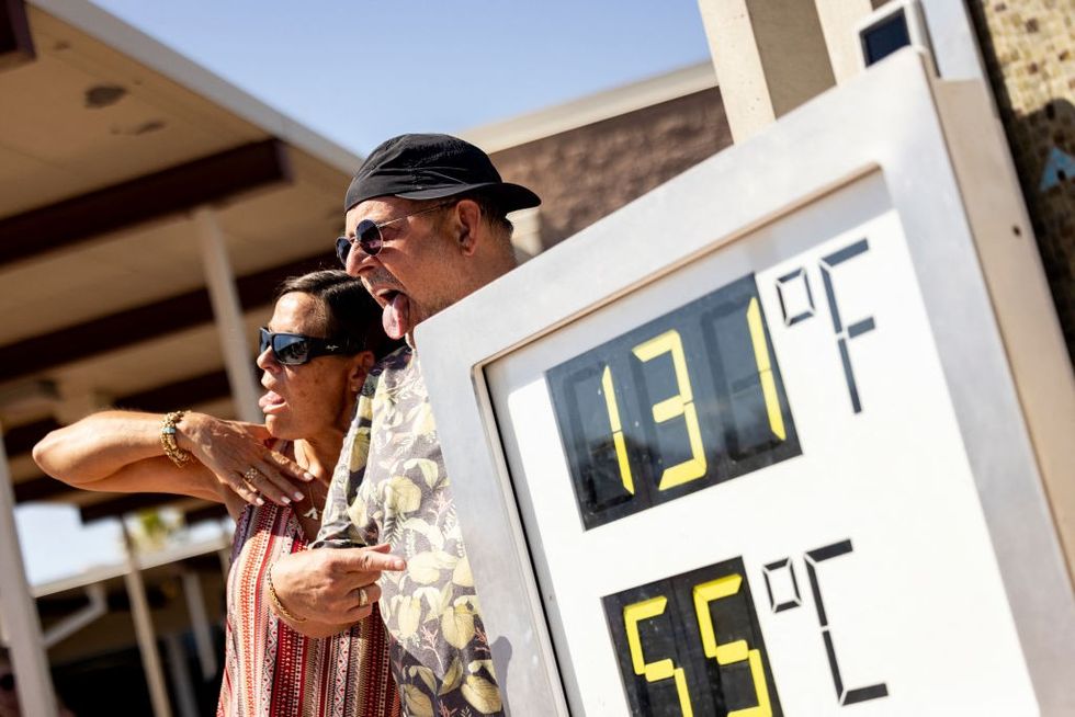 Temperatures reached as high as 131F earlier this month in California | Getty
AccuWeather senior meteorologist Tyler Roys said: “A cold front moving into a very hot and very muggy air mass in the northern Tennessee Valley, and into the Northeast and mid-Atlantic, will lead to explosive thunderstorm development.
“The strongest storms are expected from central Illinois to north-western Ohio, where they could produce flooding downpours, damaging wind gusts and hail.
“Much of Michigan and Indiana, including Detroit and Indianapolis, will have the highest risk of severe thunderstorms during the overnight hours, and across the Northeast, thunderstorms will have plenty of heat and humidity to work with.”
AccuWeather severe weather expert Guy Pearson added: “We’ve got a big dome of heat that plays a significant role in fuelling thunderstorms, as well as supporting how long these storms can last into the evening and overnight hours.”
National heat advisories are in force across almost 30 states with separate wildfire warnings covering Oregon and Washington.
Separate alerts for flooding and thunderstorms have been issued in Missouri, Kansas and across the Midwest.
LATEST DEVELOPMENTS:
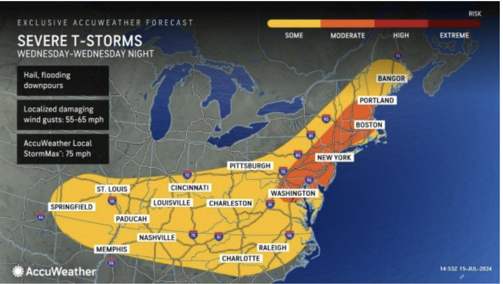
Severe T-storms are expected to hit the northeast in particular
|AccuWeather
The US National Weather Service (NOAA) has urged people to take car in ferocious heat and stormy weather.
A spokesman said: “Extremely dangerous and potentially deadly heat, particularly for urban areas in the Southeast and East Coast, are forecast.
“Energy and tropical moisture will produce showers and thunderstorms over parts of the Central Gulf Coast to the Southeast, and further, moisture over the Southwest and the Central and Southern Rockies will produce late afternoon into late evening showers and thunderstorms over parts of the Great Basin, Southwest, and Central/Southern Rockies.
“A Monsoonal pattern will remain in place over the Four Corners region, with the upper-high overhead helping to funnel in higher moisture into the region.”
The Midwest was hit on Monday by a particularly venomous ‘derecho’ storm with gusts recorded of 105mph.
In Texas, hundreds of thousands of homes were left without power as storms ripped through the region in the wake of Hurricane Beryl.
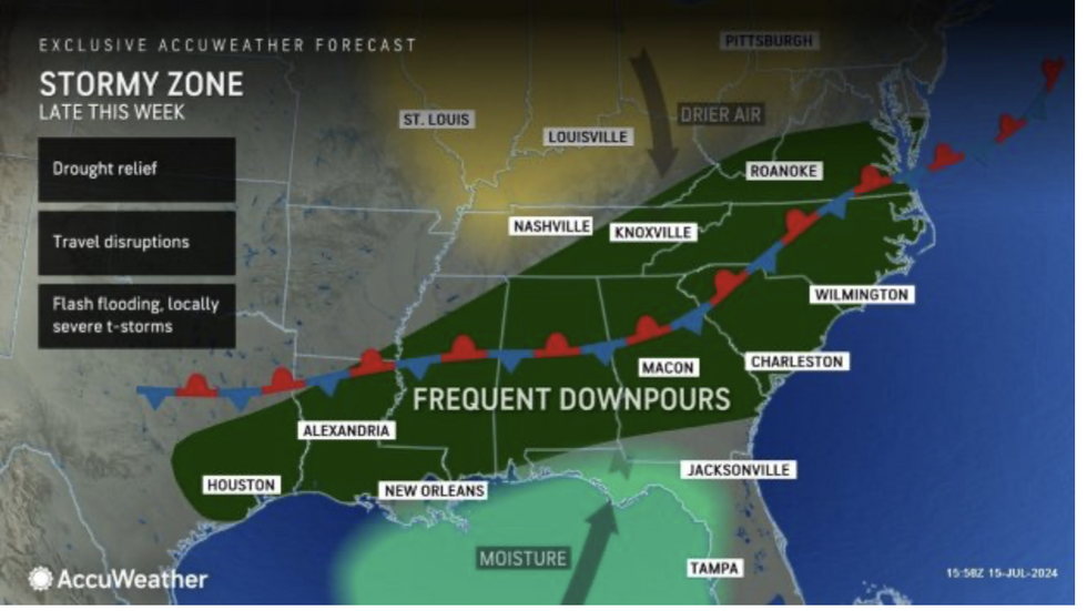
The south will be engulfed in the stormy zone
|AccuWeather
Further tropical storms are unlikely thanks to a plume of Saharan air wafting over the Atlantic.
Such dust clouds disrupt the formation of hurricanes in the tropical basin meaning calmer conditions for now.
Weather Channel meteorologist Jonathan Erdman said: “Dust-laden Saharan air surging across the Atlantic Basin will squash tropical development for the next several days after a busy start to the hurricane season.
“The National Hurricane Centre doesn't expect tropical development anywhere in the Gulf of Mexico, Caribbean Sea or Atlantic Ocean for at least the next seven days.”
Jim Dale, co-author of ‘Surviving Extreme Weather’, said: “There are no tropical storms in the forecast for the time being, but inland it is a different story with thunderstorms a risk through the week.
“This is thanks to the extreme heat across the entire country at the moment, driven by a dome of high pressure and tropical plume from the south.”


