UK weather: Tropical storm Fernand locks horns with jet stream to swoop across Britain as country blasted with heavy downpours

WATCH: Tropical storm Fernand locks horns with jet stream to swoop across Britain as country blasted with heavy downpours
|GB NEWS

Autumnal gloom threatens to hold out for the next 10 days
Don't Miss
Most Read
Latest
Torrential rain and wind whipped up by a second Atlantic tropical storm targeting Britain will end summer with a fortnight of gloom.
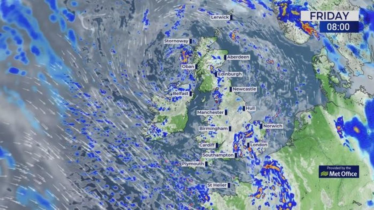
The whole country faces heavy downpours this weekend as Tropical Storm Fernand locks horns with the jet stream.
Hot on the heels of Hurricane Erin, the remains of the new storm will throw a stormy spanner in the UK weather works.
Autumnal gloom threatens to hold out for the next 10 days at least, as bands of rain sweep in from the west.

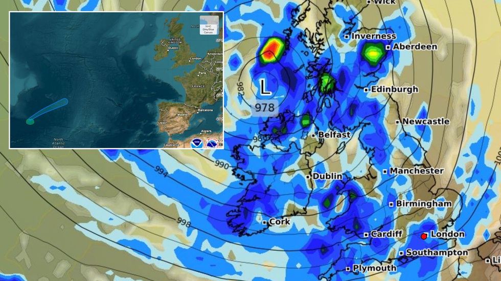
Torrential rain and wind whipped up by a second Atlantic tropical storm targeting Britain will end summer with a fortnight of gloom
|NOAA/ WXCHARTS
Met Office meteorologist Alex Burkill said: “There’s a real autumnal feel to things, and that pretty unsettled story is going to continue through the next 10 days.
“We are going to be sticking with a westerly flow, and we are going to continue to see unsettled weather coming in from the Atlantic.
“Most of us are going to see heavy rain on Saturday, and there will be some blustery weather associated with an unseasonably deep area of low pressure.”
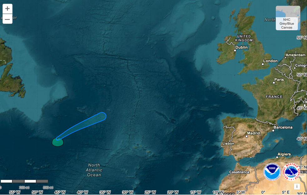
Britain’s weather is about to come under the influence of Tropical Storm Fernand, currently hurtling eastwards from the coast of America.

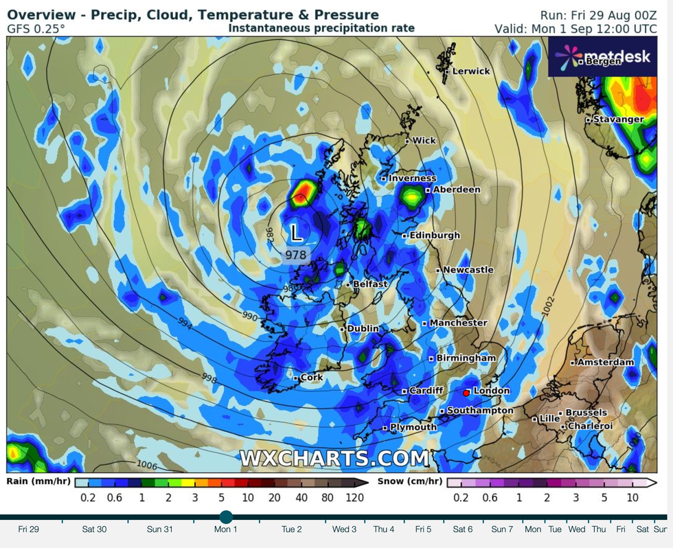
Autumnal gloom threatens to hold out for the next 10 days at least, as bands of rain sweep in from the west
|WXCHARTS
As with Erin, the storm will not directly impact the UK but will jolt our weather patterns to influence the outlook.
It will build a deep low-pressure system which will unleash strong winds and rain through the start of the weekend, Burkill warned.
He said: “On the other side of the Atlantic, there are a couple of low-pressure centres, one is technically Tropical Storm Fernand, and it looks like they will get closer towards the jet stream.
“A new feature will develop with low pressures amalgamating, and that low pressure is going to run across the Jet stream and make its way towards us.
“It is a relatively deep area of low pressure, and it is going to bring some unseasonable weather even though it is still meteorological summer, and so we are in for a bit more of an unsettled spell on Saturday into Sunday.”
Southwestern regions will see the strongest winds, he added, although major disruption is unlikely.
The unsettled spell will come just as meteorological summer gives way to autumn this weekend.
It will follow what is likely to be the hottest summer on record, as Met Office statistics reveal highest ever mean temperatures this year.

Tropical Storm Fernand hurtles across the Atlantic towards Britain
|NOAA
However, warm sea and land temperatures may fuel choppy weather through the coming months, experts warn.
Jim Dale, meteorologist for British Weather Services and co-author of ‘Surviving Extreme Weather’, said: “The sea temperatures are still high, and this is going to feed into what we see over the coming weeks and any storms that are in the pipeline.
“High temperatures feed energy into storm systems, and as we have already started to see unsettled conditions while we are still in summer, it could be that the gates to the Atlantic have now opened, and we could be in for a lively time.
“In the immediate future, the main risk of heavier showers will be to the west of the country, as weather fronts come in from the Atlantic.”


