UK weather: Tropical plume to rescue Britain’s lost summer as heat to soar to ‘mid-30Cs’
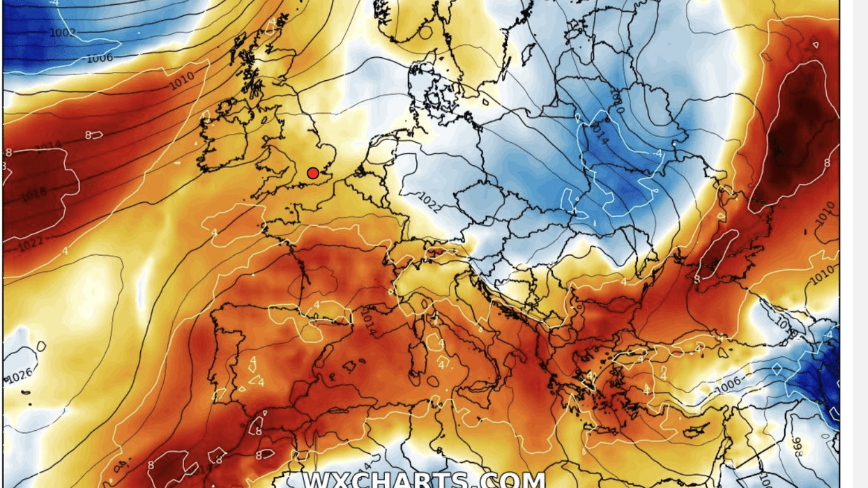
Tropical plume to rescue Britain’s lost summer as heat to soar to ‘mid-30Cs’
|WX charts

Britain could finally get its long-awaited barbecue summer
Don't Miss
Most Read
A tropical heat plume will lock horns with the jet stream to wrench the sun out of hiding and rescue Britain’s lost summer.
The UK is about to wave goodbye to grey skies and rain and gear up for a lengthy burst of fine, warm weather.
The jet stream, which wedged over the UK has tormented the nation with weeks of gloomy skies, is about to heave-ho northwards where it belongs.
On its tail will be the Azores High, a tropical pressure system promising glorious sunshine potentially through August.
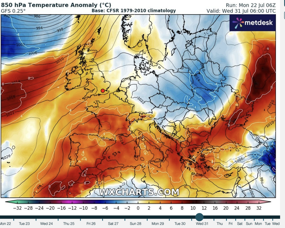 Tropical plume to rescue Britain’s lost summer as heat to soar to ‘mid-30Cs’ | WX charts
Exacta Weather forecaster James Madden said: “During the end of July, high pressure will return and become more predominant, and this will bring a pattern change to warmer or possibly hot conditions.
“Some spots could reach the mid-to-high-30Cs during the end of the month and again during August.
“This is a significant change from the pattern so far and could set a warm and summery theme for the last month of the season.”
Britain could finally get its long-awaited barbecue summer after a miserable start to July and cooler-than-average June.
LATEST DEVELOPMENTS: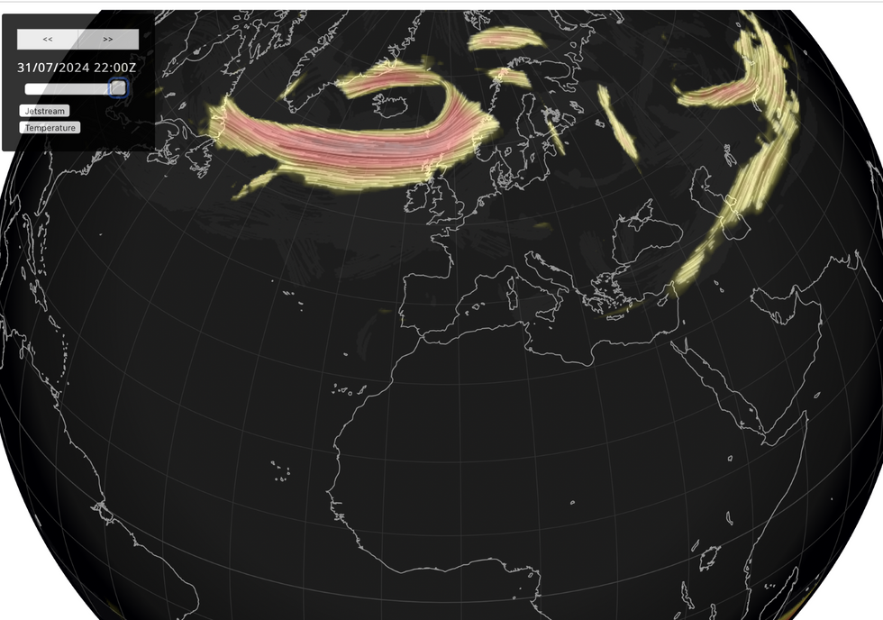
Jet stream moves to the north
|Netweather
The culprit has been the jet stream which instead of settling to the north as is typical for the time of year, has clung to the UK blocking the warmth and driving the rain.
The Azores High will nudge it out of the way through the coming days as temperatures rise into the mid-20Cs.
Met Office meteorologist Aidan McGivern said: “High pressure near the Azores will occasionally extend towards the UK to bring some fine interludes, low pressure towards Iceland will occasionally allow some showers or longer spells of rain.
“Later Tuesday a ridge of high pressure from the Azores will extend and bring a fine 24 hours or so across many parts of the UK before a frontal system turns up into Thursday.”
A ‘wiggling’ weather system will bring some rain on Thursday, although the sun will return by the weekend, he added.
He said: “A wriggling frontal zone turns up for Thursday and it contains a lot of moisture and a lot of humidity and as a result a lot of low cloud across many southern parts of the UK on Thursday.
“Friday starts off a lot brighter and drier for a lot of us, but we are going to see further showers, especially in the north where those showers will be frequent and heavy.
“Temperatures through this week not far from average and certainly warmer than July so far.
“Later Saturday and into Sunday a ridge of high pressure moves in to bring more settled and perhaps warmer weather on Sunday and into the start of next week.”
BBC meteorologist and weather presenter Tomasz Schafernaker added: “Beyond Friday and into the weekend and into next week, it looks like things really are settling down.
“The reason for that is that the computer models are pointing towards high pressure becoming more dominant across our part of the world towards the end of the month.
“It is an extensive Azores high that will be building across this part of the world and the chances are it will anchor itself across the UK and give us more prolonged spells of fine weather.”
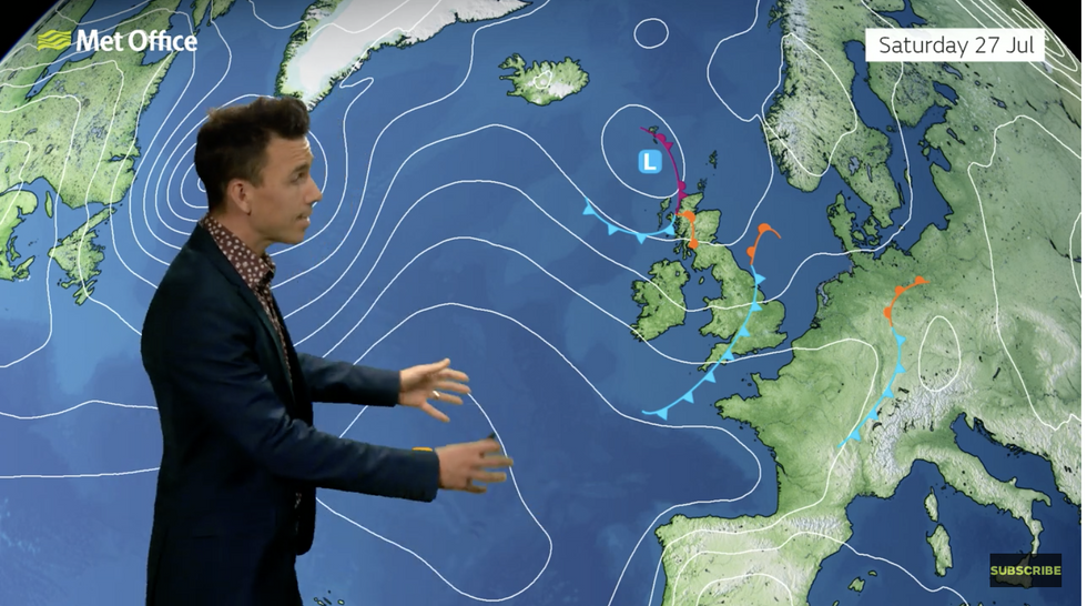
Aidan McGivern describes how the Azores High will move in
|Met Office
A tussle between the jet and the Azores high will mean Britons will have to put up with some unsettled weather this week.
However, the nation will still get ‘something out of summer’ thanks to the late-July U-turn.
Jim Dale, meteorologist for British Weather Services and co-author of ‘Surviving Extreme Weather’, said: “There is going to be a bit of everything through this week, with the jet stream still keeping the Azores High from pushing to far northwards.
“But this is likely to change as we get into August, and that means there is still a chance that we get something out of summer yet.”


