


Summer is on hold for at least another week before a nationwide split returns the sunshine to half of the UK.
Britons are urged to keep raincoats and brollies at the ready through the run-up to mid-June with little promised other than wind and rain.
A Scandinavian storm spinning to the north of the UK will hit the nation through the coming days with bouts of unsettled weather.
Southern regions can expect a reprieve around the second week in June, although the outlook for the rest of the country is stubbornly soggy.
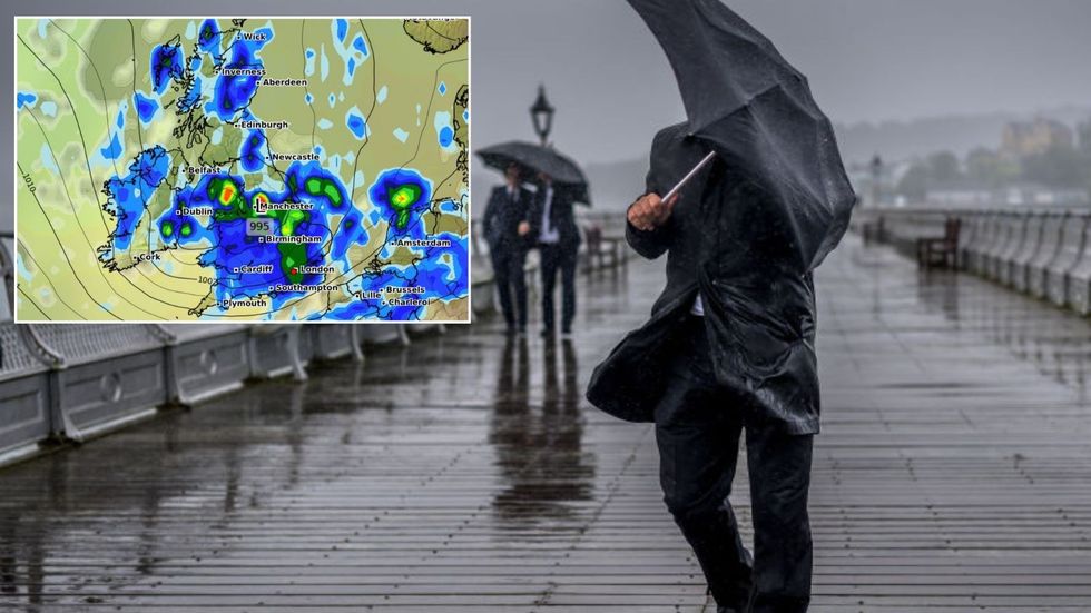
Summer is on hold for at least another week before a nationwide split returns the sunshine to half of the UK
|Getty/ WXCHARTS
Jim Dale, meteorologist for British Weather Services, said: “For the time being, the sunny, dry and very warm weather is on the way out and there is more rain and unsettled weather to come through the rest of the week.
“Low pressure to the north of the UK will keep us in this regime, bringing bands of rain across the UK, and it looks relatively unsettle until the middle of June.”
A shift in weather patterns could pull southern Britain out of the mire during the middle of the month, he said.
Temperatures here are likely to push back into the mid-20Cs or higher, while it stays cooler further north, he added.
He said: “There is likely to be a north-south divide during the second week of June, and this will bring the drier, warmer weather to the south and the east of the country.
“We could be looking at temperatures in the mid- to high-20Cs or even 30C, but at the moment, this is one to watch.
“This all depends, however, on what happens over the Continent, and whether warmer weather there moves northwards into Britain.”
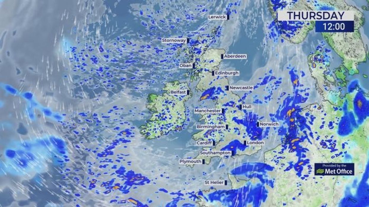
Showers and longer downpours will blight the UK through the next few days as a low-pressure storm system spins to the north.
Britons should have brollies and raincoats at the ready this weekend as westerly winds drag in the misery of the Atlantic.
Met Office meteorologist Honor Criswick said: “We are still in a westerly flow, and it is still going to be dragging in plenty of showers and these showers forming longer spells of rain as they become more organised and band together.
“It is a wet and windy start to Thursday, and we are probably going to see those winds pick up as well.
“And then it is a continuation of showers drifting in from the west, and that is pretty much the set up over the next few days.”
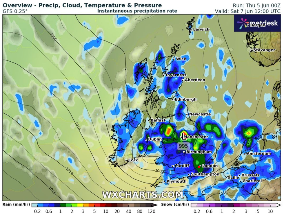
A Scandinavian storm spinning to the north of the UK will hit the nation through the coming days with bouts of unsettled weather
|WXCHARTS
It is a different picture from the past three months during which Britain has roasted in the hottest and sunniest spring on record.
The UK’s four nations recorded their highest spring mean temperature with parts of the country almost 2C warmer than average.
A worrying lack of rainfall also led to the driest spring in more than 100 years with parts of the country seeing less than 30 per cent of the regional average.
A change in fortune will bring a U-turn through the next week at least as high pressure gives way to stormy Atlantic lows.
Jason Nicholls, lead international forecaster for AccuWeather, said: “Another low will bring more rain across the UK later this week, with lingering showers possible.
“There are some indications that drier weather will return in parts of the country at the weekend.”