


Britons have received an urgent heat warning as the UK looks set to bake in possibly the hottest June ever.
Temperatures could soar to as high as 36C over the coming days, with the UK Health Security Agency warning of significant strains across health and social care services.
Records are at tipping point as a simmering tropical plume surges in from the Mediterranean and North Africa.
Temperatures will rocket through the week before a nationwide weekend scorcher pushes the mercury into the 30Cs.
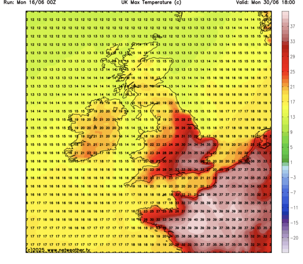
Netweather's forecast for June 30
|NETWEATHER
But it is later this month that records could tumble, with weather models across parts of the country predicting 40C heat.
Jim Dale, meteorologist for British Weather Services, said: “The hottest June temperatures are now under threat, if not this weekend then before the end of the month when there is every chance we could hit the 35C or 36C mark.
“Some of the weather models have been putting out temperatures of 40C before the end of the month, and that is a sign that we are now in new territory where these sorts of temperatures are at risk of becoming the norm.
“Temperatures will rise through this week, and depending on when a front comes through, it will be Saturday or Sunday when we see the peak of this heatwave.”
LATEST DEVELOPMENTS: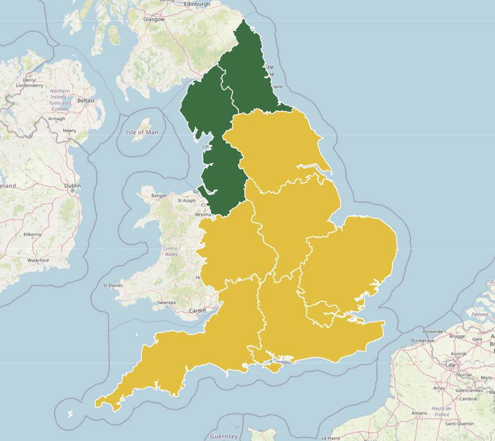
The UKHSA has issued health alerts across England
|UKHSA
The UKHSA's heat warning suggests it is possible deaths could rise among those aged 65 and over, internal temperatures in care homes may exceed the recommended threshold and there is a risk of indoor environments for people living in community and care settings overheating.
Southern Britain will be in the firing line for the hottest temperatures with a cold front keeping things cooler further north.
High pressure, the harbinger of hot summer weather will anchor over the UK later this week, according to experts.
A showery and, in parts, cooler start to the week will give way mid-week to temperatures rising into the mid-20Cs.
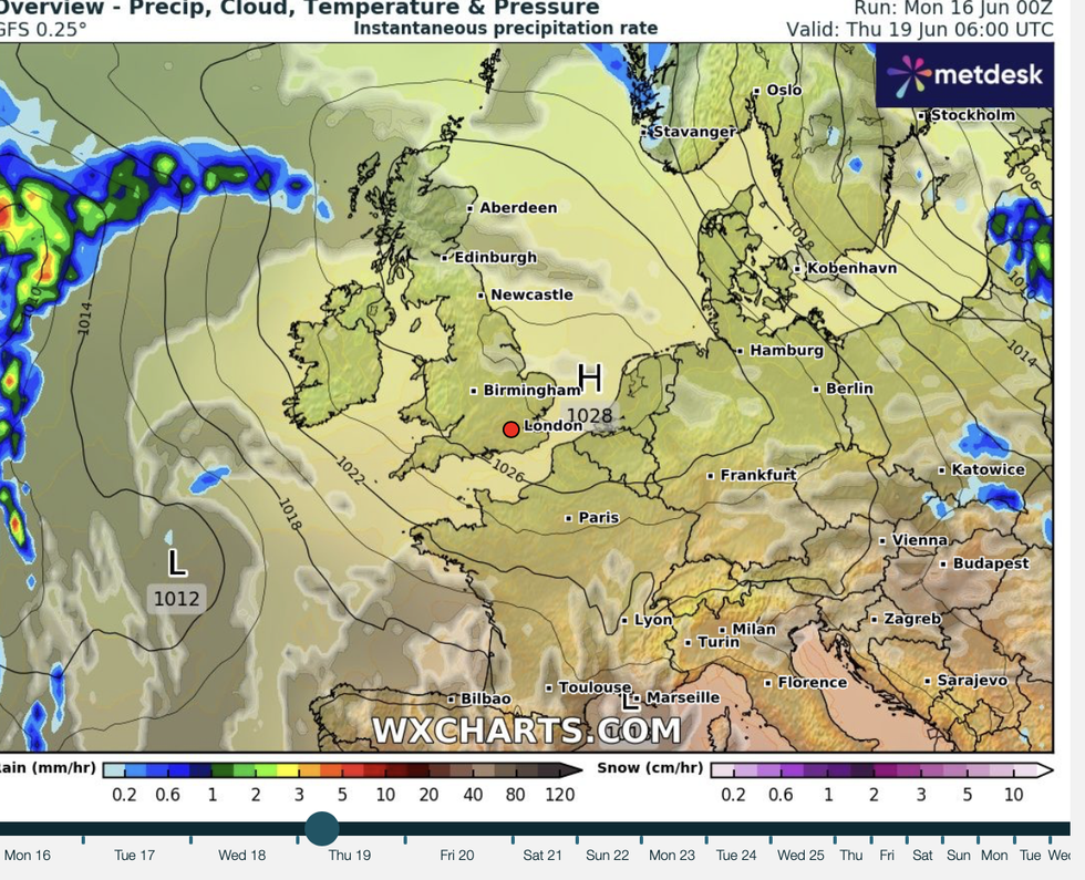
Conditions are expected to remain dry later this month
|WXCHARTS
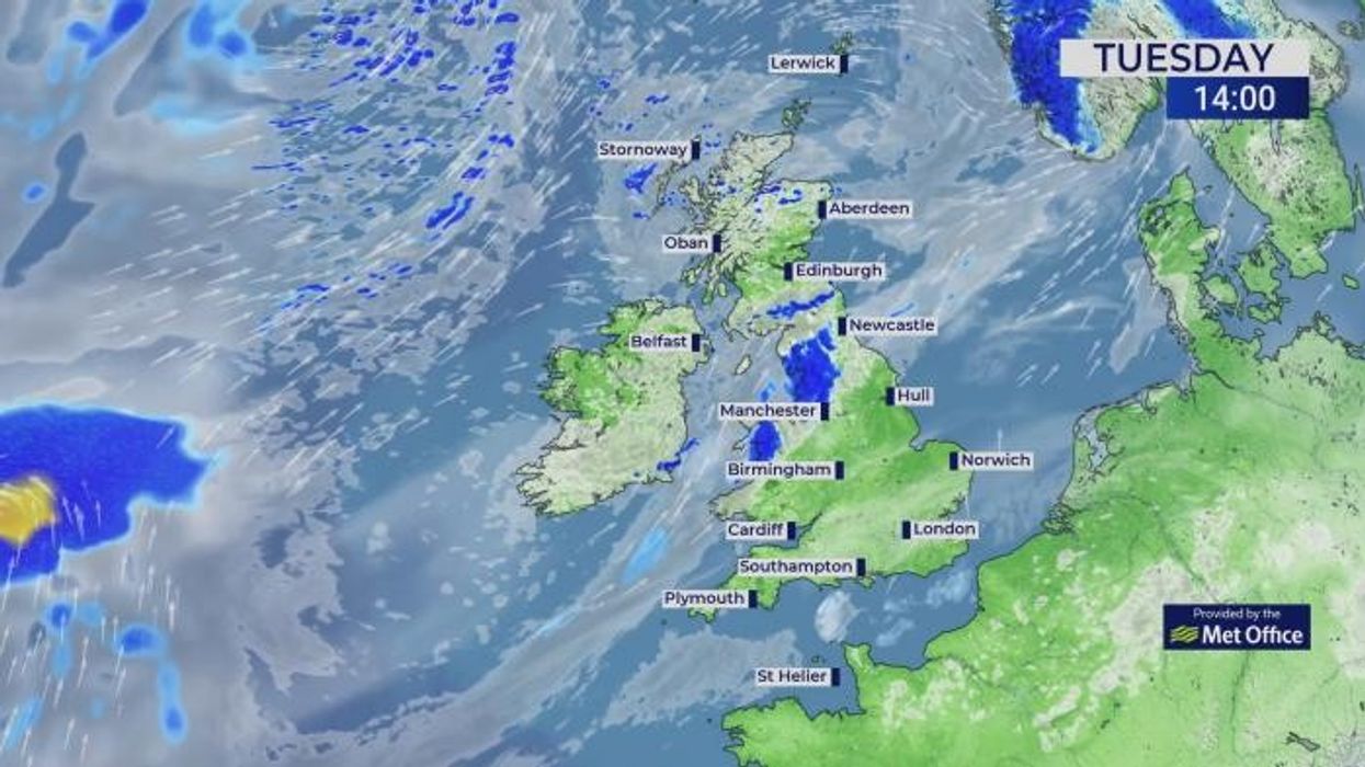
Met Office meteorologist Jonathan Vautrey said: “A band of rain on Tuesday pushes its way south and eastwards but it is going to be weakening as it does so, so that rain will be light and patchy.
“It is the south and the east where we will hold on to the heat, where we will see 25C or 26C as the high, but it will start to feel a little bit more fresh up towards the north and the west.
“Once a weather front moves out of the way, we are going to see high pressure build in more across all areas of the UK and it is going to be our main driving force of the weather as we head later on down the line.”
Weather models show temperatures across eastern and southeastern Britain hitting 34C this weekend.
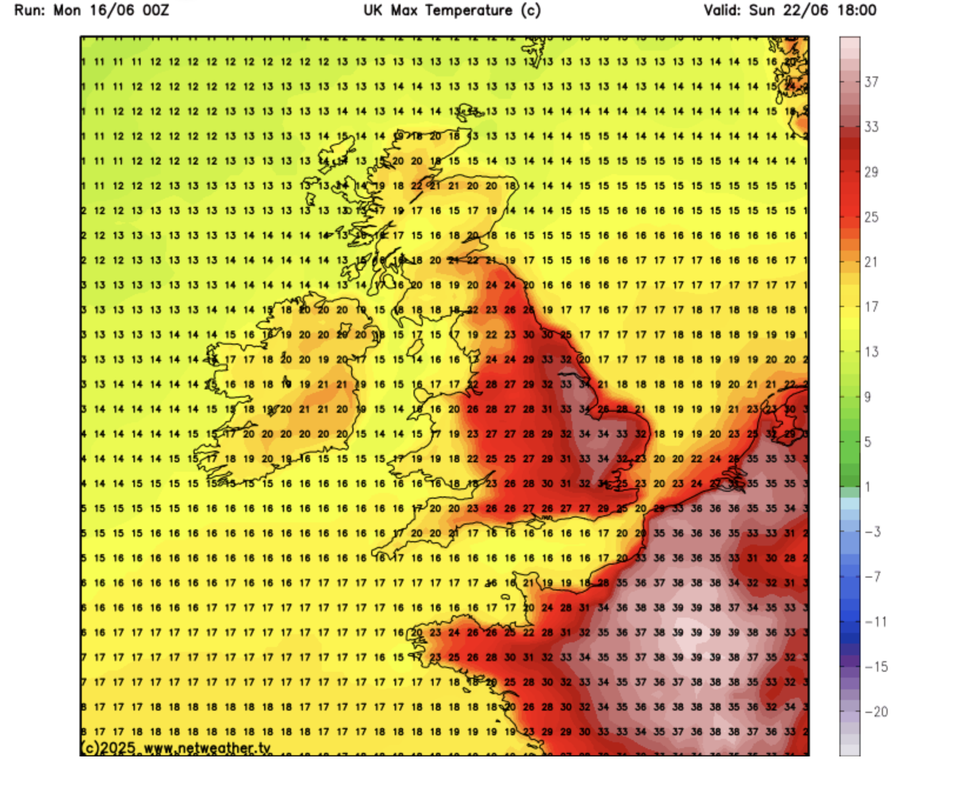
Temperatures could hit 34C this weekend
|NETWEATHER
A cold front passing across the UK may bring delay the peak of the heatwave to Sunday or bring an earlier breakdown.
Dale said: “The hot weather will affect the whole of the country, but it is London, the southeast, and East Anglia where we are keeping our eyes peeled for the highest temperatures.
“It could be that Saturday is the big day, when we see the highest temperatures, but this depends on a front moving through, and that could delay the heat or see it move off to the east earlier on Sunday.”
While the June record of 35.6C, set in Southampton in 1976, is unlikely to fall this weekend, it could topple by month end, he added.