


An upside-down heatwave straddling Europe could rescue Britain’s summer for the last stretch.
Huge temperature contrasts across the Continent are sizzling Scandinavia and the Arctic circle while the south shivers.
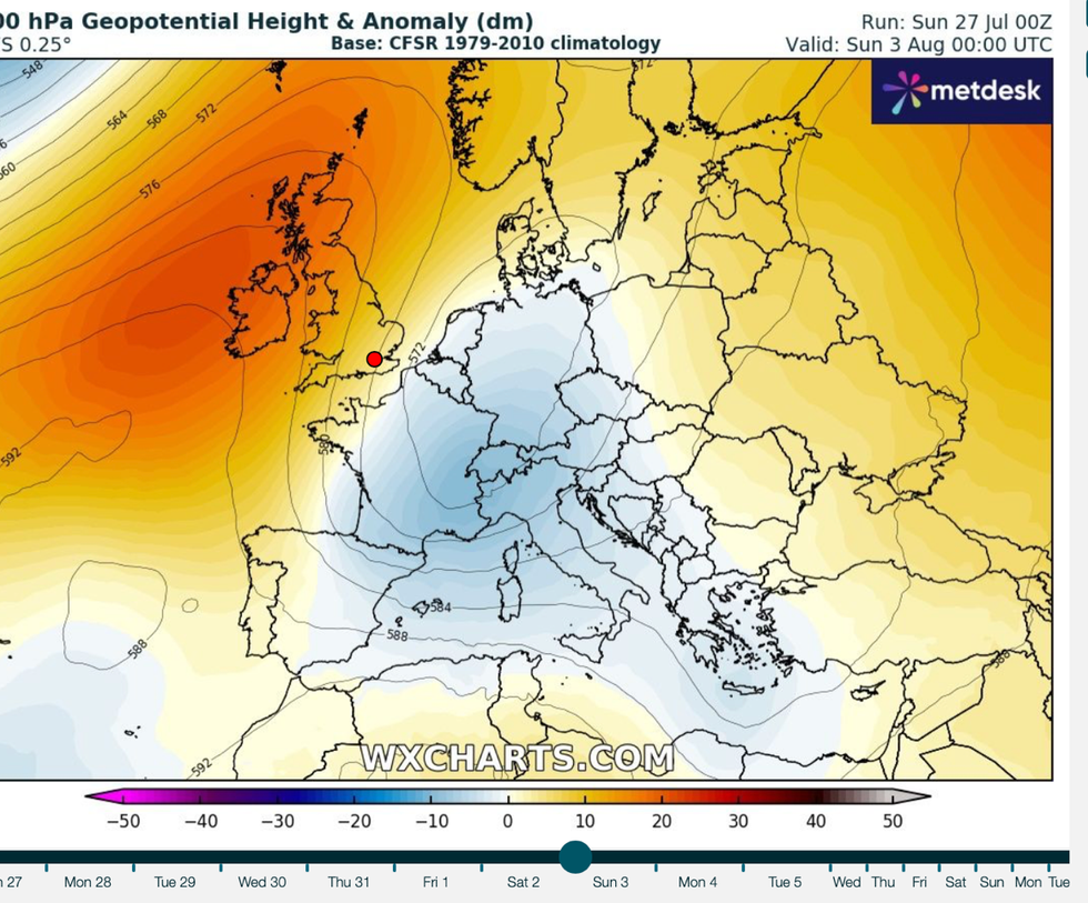
Usually, southerly gusts drive heat across the UK, but thermometers through the coming weeks may instead get a boost from the north.
Even Lapland known for snowscapes and picture-postcard winter scenery is baking in 30C heat.
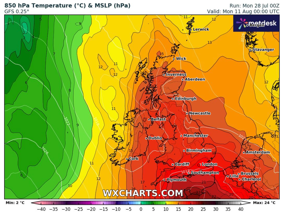
Longer-range outlooks point to a chance of 30C during the start of August as warmth sweeps in from the north
|WXCHARTS
Met Office meteorologist Aidan McGivern said: “It is unusually hot across Scandinavia, and unusually hot across southeastern parts of Europe.
“But it is across France and into Northern Spain, Germany, and northern Italy where temperatures have been much lower than you would normally expect at this time of year.
“The forecast for Rovaniemi, where Santa lives, will be 30C later next week and into the weekend, and you don’t expect 30C in Lapland.
“The temperature anomaly through next week is for unusually cool weather across central Europe, Italy and Eastern Spain, and the UK turning a bit warmer.”
Britain’s next heat blast, though, still hangs in the balance with only tentative signals for an August sunbath.
Temperatures through the next week will wobble close to average with nothing spectacular in the forecast.
Longer-range outlooks point to a chance of 30C during the start of August as warmth sweeps in from the north.
Jim Dale, meteorologist for British Weather Services and co-author of ‘Surviving Extreme Weather’, said: “There is a good chance that we will see temperatures in the 30Cs again after this week and during the start of August.
“It is going to be one to watch as there is a lot going on with hot weather over northern Europe and the Arctic circle and colder temperatures over the south.
“However, we have another month of summer to go, and even into September, there is a good chance we could see temperatures rising again.”
Warm air from Eastern Europe will sweep around a region of low pressure into Scandinavia and down to the UK, he explained.
He said: “Normally during summer we get the Continental flow from the south, and that can bring the heat.
“What is likely to happen after this week is that we see the air moving around an area of low pressure over Italy, then tracking to the north with a squeeze into the UK.
Huge temperature contrasts across the Continent are sizzling Scandinavia and the Arctic circle while the south shivers
|WXCHARTS
“So, there may be more of an influence from the north than from the south which is what we would usually expect.”
The Azores High, a high-pressure dome responsible for summer heat, is just out of reach to light the burners.
The edge of the high is touching the UK’s west coast, bringing cooler winds through the next week.
Temperatures over the coming days are likely to hover in the high teens or low-20Cs, with little in the way of rain.
Jason Nicholls, lead international forecaster for AccuWeather, said: “There will be some sunny spells to start the week, although with some showers in the north.
“This will continue with sunny spells, a mix of cloud and some further showers into mid-week.”