


Britain is bracing for weeks of unsettled, wet weather as forecasters warn of heavy downpours and thunderstorms.
The Met Office says recent wet and windy weather is set to continue through the middle of this week and into the weekend.
From Wednesday, the heaviest and most frequent showers will most likely hit northwest England, as well as Northern Ireland and parts of northern Scotland.
Temperatures for most of the country looks set to reach 23C - but the warm conditions will be interrupted by downpours.
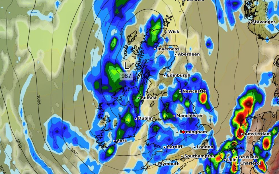
From Wednesday, the heaviest and most frequent showers will most likely hit northwest England, as well as Northern Ireland and parts of northern Scotland
|WXCHARTS
Met Office Chief Meteorologist Andy Page said: “The UK is predominantly under the influence of low-pressure, which is continuing a showery regime, with some potentially heavy and thundery showers possible at times through the week.
“While not everywhere in the UK will experience the heaviest downpours, it will remain an unsettled and relatively cool period, in stark contrast to the heat we experienced in June.”
Weather maps suggest a huge wall of rain is set to batter Britain due to a change in the jet stream.
Met Office forecasters also added that they can't rule out the possibility of more weather warnings being put in place.
Conditions will start to become brighter across the weekend, but continuous showers will persist.
As for when the rain could stop, Britain is still likely to be in for at least another week of unsettled and wet conditions.
Grahame Madge, spokesman for the Met Office, told the Mirror: “The current weather pattern is looking to be quite dominant for a week to ten days or so.
“Beyond that, a typical pattern for the latter part of summer would be another high pressure system.”
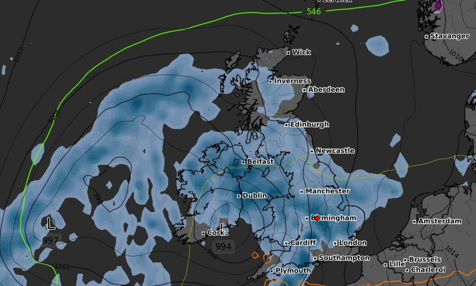
Weather maps suggest a huge wall of rain is set to batter Britain due to a change in the jet stream
|WXCHARTS
While forecasting beyond ten days can often be imprecise and difficult, the Met Office said it would be “unsurprising” if such a high pressure system asserted itself, bringing back sun and blue skies.
Its long range forecast warns that from the middle of the month onwards “a generally unsettled picture” is expected, with showers and longer spells of rain.
The Met Office added: “However, towards the end of the month, there are tentative signs of slightly drier conditions taking hold, with fewer in the way of showers and longer, drier spells, and consequently it should feel a little warmer too.”