


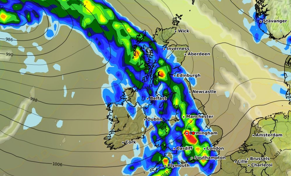
Britain is set to be battered with thunderstorms and torrential rain as the wet weather brings more misery.
Rain showers and thunderstorms are set to hit on Tuesday evening and will continue into Wednesday.
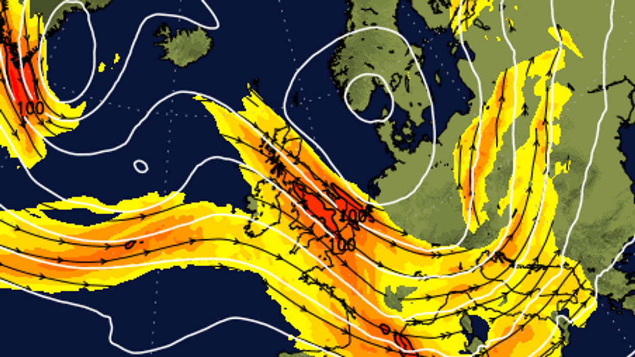
Experts suggest that surface heating in sunny spells combined with breezy conditions towards the North Sea and the English Channel will cause heavy showers across eastern Britain.
Thunderstorms are set to develop across south east Scotland and towards coastal areas of eastern England, as well as areas bordering the east of the English Channel.
Thunderstorms are set to develop across south east Scotland and towards coastal areas of eastern England, as well as areas bordering the east of the English Channel
|WXCHARTS
Later in the week, rain and high winds are expected to return with a “feeling humid” and sunny spells returning by Friday.
The Met Office said conditions are likely to be “unsettled” into early August, including “showers which could be heavy with the risk of thunder, and potentially some longer spells of rain”.
Experts predict the north and west of the UK are likely to be wettest, with western and southern coasts likely experiencing fresh to strong winds.
Temperatures are expected to be around normal.
According to the Met Office’s latest State of the UK Climate report, the UK has become wetter in recent decades.
Met Office spokesperson Oli Claydon explained the “unsettled nature” of the weather this month had been caused by a low pressure.
He said: “The jet stream is bringing low pressure across Atlantic to the UK. This is in contrast to the high pressure we had in charge of our weather in June, bringing prolonged spells of settled weather.”
BBC meteorologist Simon King added that the jet stream could move further north next month, which could cause higher temperatures in the UK - but conditions like those in Europe aren’t unlikely.

Britain is set to be battered with thunderstorms and torrential rain as the wet weather brings more misery
|Net weather
A Met Office spokesperson said: "The end of July is likely to remain unsettled with showers, perhaps heavy and thundery, especially in the north, giving way to longer spells of rain.
"Often quite windy as well, especially for the time of year, with southern areas probably seeing the strongest winds. Temperatures are expected to remain below normal, and it is likely to feel especially cool in areas of more persistent rain or stronger winds.
"Early August is likely to be changeable, at times unsettled, with spells of sunshine, interspersed with showers or more prolonged periods of rain, again most prominent in western areas.
"Generally, a greater likelihood of strong winds than usual for early August, and it is expected to continue to feel fairly cool for most."