


The Met Office has warned Britons could face blistering temperatures of 27C as a heatwave looks set to strike in June.
Mercury could reach its highest figure in 2023 in a matter of weeks, just days after temperatures hovered around 23C in parts of Wales and the South West of England.
Weather maps have predicted high temperatures from as early as June 3.
There is also a possibility that the South East of England could see mercury reach even higher levels.
 Brits could expect temperatures to soar in the coming weeks | Steve Parsons
Temperatures in central London could even hit as high as 28C.
The Met Office’s long-range forecast for May 29 to June 7 also said: “High pressure will continue to dominate the weather into early June, meaning plenty more dry weather for much of the country.”
Temperatures might not persist over the next weeks and months, with the UK’s national weather service suggesting “unsettled conditions” will likely to follow.
The long-range forecast from June 8 said: "Through this period there is an increasing likelihood that unsettled conditions will slowly begin to extend northward across the UK from the south, with some heavy, thundery showers and longer spells of rain possible.
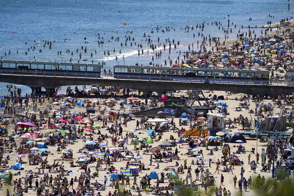
 Summer is quickly approaching with meteorologists suggesting temperatures could even hit 25C on Friday | PA
"The northwest of the UK is likely to experience the driest conditions.
“Winds are expected to be light but with stronger sea breezes in some coastal areas at times.
"Temperatures are most likely to be above average overall, though eastern coastal areas may feel cooler, with a greater chance of onshore winds here."
Britons will likely experience temperatures hovering around the high teens and low twenties until mercury heats up over the next few weeks.
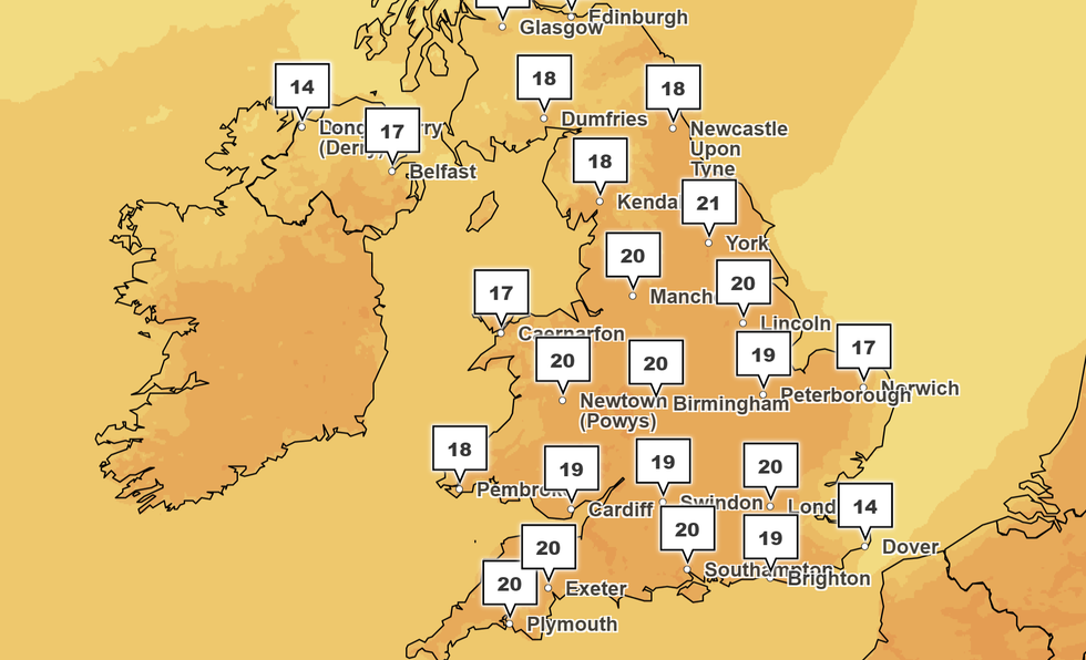
Temperatures look to teeter towards 20C over the Bank Holiday Weekend
|PA
Looking ahead to the Bank Holiday Weekend, Met Office chief forecaster Paul Gundersen said: “The jet stream sitting to the north of the UK is holding unsettled weather systems at bay and allowing high pressure to dominate bringing fine weather to the vast majority of the UK.
“The current position of the high-pressure means we will see a westerly air flow over the UK, a cooler direction than if air was being brought up from the south, and areas such as Spain or Africa.
“Therefore, we are not likely to reach heatwave conditions, but temperatures will still be warm reaching the low 20s for many, particularly in the South West and southern Wales.”
Families will want to make the most of the extended weekend and may hope to bask in the sunshine.
RAC spokesman Rod Dennis said: “We fully expect families to make the most of the largely fine weather over the coming days which is we’re forecasting the busiest late May bank holiday since before the pandemic.