


Britain is set to be battered with high winds and heavy rain showers as a change of airmass signals frost and cold conditions next week.
Forecasters warn of a change in weather following a spate of warmer conditions as temperatures tumble to single figures on Monday and Tuesday.
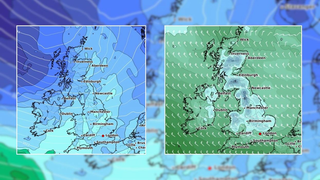
Wind gusts could hit 50mph across the UK early next week while a cold northerly flow moves down from the Arctic.
A cold front is expected to barge through through mid-weekend - bringing fresh airmass from the North Atlantic on Sunday.
Forecasters warn of a change in weather following a spate of warmer conditions as temperatures tumble to single figures on Monday and Tuesday
|WXCHARTS
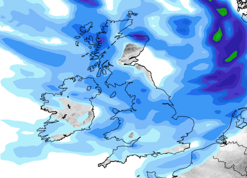
Forecasters suggest the cold front could trigger snow on mountains and northern hilltops as well as hail or icy rain.
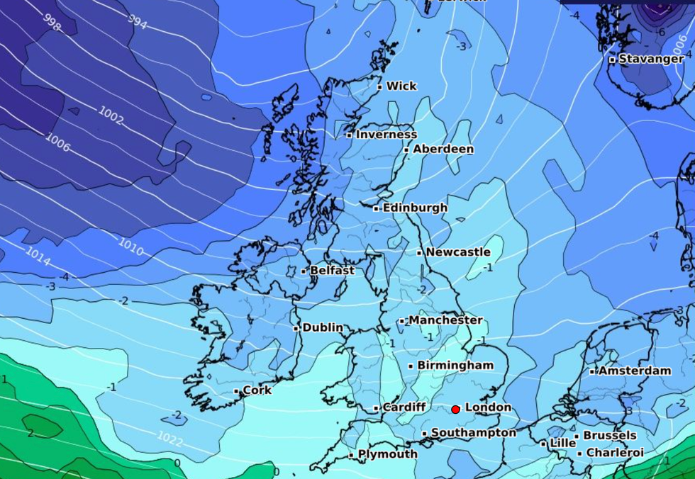
Conditions are set to remain cold and wet until high pressure builds out west mid week.
A colder airflow is expected to move towards south east Britain and eastern England later next week.
The chilly conditions come after temperatures hit 20C on Thursday following an African plume.
Net Weather meteorologist Jo Farrow said: "The northerly flow for the start of the working week means that rather than the 17 to 20C maximums of this week, daytime temperatures will more widely be 7 to 12C with some chilly nights.
LATEST DEVELOPMENTS:
"Gardeners do beware of this upcoming colder shift. There will be a risk of frost on the grass, with an air frost for inland northern Scotland. We’ll have to see how the cold flow develops as Thursday night looks potentially chilly across the UK."
Monday is set to be the windiest day of the week, with gales in exposed parts which are expected to ease down through Tuesday.
The Met Office said temperatures will feel "notably cooler" early next week.
A spokesperson said: "Generally bright, breezy and cooler on Sunday. Showers in the northwest, spreading to all parts on Monday.
Conditions are set to remain cold and wet until high pressure builds out west mid week
|Net Weather
"A notably cooler feel as temperatures drop to average for April.
"Winds from the north or northwest are expected to affect the UK at the start of this period. This brings showers or some longer spells of rain, these most frequent across the north and northwest.
"Some heavy rain is possible at times with a risk of snow over high ground. However, further south conditions will be drier and brighter. Temperatures will mostly be below normal."