


Britain’s fading spring is about to suffer another blow with a ‘significant change’ to torrential downpours.
Sun-lovers face a Bank-holiday washout with long-absent rain set to make a return before the end of the month.
High pressure, the driver of the warm, dry weather, will finally give way to a battering from the Atlantic.
The rot will set in towards the middle of this week before the heavens unleash an autumnal deluge.
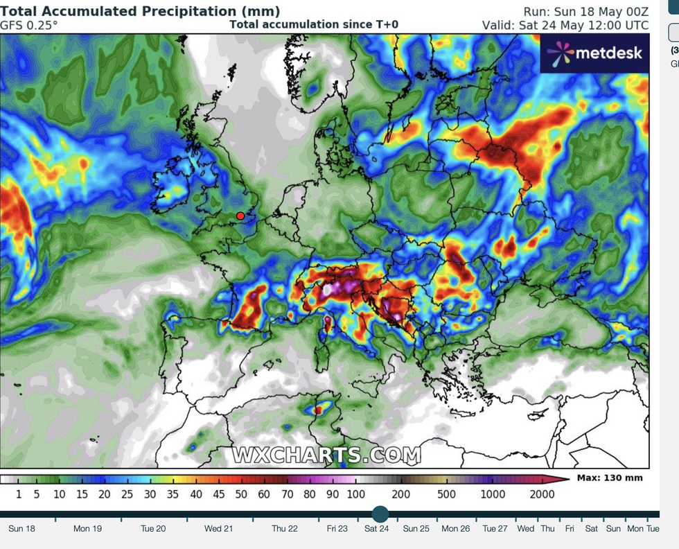
Rain on the way back to UK by end of May
|WX CHARTS
Met Office meteorologist Aidan McGivern said: “There is a significant change during the final week of May as low pressure arrives.
“That last week of May could be wetter than average, so we are looking at a significant turnaround in our weather patterns for the last week of spring, having seen so much sunshine and dry weather.
“So, there is a very significant change on the way.”
High pressure will remain at the helm through the start of the week, with sunny warmth on the cards for many.
Temperatures across the west will be higher than the east, where North-Sea winds will bring an unseasonable chill.
Then the gates to the Atlantic will open ahead of the weekend, sweeping the nation with torrents of rain.
McGivern said: “Up until the middle of the week, the situation with high pressure to the north is almost exclusively the one that is being predicted by computer models.
“Then Atlantic lows are returning, and the changeover seems to happen around Friday and Saturday.
“There is uncertainty about how and where low pressure will arrive, but there is a lot of confidence that low pressure will indeed replace high pressure.”
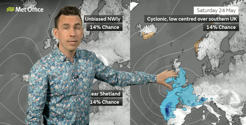
Aidan McGivern warns low pressure is about to return
|MET OFFICE
The return of the Atlantic will see off sunny blue skies with the fine spring weather ‘on the way out’.
Showers will move into parts of the country through the start of the week before a widespread weekend washout.
Jim Dale, meteorologist for British Weather Services and social commentator, said: “High pressure is on the way out and low pressure is on the way in.
“There is going to be a switch away from the fine spring weather to heavy rain and cloud, with the heaviest showers in the west.
“There will be the additional risk of thunder in parts, so a real change from the very dry and settled weather we have had so far this spring.”
Jason Nicholls, lead international forecaster for AccuWeather, said: “There is a risk of isolated showers, some of which will be thundery, across southern England and Wales at the start of the week.
“Elsewhere will be dry and sunny, although additional rainy periods are expected later this week and into the weekend.