


Drizzle, grey skies and lacklustre temperatures will keep summer on hold for a week before the sun returns in a blaze of glory.
Temperatures could rocket back into the 30Cs before the end of the month, according to weather models.
Low pressure behind the recent wet and windy weather will back down to high pressure from the west.
Tentative signals for the last week of July show the Azores High – the driver of blazing summer heat – nudging into Britain.
Jim Dale, meteorologist for British Weather Services, said: “As we go through the end of the month, from the last weekend of the month, there are signs that we could get back to 30C or higher as warmth pushes up from the south.
“It is early days, but the signs are already there, with high pressure, the Azores High, creeping into the south of the country.
“We could be back into the mid-20Cs by the end of this week.”
Meanwhile, swathes of Britain are on alert for heavy showers and the risk of thunderstorms.
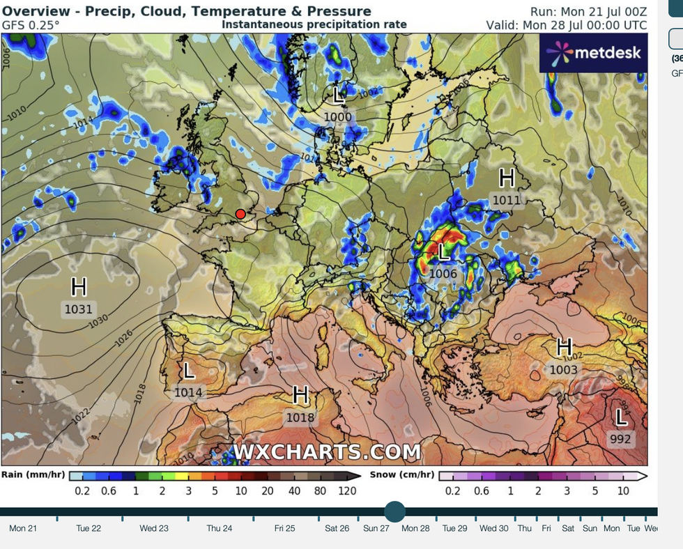
Azores High weather pattern over Britain
|WX charts
Low pressure to the west will sweep rain through northern regions, with unsettled weather likely to hold out through the week.
Dale said: “We are looking at two or three more days of unsettled weather with the risk of thunderstorms in parts.
“The end of the week should be relatively pleasant, with a burst of typical summer weather on the way.
“We are then waiting for the next hot plume.”
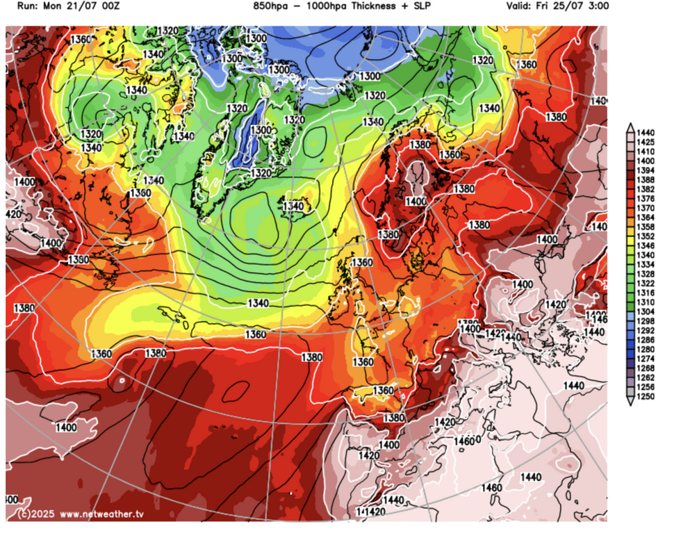
Heat edges in through the end of the month
|Netweather
Temperatures over the coming days will pale compared to the 30C highs recorded through the start of June.
Northern and central regions will hover in the mid- to high-teens and low 20Cs with London and the southeast scraping 25C.
Cooler conditions may come as a relief to many before the heatwave countdown resumes after the weekend.
Showers will ease in parts today with pleasant sunshine and dry weather on the cards for many.
Met Office meteorologist Tom Morgan said: “Tuesday is not looking as unsettled as of late and the showers won’t be as widespread or as heavy as they have been, but there will be some showers of longer spells of rain for Scotland in particular, the west and northwestern parts of England.
“Many parts of England and Wales will get a fairly reasonable day, and if the sunshine does break through the clouds, temperatures will reach 24C or 25C.
“So, it will be pleasant enough in the sunshine, but overall, temperatures will be a little bit lower than they have been.”
Jason Nicholls, lead international forecaster for AccuWeather, added: “It will be an unsettled start to the week, although there will be sunny spells amid the showers.
“Later in the week and into the weekend, it is likely to turn drier and brighter, although there will still be a risk of showers spreading eastwards through the latter part of the weekend.”