


The UK is set to be battered by flash floods and, in places, could be threatened by freak tornadoes as a major storm batters Britain.
In a weather blog post issued on Friday, Netweather forecaster Nick Finnis, warned of "heavy showers and thunderstorms" particularly across central, southern and eastern England.
This forecast has been echoed by the Met Office which issued a yellow thunderstorm warning this morning for East Midlands, East of England, London, South East and South West.
The alert stretches for a full 12 hours from 9am to 9pm on Saturday and warns "heavy showers and thunderstorms may lead to some disruption to transport and infrastructure".
Issuing further details about the yellow warning, the Met Office wrote: "Frequent heavy showers and thunderstorms are expected for much of Saturday before fading from the west during the mid to late afternoon.
"10-15 mm of rain could fall in less than an hour, whilst some places could see 30-40 mm of rain over several hours from successive showers and thunderstorms.
"Frequent lightning, hail and strong, gusty winds will be additional hazards."
Writing for Netweather, Finnis said: "Dry air entrainment aloft from the jet stream may enhance instability and bring strong winds aloft towards the surface as isolated strong gusts.
"With steep lapse rates and dry air entrainment, isolated large hail is possible too, while convergence and local backing of winds against the strong westerly flow aloft may enhance low-level shear enough to allow rotating updrafts and an isolated tornado risk.
"Localised intense rainfall may also lead to flash-flooding where storms train along convergence zones."
LATEST DEVELOPMENTS: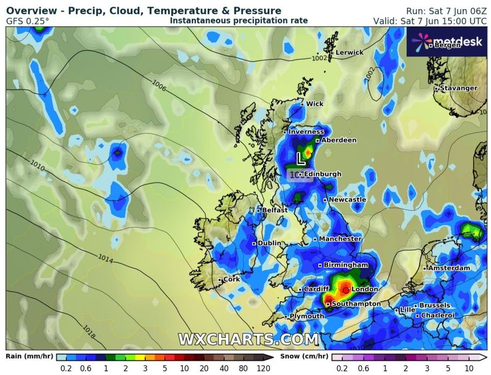
WX Charts map shows heavy rain to strike across UK
|WX Charts
However, in an update at 2pm on Saturday, Finnis added: "More organised rain than expected along a back-bent occlusion moving in across southwest England and moving east across south England has meant cloud cover has limited surface heating, thus convective initiation has struggled so far this afternoon.
"Therefore, Thunderstorm Risk has been downgraded across south England and East Anglia.
"Nevertheless, strong deep layer shear along the south and some organised strong convection evident along the south coast of southwest England this afternoon suggests a tornado can't be ruled out, while a risk of flash-flooding is also possible.
"Lightning is likely to be limited though in south England."
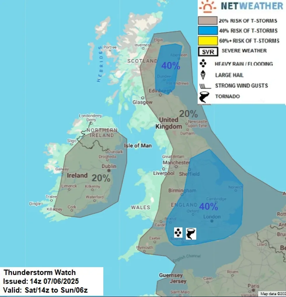
Netweather map shows localised risk of tornadoes
|Netweather
Looking ahead to Sunday and into next week, the Met Office forecast says heavy rain will be more frequent in the north of England.
It's online forecast reads: "Sunny spells and scattered showers, these heaviest and most frequent in the north.
"Turning cloudier from the northwest later with further showers outbreaks. Breezy for many and feeling rather cool."
Then in an outlook for early next week, it continues: "Changeable with a mixture of sunshine, scattered showers and longer spells of rain this week.
"Breezy and feeling cool at first, but temperatures on the rise by midweek."
Looking even further between June 12 and June 21, the UK's national forecaster suggested drier conditions are liekly to return.
The Met Office wrote: "The start of this period is likely to be quite unsettled but also widely warm or very warm, perhaps locally hot in parts of the south and east.
"Some showers and thunderstorms are likely to affect most parts but there will also be some sunshine.
"Over the weekend and into the start of the following week, most parts will become drier.
"However, there may be another brief spell of rain with a risk of some thunderstorms, before high pressure more firmly builds in from the west.
"The rest of the following week looks like being mainly dry with variable cloud and some sunshine and often warm or very warm.
"The far north may be largely cloudy with a threat of some more rain at times though."