


A blast of Atlantic cold air is set to hit the UK in the middle of next month, with weather maps indicating virtually the whole country will be blanketed in snow.
High pressure is set to lead to plummeting temperatures, with an icy freeze settling over the UK.
WX Charts graphics indicate a heavy dollop of snow will fall on January 11, with up to 8cm of the white stuff falling an hour.
In the days following, cool temperatures will leave a layer of snow on the ground from Southampton all the way up to Inverness.
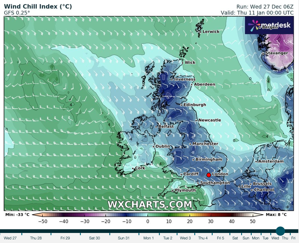
A bitter wind chill is anticipated in January
|WX CHARTS
According to the Met Office, the freeze could indicate the start of a "prolongued" period of winter conditions.
The national weather service's long range forecast for the period warns of "unsettled" weather.
"It is most likely to be unsettled at the start of this period with showers or some longer spells of rain affecting the UK," the Met Office said.
"Some snow is possible in places, especially higher ground in the north.
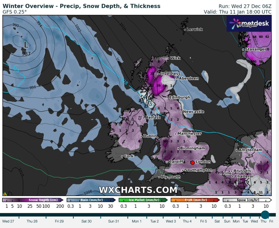
Virtually the entire country will be blanketed in snow
|WX CAHRTS
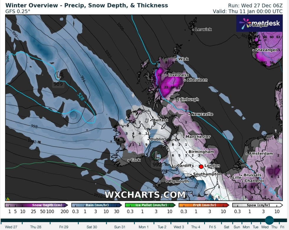
The dollop of snow will move in from the Atlantic
|WX CAHRTS
"From the middle of January onward, conditions will probably turn drier and more settled as high pressure starts to have a greater influence.
"This also means an increased risk of more prolonged and widespread cold conditions."
It added that confidence in the forecast for the period remains low.
NetWeather says the extra cold period could be caused by a Sudden Stratospheric Warming.
It says: "There is an enhanced chance of a Sudden Stratospheric Warming during the month, due to extended forecasts indicating a weakening of the stratospheric polar winds and signs of favourable upper flow patterns during December for wave propagation towards the pole creating warming of the stratosphere.
"If an SSW occurs, it could bring blocked and more persistent cold weather after a few weeks of the SSW occurring, but if one occurs it’s no guarantee of colder weather."
The weather forecaster's Nick Finnis added: "If the SSW does occur in the New Year, which is looking increasingly likely, though not a certainty yet, then there is a strong chance that the UK and northern Europe could see some cold and wintry impacts later in January and perhaps over into February too."